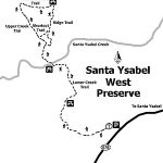
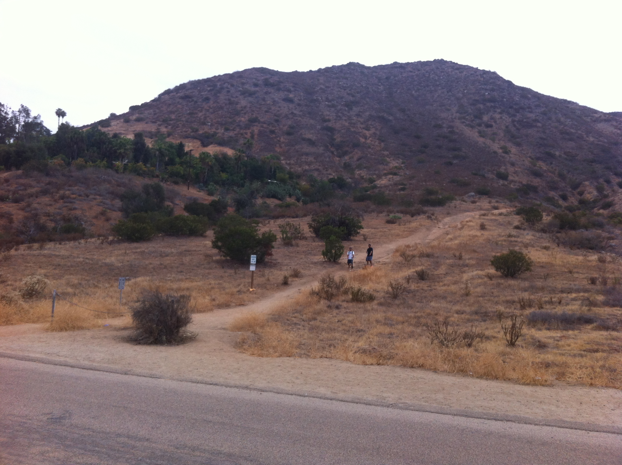
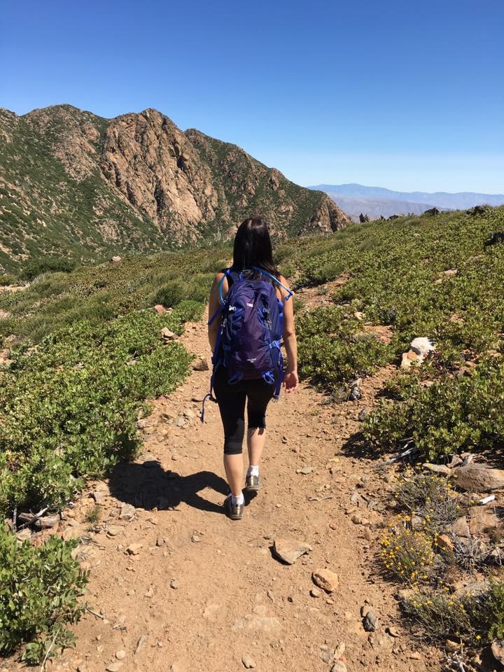
Distance: 7.4 miles without the loops, 10 miles with the loops ; West Loop is 1.3 Miles, & Kanaka Loop is 2.3 miles Elevation Gain: 1200 feet. Time to complete: 4 hours
Directions To The Preserve: East – Farmer Staging: Take Highway 78/79 into Julian, to Main Street. Going north, Main Street turns into Farmer Road. Take Farmer Road to Wynola Road and turn right, then a quick left back on to Farmer Road. Pass the Volcan Mountain Wilderness Preserve sign on your right. Santa Ysabel Preserve will be on the left side, approximately one mile from the Volcan sign. Parking is available in the staging area. West: Take Highway 78 to Santa Ysabel. Staging Area is one mile west of Santa Ysabel on Highway 78 at call box #495 or across the street from 29313 Hwy 78.
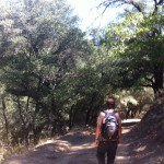
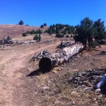
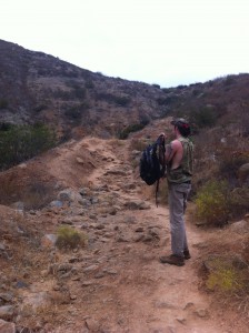
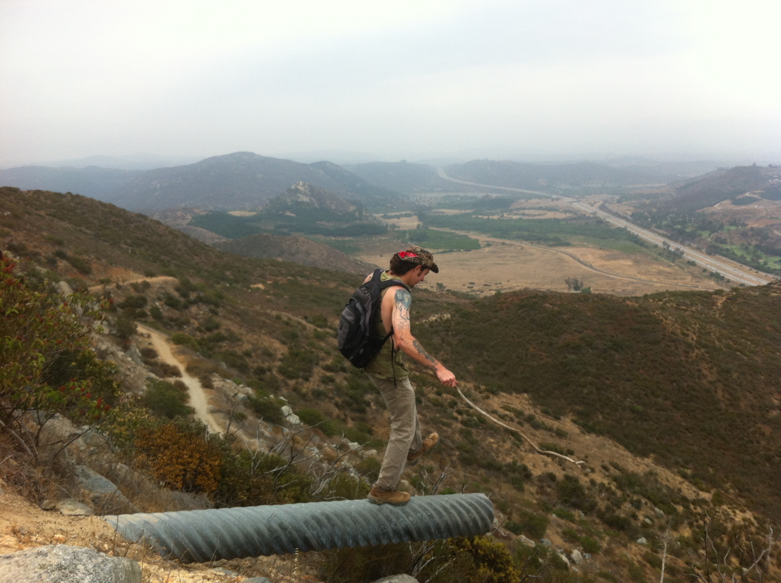
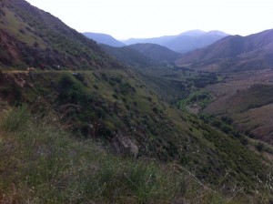
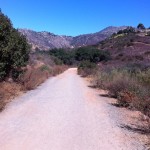
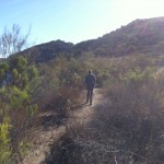
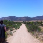
The Coast to Crest Trail and the trail we took this day, the Kanaka Loop Trail, which is the East approach off of Farmers Rd. One of the benefits of hiking Santa Ysabel Preserve is just getting out there, driving the one lane country roads through Ramona past the hill, into Julian you definitely get the feel of being in the back country surrounded by vast open beauty, pine and oak trees and of course a mountainous terrain.
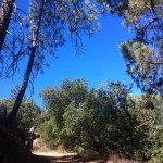
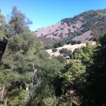
The Santa Ysabel Preserve really reflects the area, both in vastness and vegetation as well as offering views at many spots along the trail of other hikes in the county, including, Mt. Woodson and Iron Mountain, Mt. Gower, and far off in the distance Palomar Mountain.
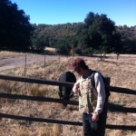
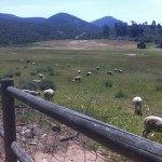
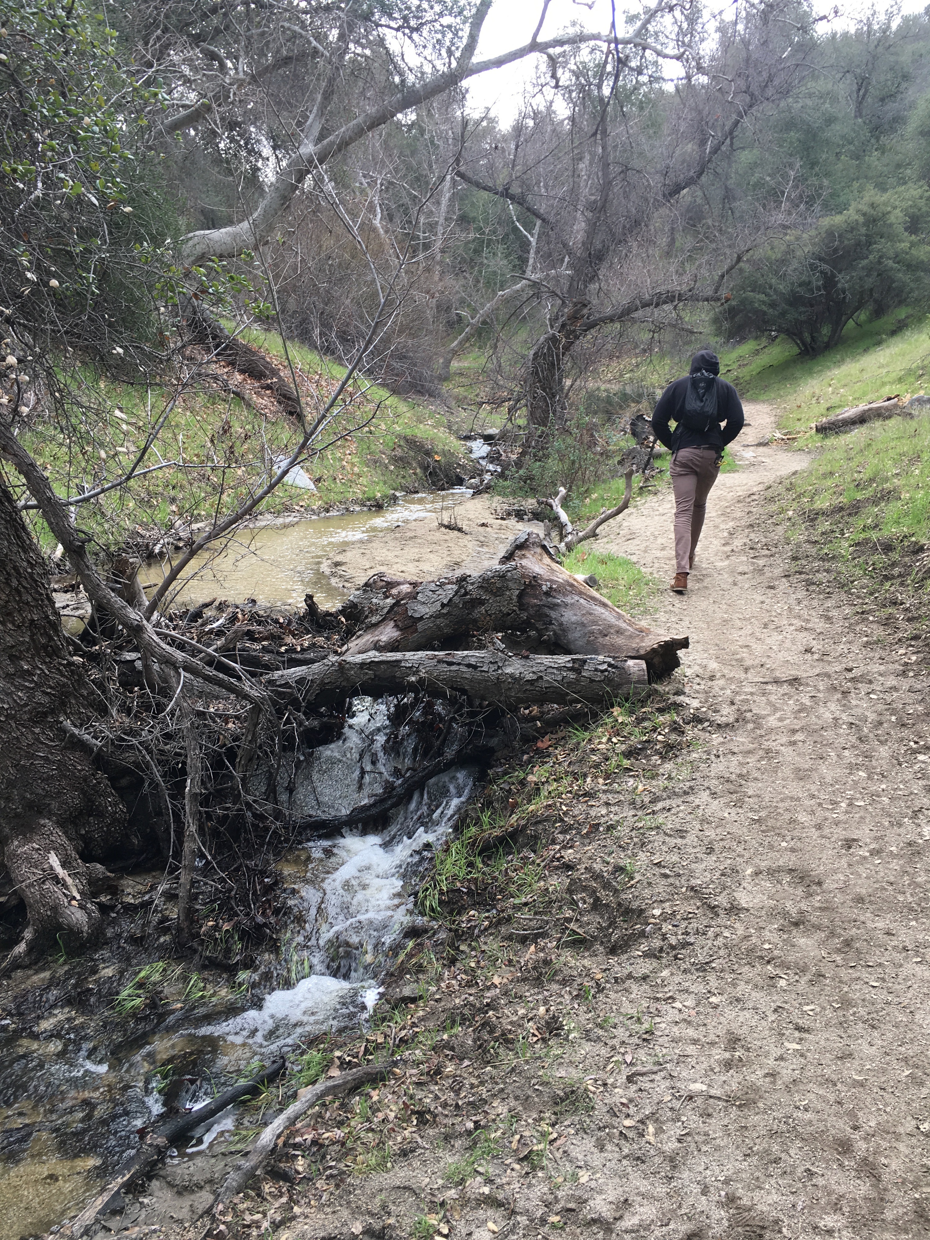
The first thing that strikes you about the Kanaka Loop trail-head start, is that you are greeted by the local 4-legged creatures. In fact as you walk through the gate that starts you onto the trail, you will more than likely be greeted by a bovine friend chopping away at the grasses and vegetation along the trail. The start of this trail is pretty flat and open but soon you are heading uphill through a covered forested area with a creek on your left.
Palomar Mountain and observatory in distance
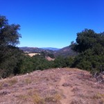
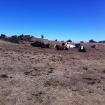
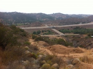
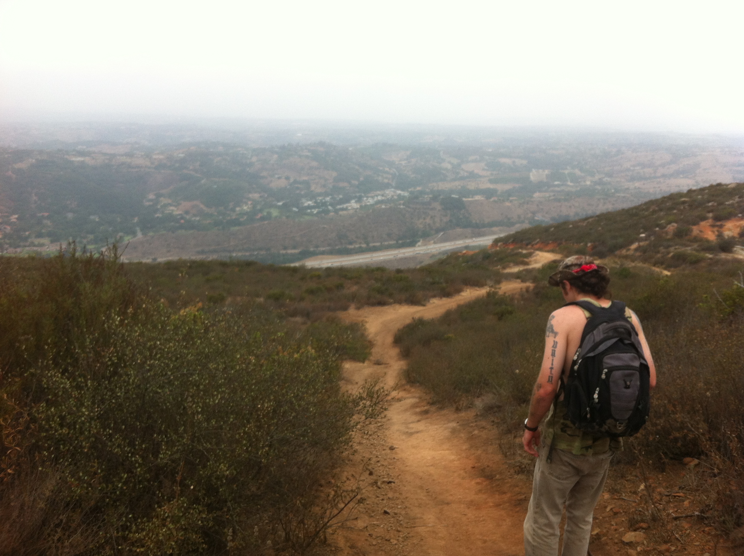
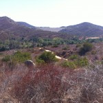
The trail continues to climb to a point where looking to the north far off in the distance is Palomar Mountain and if clear the white dome of the observatory. As you continue to the left a wide-open expanse of a meadow/field is upon you, at this point the trail makes a huge loop and is marked guiding you to veer off to the right beginning the loop section of the hike.
From here you can take a small detour up an easily climbable grade to get good views of Mt. Woodson and Mt Gower off in the distance.
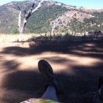
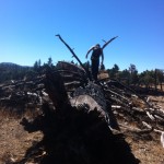
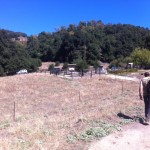
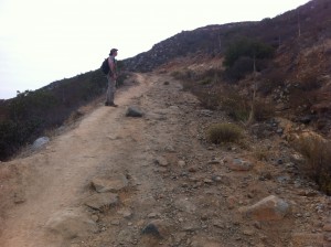
As you wind back down you come upon a small herd of resting cows that gather at a watering hole. Continuing on you will come across good-sized downed burnt charred trees, which are left over remnants of the Cedar Creek fire of 2005. From here you will climb a steep grade through pines and other vegetation, the trail will wind down and then will lead you to an open area that provides amazing views of the surrounding hills and mountains.
Charred trees from 2005 Cedar Fire
and done
You can see Volcan Mountain, which trail-head start is just down farmers road from Santa Ysabel Reserve. Ascending from this point you will so join up with the start point of the loop and the ascent down and back to where you started.
On this day that we hiked the sky was blue, no clouds and the temp was high 60’s when we started and near 80 when we ended in early afternoon. Bring at least 2 quarts of water, snacks a lunch and as always good hiking shoes/boots. …..A gorgeous day for hiking and a gorgeous hike to do. Have fun…..Next… the hike up the road from Santa Ysabel…Volcan Mountain.. See you on the summit…..Hike on!
Here’s a secret tip for the best pie shop in Julian
Time to Hike: 12-3pm Distance: 3.5 miles out an back Hikeability: moderate to difficult in spots
Snacks/Water: Orange, snack bar, 2L water and bottle of Gatorade at the end Temp: 70’s
Monserate Trailhead Start HIker Therapy
I’m always so impressed with the amount of quality hiking in our county and no matter what part of the county you live; you can find a hike that will fit the need.I recently moved up to Oceanside from Encinitas and have been looking for hikes up here in the northern section of the county.
I had been used to heading south to such trails as; Cowles Mtn. and the Mission Trails system, Iron Mt. and Mt Woodson in Poway, and even out to the eastern part of the county and the Laguna Mt.’s and the Big Laguna Loop trail.
However, many of the hikes up in the North part of the county were unfamiliar to me.A trail I just discovered through 100peaks.com was Monserate Mountain Loop in Bonsall/Fallbrook area of the county.The Fallbrook Land Conservancy has done an outstanding job of providing a hiking trail in the San Diego North County.
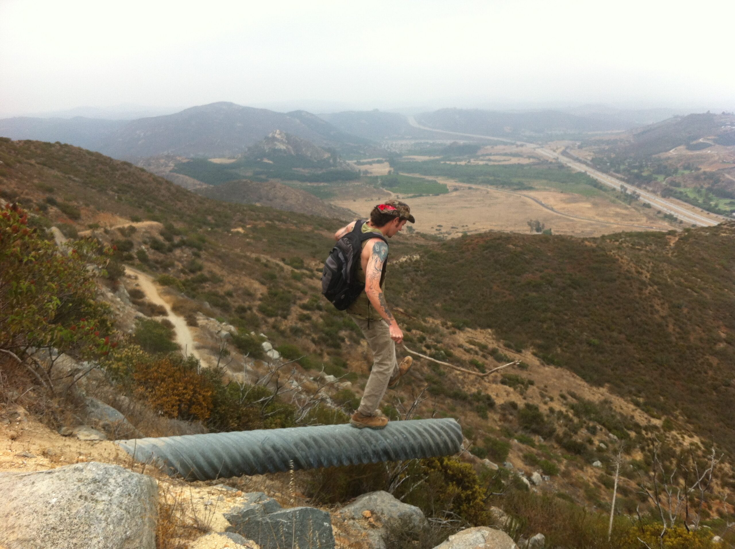
This out and back hike covers about 3.5 miles and has some serious climbing in spots.. This hike has a trailhead to summit net elevation gain of 1,183′ in 1.6 miles so it gets steep quick and exceeds that of Cowles and Iron Mountain as far as steepness.The trail is only 1.75 miles to the 1567 ft. summit but a few side side trips such as a the Red Diamond trail off the main trail, add to the total distance.
Though short and sweet Id consider this hike more short and steep as right from the trail-head start you begin a rather an uphill climb for the first .75 miles.Even after that as the trail twists and turns, flattens and dips, you are on a continual inclined ascent. The rugged composition of this rocky trail really adds to the feel of being on a mountainous hike as well as offering to the physical demands of the hike.
Freeway 15 in distance
going up at .75 miles
Halfway
Sam taking in view
Even though the I-15 freeway is in sight for much of the first .75 miles, the noise from the cars starts to dissipate as you climb.In fact, as you turn left at the .75 mile marker and head north east the noise pretty much is nonexistent and the views become even more eye catching, beautiful and absorbing.
On this day the haze and marine layer kept us from seeing the Ocean and some distant mountain ranges, but even with that you still could het a good sense of the vast openness, mountains and green avocado orchards this part of our county geographically consists of.As you continue the ascent the trail twists and you will come to an arrow made of small rocks, trusts its direction and you will soon be at the summit.
Walk this way
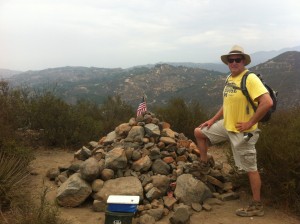
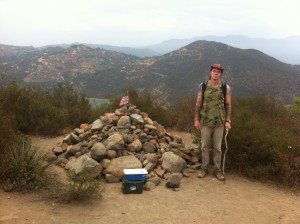
Summit of Monserate,
Sam at Peak
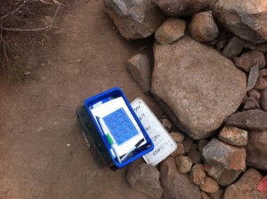
Journal Box
I especially like the summit of Monserate Mountain, not only because of the wonderful views it provides, but this peak also gives you the chance to journal your thoughts or simply sign that you made it to the top!I’d say about 30% of the hikes I do have a journal box atop the summit; a one that immediately comes to mind is Iron Mountain in Poway.Great idea that started this concept and one my son and I took advantage as we always do.
Stepping into nature
After a lunch and 30 minute break we started our descent back.Steep up means steep down, and I usually find this the harder part of the hike for me.However, after a side trip on the short red Diamond trail we were soon heading back down to the trailhead start.The 1.7 plus miles back goes pretty quick.
It had been a few weeks since I had hiked and once again I was in need to be reminded what getting out into nature does for me.Anxieties slip away, purpose and accomplishment are always achieved not too mention the physical aspects and challenges that a hike, and certainly this one in particular, present.
The reward of being up to the challenge both mentally and physically out in a beautiful natural setting surrounded by the sights and sounds that touch all the senses are why the sport of hiking is such a therapeutic gift.Give yourself this same gift and hike Monserate Mountain.
Great Views
Directions to hike : Exit from Interstate 15 at 76/ Pala Road and drive west to Old Highway 395 and turn right (north). Drive 2.6 miles then turn right on Stewart Canyon Road and go east under the Interstate to Pankey Road. Turn right and park on the right. The start of the trail is across the street and is marked by a sign
h 29. 2013 11:30AM – 2:30AM Temp: 80’s Hikeability: Strenuous
Best Hiking Months: November through May Water & Food: 1 gallon water per person, 1 bottle gatorade, lunch, oranges and snack bars
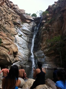
If you want to add some thrill and excitement to your hiking repertoire than the Cedar Creek Falls trail is the one for you.
Of all the trails I have hiked in our county I have yet to go on one that posts a sign at trailhead start that warns “HEAT KILLS! and IS THIS THE HIKE FOR YOU?
Cedar Creek Falls
Going Down!
Beautiful!
It is no wonder that besides Torrey Pines and Cowles Mountain Cedar Creek Falls has the highest amount of rescues in the San Diego County Sheriff jurisdiction.
Luckily I didn’t read this sign until I had completed the hike. All warnings aside, this may be one of the most scenic and beautiful trails I have hiked.
Not only does this trail offer great mountain views, diverse vegetation and dessert chaparral, but the undeniable reason anyone hike’s this trail is the 90 foot cascading waterfall at the midpoint of this out and back hike.
Even the drive to the trailhead start provides mile after mile of the natural raw beauty that the area surrounding Julian, CA is known for.
There are two approaches to Cedar Creek Falls and the hike detailed here is from the East approach. From Santa Ysabel(Dudley’s), take Highway 78 east towards Julian to Pine Hills Road, turn right (from this turn it is 20+ minutes to the trailhead). Turn right onto Eagle Peak Road.
The last 8 miles of Eagle Peak Road are dirt but this does not detract from what this hike offers and in my opinion adds to the remote beauty of the adventure. Once you come to the end of Eagle Peak Rd, you will dead end into a cul-de-sac and the trailhead start.
You can park alongside the road edge but be aware that on the weekends the road gets pretty full. After you park walk towards the cul-de-sac with the tree in the middle of the road and veer right to the trailhead start.
This trail is unique in many ways including the fact that unlike most hikes, the start to this hike immediately begins to descend for the next 2.5 miles it takes to get the waterfall.
You are essentially descending this trail to a valley surrounded by the local mountains of the Cleveland National Forest.
The trail is very hike-able and although it is strewn with rocks in places the vast majority of the trail is made up of soft earth and sand.
On the decent you have the mountainside to the left of the trail and the drop-off to valley floor below on your right.
The topography on this hike creates a sense of vastness and an open feel that adds to the majestic views that surround you.
Signs along the way will chart your progress and before you know it you will be at trail end as you approach the valley floor.
A signpost to the left will guide you to the waterfall. The vegetation changes here and becomes denser with California Scub Oak and low-lying brush.
Beware of Poison Oak which are those deep red leaves growing from the low lying plant, bush.
You will come to a few places where rockbeds indicate you are crossing a river and depending on the time of year and rain/snow fall the depth of the river at these crossings will vary.
When I did this hike at the end of March I had no problem stepping across the river on rocks that were dry and easy to maneuver.
The trail will lead you right up to the falls along with more and more hikers as you approach.
Enjoy a long break here with lunch as you take in the sounds and sights of the falls and the people watching of the cliff divers and others who join you at this oasis amidst the rocks, scub and the good size waterfall pool.
Once you are done enjoying the reason why you are doing this hike, it will be time to return and the ascent back.
Take your time if you must, drink a lot of water and enjoy the accomplishment of hiking Cedar Creek Falls!
Although this hike is highly touted as one of the most dangerous hikes in the County, so long as you are well prepared with lots of water, good hiking shoes, and plenty of common sense you will be rewarded with a great hiking experience!
A hiking trail to consider in San Diego County is the Iron Mountain/Ellie Lane Trail in Poway, CA. The trail head is located on the east side of Highway 67 and Poway Road. There is a small gravel parking area with restrooms available.
Let’s Hike!
This trail offers a challenging hike amongst the diverse beauty of a mountain trail. The “typical” trail to the top of Iron Mountain is the most popular route to take, and offers great scenery, a strong workout, and a very doable hike with the reward at the summit of an amazing view of our County.
Iron Mountain
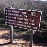
However, a hybrid hike that can add some diversion and spice from the main trail is the Ellie Lane Trail. To access this part of the hike, which is roughly 1.25 miles from the start of the Iron Mountain trail-head, you will come to large signboard directing you to the various trails that branch off of the main Iron Mountain trail.
Trail system sign board
The Ellie Lane Trail winds to the left of the sign board and steadily ascends from here leading you through a trail of low lying dessert chaparral. The duration of this hike is well marked with “Ellie Lane Trail” signs posts, which will guide your route. The beauty of hiking this part of the trail are the views which stretch out in front of you both near and distant.
Another bonus to branching off onto this trail is the much more rugged aspects offered. The Ellie Lane trail lives up to the definition of rugged as its, broken, rocky, and uneven surface adds to the surrounding beauty and the “roller coaster” terrain offers a workout that of a hike double in distance. However, this section of the trail system is very doable, and while a strenuous physical challenge, you will be absorbed by the peace and quiet that this hike offers. In fact on this particular afternoon, only 6 other hikers chose this part of what Iron Mountain has to offer.
Ascending the Ellie Lane Trail
After, making the initial ascent onto the Ellie Lane Trail and winding around the dips, climbs and twists of this trail you will come to a Eucalyptus grove which not only adds a distinct change in topography but signifies that you have descended to the home stretch segment to the trail and have a little less than a mile to Hwy 67.
Eucalyptus Grove
As you hear the road noise in the near distance and the sight of Iron Mountain off to the left start making your way south towards the initial trailhead start of Iron Mountain. There are no trail identifiers but you will see a sign marked for a horse trail and road which is the best path to take and one that will lead you to the Iron Mountain Trailhead start. At trails end I was surprised to read that my GPS indicated a total distance hiked of 4.2 miles. This hike has a much bigger hike feel to it due to the ruggedness of territory at certain areas along the way as well as the numerous ascents and descents the Ellie Lane Trail presents. Besides that route I have talked of here, you can also start the Ellie Lane Trail at the Ellie Lane Trail Staging area, which is on the east side of Highway 67 approximately 0.7 miles north of the Highway 67/Poway Road junction.
Iron Mountain is one of my favorite hikes in the county for numerous reasons, chief amomg them being the added options of trails you can create and blend together depending your “hiking mood” that day.
Distance: 4.2 miles
Date and Time: Monday January 6. 2013 10:30AM-1:10PM
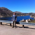
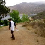
The Blue Sky Ecological Preserve trail is a well-kept secret of a hike hidden in the shadows of its big brother, Mt. Woodson in Poway. Not only does this trail offer similar scenic beauty as Mt. Woodson, it also has its own lake embedded in the hike as well!
Although unlike Lake Poway, which starts out the Woodson trail, Lake Ramona is at the end of the Blue Sky Preserve trail and in my opinion a much more radiant Lake due to its naturally barren scenic surroundings and a very welcoming and rewarding end to this out and back hike.
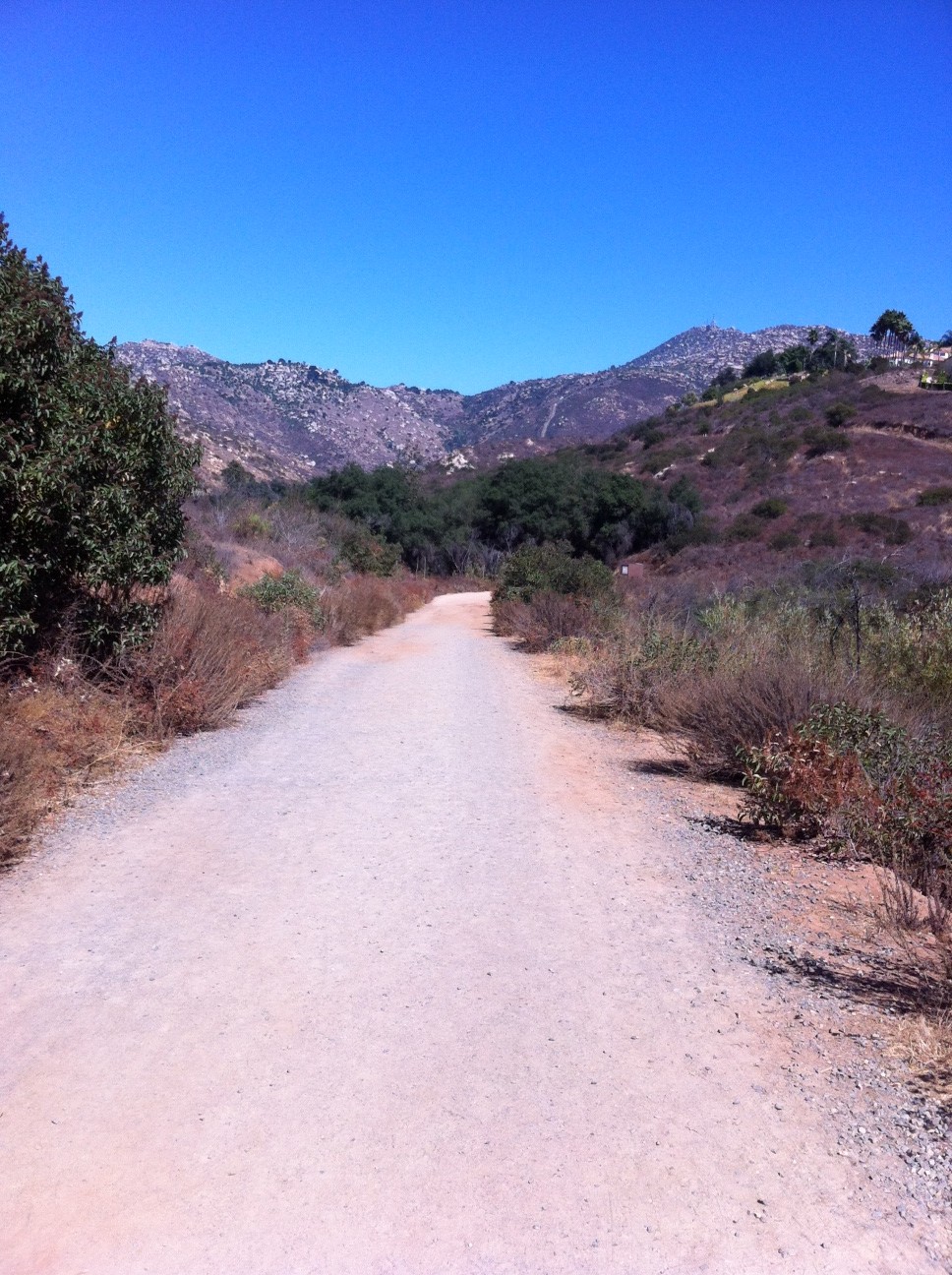
The Blue Sky Preserve trailhead start is well laid out as you pull in off of Rancho Bernardo Rd (which turns into Espola). The trail itself is well marked, wide, and consists of alternating compacted earth and sand, no rocks or gravel.
As you start out on the trail you immediately get a feel of a “mountain” hike as the hills and peaks of the area cover the landscape ahead.
The openness of the trail gives way to a tree-covered path, as many California Live Oaks surround a good portion of the middle of this hike. Signs will guide you as you go along this very flat and fast trail. At about the two-mile mark you will come to the more challenging part of this hike and well within site of the Dam that forms Lake Ramona.
You will begin a steady ascent for the last third of this hike, which leads you to the Dams edge, and a spectacular view of Lake Ramona. Many stop here, but my son and I continued on so that we could find a trail that winds down to the lake.
Trailhead Start
Sam on the Dam!
Down to Lake’s edge
California Live Oak Grove
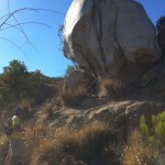
On the way up!
Me and Big Rock!
Trail back along Lake Ramona
You can also make your way along the lakes edge along a somewhat formed trail that will lead you back to the main trail and the top of the Dam. From here it is the same trail back the return hike back to the trailhead start. The plant life highlights of this hike as mentioned before are the groves of California Live Oak.
Another highlight of this hike to add to the before mentioned, is the fact that this hike, especially upon the return gives you a detailed view of the Mt. Woodson trail from start to finish. Its an interesting view in that you can see the total distance of the hike which looks much shorter and effortless compared obviously to the enduring nature and length of the trail as compared to when you are in the moment hiking it.
I really enjoyed this hike and all that it offered in first time hiking this trail, scenery, the California Live Oaks. the challenge of the trail as well as the beautiful Lake Ramona.
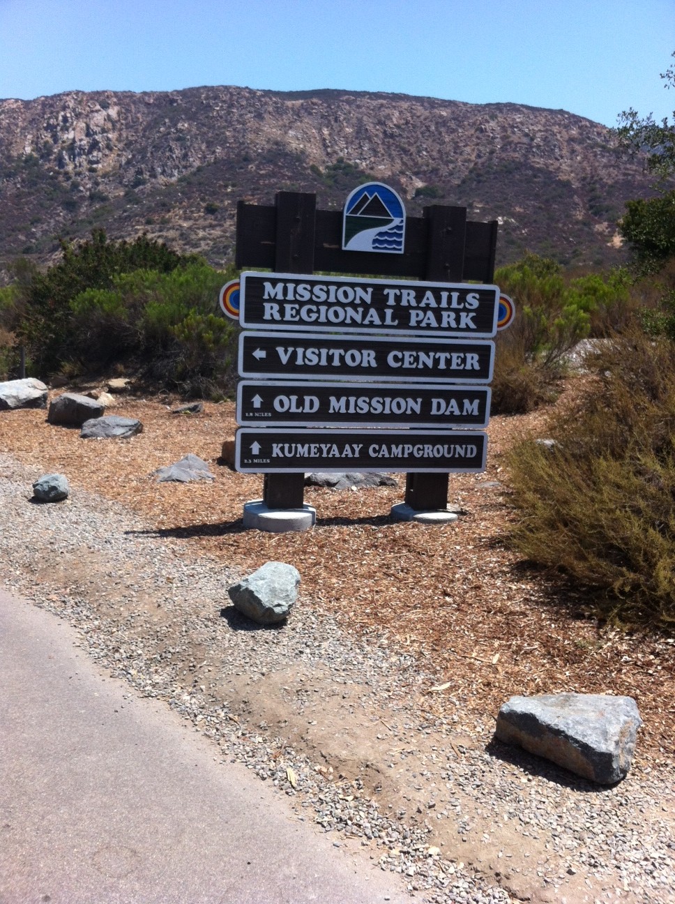
Mission Trails Regional Park offers many distinct, scenic and challenging hikes each with their own personality and the Fortuna Mountain Saddle does not disappoint in this area.
The Fortuna Mountain Saddle includes both North and South Fortuna Peaks. While you can do each at separate times, why not take in the beauty and the challenge of both trails on the same hike. The loop to do both starts from the visitor center entrance and covers nearly 8 miles. You can park your car on the service road area and walk a short distance to the trailhead start, you will see the Mission Trails Regional Park sign on our right.
Sign landmarks the start!
Off we go!
The trail to the saddle starts out on the South Fortuna trail and is well marked and consists of well-packed earth covered in a sandy beginning. The relatively flat trail loops around through dessert brush with a great view of your destination, the South Fortuna Summit off in the distance. The trail widens with a sloping hillside on your left and a wooden fence on your right.
Great view along the road
Soon you will get to the Jackson Crossing area of the San Diego River. Here trees and cover give this area of the trail a forest feel. You will walk along a concrete wall to cross the river and head up the trail to the road.
Sam at Jackson Crossing
This is where the trail gets fun as the road ascends at a rather steep incline which will get your heart pumping, lungs puffing and legs burning! The road switches back a few times and before you know it you will be at the top of the hill near the Twin Towers where the trail returns to a rocky sandy consistency and winds on gentle slopes and soft inclines through brush, small trees and rock. On this day we hiked it was in the low 90’s, so as always make sure you have plenty of water. The heat is much less a factor when you are well hydrated which keeps your energy level up.
This road is a heart pounding burner!
The trail opens up as you hike along a well-compacted stone and earth trail surrounded by dried brown low lying brush. Off in the distance you see the steep slope to the South Summit and the much talked about “Stairs†that lead you up this wickedly steep side of the mountain. As you hike towards the steps the landscape and geography take on a real dessert feel as the dirt gets redder and the trail itself is much more stone and rock.
The Stairs
As you head up towards the “stairs†large boulders dot the scenery. The stairs themselves are made up of wooden steps that lead you up towards the summit of South Fortuna Mountain.
Once at the top don’t be deceived you are still have a bit farther to go to get to the summit but the hard part is over and the challenge well worth it as the panoramic view of Mission Trails and the vista of San Diego is gorgeous. At this point I was pretty gassed, but after sucking down half a bottle of Gatorade and getting back my breath I was ready to push onward towards the summit. After a short hike we were soon at the South Fortuna Peak where a sign and cluster of rock landmarks your accomplishment. From here you get a good view of the winding ascending trail over the
saddle to the summit of North Fortuna. So far the distance traveled is about 3 miles with just about a mile separating both summits.
Sam on South Fortuna Summit
After a short break, some fried chicken and more water we were off to the next peak!
The trail over to the North Fortuna summit is layed out in front of you and very plain to see from your starting point at the South Fortuna summit. The trail is mostly rock and ground up earth and wide. The trail dips, twists and turns until the final ascent the last ¼ of a mile up the slope.
Once you reach the summit you will see the sign marking that point and the wonderful view it offers of all the peaks in the Mission Trails system; Cowles, Pyle’s, Kwaay Paay and besides the North Fortuna you also can see the South Fortuna summit from here.
North Fortuna Summit
Walk a bit more up the trail and you will come to a very large boulder and two marine ammo boxes which contain journals where you can sign in and write about your experience on the saddle!
Write about our adventure at the North Fortuna Summit!
Hiking back can be as adventurous as you make it. You can retrace your way back over to the South summit and head back down the stairs or you can do what we did and followed the SDGE power lines trail back down. Distance wise all ways that lead back are about the same mileage or about the 4 miles it took you to ascend the saddle. However, the SDGE trail was steep and very rocky so be careful. Soon you will meet up with a trail that leads you back to the visitor center via the road you took to ascend up to the Twin Towers. Signs will guide you!
The views back are just as pleasing and beautiful as they were on the ascent. By now the heat was taking it’s toll and we (my son and I) were pretty worn out after our return to the visitor’s center and our completed 8-mile hike. Again, make sure you brig plenty of water, something to eat to restore your electrolytes and as always be on the watch for wildlife.
Didnt see this on the trail
We did not encounter any snakes on the hike but keep in mind that the Missions Trails system is rife with rattlers but so long as you don’t bother them they wont bother you. I recently read that the majority of snakebites occur when the hiker starts to improvise the trail or the hiker hassles the snake, both not smart!
The Mission Trails system has become one of my favorite places to hike as well as home of more strenuous level hikes than any other area in the county. For variety, a good workout and a pleasing accomplishment I highly suggest hiking the Saddle and taking in both the North and South Fortuna summits!
Directions: From downtown San Diego: Take 163 north to I-8 East. Merge onto I-15N and exit on Friars Road East. Follow Mission Gorge Road for 5 miles to Jackson Drive and turn left into the parking area. If you miss this left turn, you can also park in the parking lot for the Visitor Center.
See More Photos at Trail Shots
Distance: 8 miles out and back
Hike Date and Time: Saturday July 21, 12PM-3: 30PM
One of the most scenic and geographically diverse hikes in San Diego County is Mt. Woodson, near Lake Poway. It is also one of the longer and more strenuous hikes to do and requires a half-day. On this early morning Monday start a few other hikers were on the trail but nothing in comparison to what the weekends bring in regards to the number of folks who hike Woodson. The early morning start also provided a cool temperature of roughly 65 digress which was perfect for taking on this challenging hike. The trailhead we started at is on the Lake Poway west end in the recreation area parking lot. There is a rest room near the trailhead to help you landmark the start. The trail starts out taking a slight dip and then climbs with the scenic backdrop of Lake Poway on your left and the summit of Mt. Woodson straight ahead.
The trail then begins a steady and blood pumping incline ascent. The scenery is a mix of brush and boulders with sloping hillsides on either side. The trail itself consists of compacted earth and sand and is very easy on the knees and feet. Markers along the way alert you of your destination as well as distance hiked and remaining to get to the summit. As we hiked on, the gray of the morning gave way to mixed blue skies scattered with wispy clouds. At this point in the hike, at about the 1.5 mile mark, the trail steepens into a series of switchbacks; I’m reminded of the Cowles Mountain trail for a good visual example. Im also reminded at this point in the hike why I like Mt. Woodson besides the natural beauty; it’s trail diversity! The last 1/3 of this hike the trail gets much rockier and the surrounding scenery turns to massive boulders amidst the plant life and brush.
The views are amazing as the open land, hills, and winding roads dotted with houses and ranches provide a stunning overhead panoramic, much like you might get from being in an airplane.
This is the second time I have done this hike and the difference between the two astounds me. Im in much better hiking shape, equating to “less sucking it up” which leads to more moments to enjoy the nature, scenery and rewards of this trail. As you get to know the personalities of each hike you can better absorb the nuances of the trail and expectations along the way. However, even the same trail can offer up something new, and a first time experience, the second time traveled. This happened on this hike as we took the viewpoint cutoff to get in a little more challenge and a different view as well as some “rock climbing.
As in life, its always a good idea to change it up, take on a new route and see the same things in a different way. This is especially a good idea if you find yourself not being challenged or getting comfortable with the status quo. Having said that, for the most part that is why I like to hike anyways, if offers me a place of serenity, peace and of being mindful, or in the moment which keeps me present. Hiking also provides me an “escape” from the stresses of the day and to get a new outlook on a familiar or ongoing situation, problem, or event that needs to be considered differently.
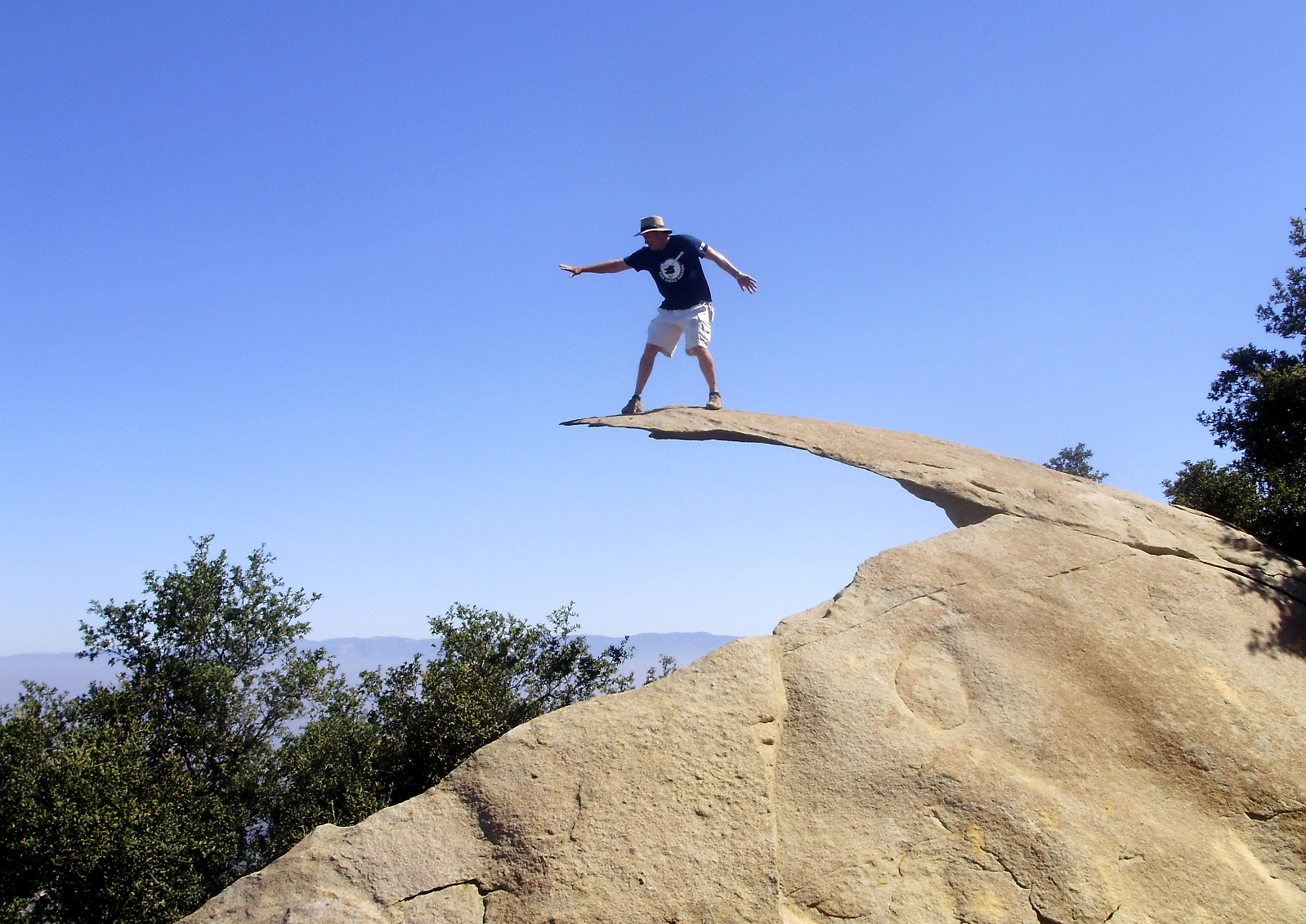
As we approach the summit of Woodson its peak is shrouded in a wispy overhang of clouds/fog that offers a magnificent view to our destination and goal! Potato chip rock appears on our left, which marks the 3.6-mile part of our hike. However, we do not consider our goal of being at the summit’s peak until we go an additional .2 mi up the road and to the right where a pine tree grove appears. Again, yet another scenic diversity this hike offers and my favorite part of the trail, a view through the pines to the landscape far below.
After spending a few moments here, we headed up the trail past Potato Chip Rock to our “break” station to sit, rest, snack and take in the views from the summit peak. This high above view included looking over a vast sea of white clouds that stretched out as far as the eye could see.
At this point my son and I suggested we get up and move on or we may just sit here the rest of the day, a very rewarding choice but we do need to get to the “Chip.”
Although strenuous and demanding, the Mt. Woodson trail is a must on the upper tier hikes in San Diego County to add to your “Need to accomplish” list. A must to do after this hike and a way of rewarding your accomplishment is a visit to a fantastic smoothie shop at the corner of Twin Peaks and Espola Rd.
Great fresh homemade smoothies!
Distance: 7.5 miles out and back
Hike Date and Time: Monday July 2, 2012 7:30am-11:30am
Hike-ability: Strenuous
Water: 50 oz plus 1 liter of Gatorade
Temperature: 60’s
Directions to trailhead: Exit I-15 go east on Ted Williams Pkwy to Twin Peaks road turn right to Espola Road turn left to Lake Poway Road turn right. You will pass water district on your right as you drive up hill. On weekends you have to stop at gate to pay $5.00 fee. Weekdays you do not. Drive to the right into parking area to far end, you will see restroom house on your left, park here. Trailhead is behind the restroom house. Have fun!
If you are looking for a sleeper hike that wallops a big punch for a “short” hike then the Kwaay Paay trail is for you! The Kwaay Paay trail is part of the Mission Trails Regional Park system that consists of many trails all offering varied experiences and challenges. The Kwaay Paay trail may be the most physically challenging hike I’ve done to date! Mt. San Antonio challenges you mentally, Mt, Woodson challenges your stamina but Kwaay Paay, although very simple in design, offers quite the workout amongst a background of scenic beauty. Most of the challenge of this hike lies in its steep ascent that starts out relatively flat but steadily increases in steepness the further along the trail you go.
Let the Climb Begin!
The trail itself is very well marked, well maintained and is mostly compacted dirt spotted with rocks, and most of the trail is quite wide. However, the closer you get to the summit of this trail the narrower as well as steeper it gets! The summit offers a great view of The Fortuna Mountains, Cowles Mt. and Pyle’s Peak.
On the descent be careful of the steepness of the trail and the rocky path, not only do you risk slipping and falling but turning an ankle is a concern as well! The Kwaay Paay trail is not for those adverse to a good “burn” on the legs or push on the lungs! On this day hiked the trail was lightly traveled as we passed only 10 others who were on the trail! I really enjoyed this hike due to the physical challenge, the beauty of the trail and surrounding hills/mountains, and the perfect length of trail that matched the physical demands it presented!
We live in a fast-paced society. Hiking slows us down.†— Robert Sweetgall
More Photos at Trail Shots!
Summit View!
Distance: 4 miles
Hike Date and Time:Tuesday June 12th. 12-2PM
Hike-ability: Physically challenging and strenuous! Highly suggested for experienced hikers only!
Water: 40oz
Tempature: 80
Trailhead:There are a few trailhead starts to the Kwaay Paay trail but the one chosen was at the Equestrian Staging area parking lot. Exit right off of Mast Blvd in Santee if you are going east on California 52. The entrance to MIssion Trails Regional Park is right off of the exit ramp Entrance to trailhead is near back of Equestrian Staging area.
Eagle Rock, PCT, Los Coyotes Indian Reservation, Warner Springs, CA
What differentiates a hike from a walk? Can you hike through the mall? Can you walk up a mountain trail? When out of milk do you hike to the local market? Is there areason that we have “sidewalks” and not “hike walks?†I’ve heard it said that a hike is a “walk with purpose.”
I would certainly agree with that but I also feel a hike is so much more. In my opinion that which separates a hike from a walk reflects the richness that a hike can provide that leads to optimal mental health and physical fitness benefit and well being in an environment not normally visited.
Garnet Peak, Pine Valley, CA
As far as the mental health benefit, being out in nature and witnessing the varied terrain and scenic views offers a stunning picture that we do not routinely see. We are seeing mountains, rivers, wildlife, terrain and colors not often experienced.
Not only are we seeing these surroundings, but other senses are affected as well. Sounds we don’t normally experience are heard, the crunching of leaves, the rustling of branches, the rushing of streams and rivers and the songs and chirps and calls of wildlife that surround the hiker.
We also feel the warmth of the sun, the breeze of the wind and the various textures of the rocks, stone and earth we are walking upon which appeals to our sense of touch.
As these senses get stimulated a natural calming affect starts to take place, or as I like to call it, “Nature’s tranquilizer” kicks in, which in my opinion is reason enough to go hiking. We also gain a sense of accomplishment and reward from completing a hike yet another mental health benefit to the sport of hiking.
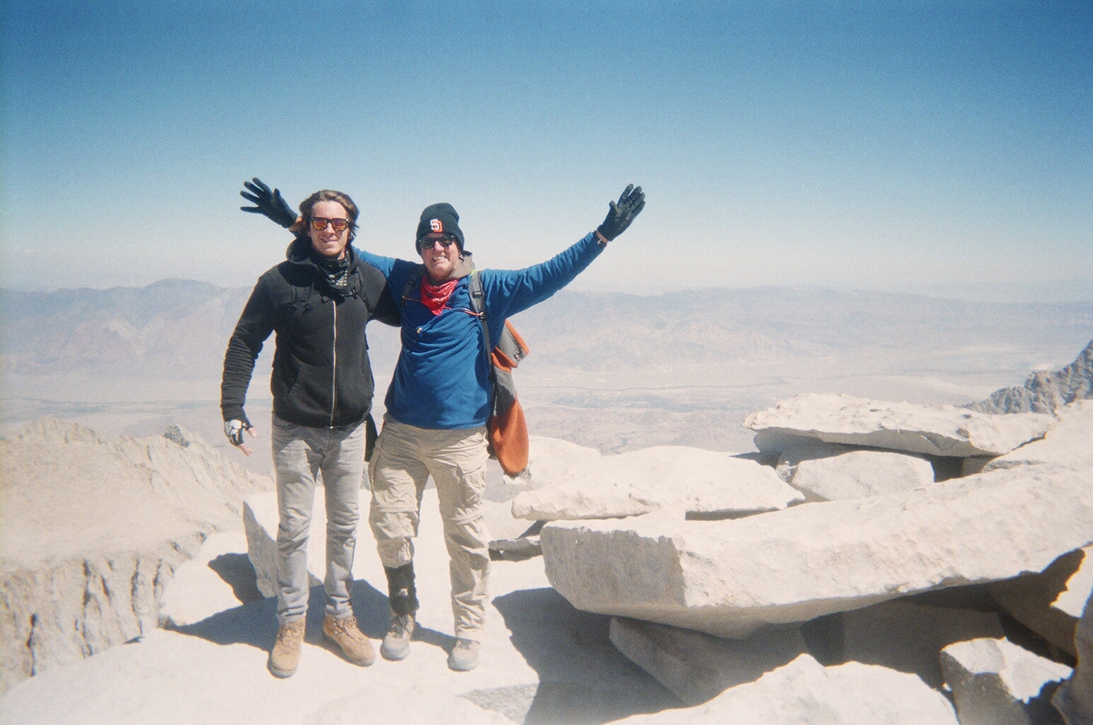
Whitney Summit 09/14/2106
Hiking also provides a very significant physical fitness benefit due to the unpredictable nature of the hike and the physical challenges that are presented.
Not only does the distance of the hike offer a physical challenge to the body aerobically, but the climbs, dips and the various compositions of the hiking trail workout different muscle groups, not only in our legs, but the back and bottom as well! ….If you want to get your legs and butt in shape, go hiking!
Hopefully, I have offered some insights in answering the question “what’s a hike” as well as opening you up to the mental health and physical fitness benefits to the sport of hiking.
I leave you with the following thought: If you want to get from point A to point B go on a walk.
If you want to go on an enlightening journey go on a Hike!