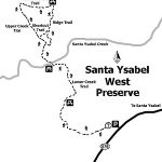
Distance: 7.4 miles without the loops, 10 miles with the loops ; West Loop is 1.3 Miles, & Kanaka Loop is 2.3 miles Elevation Gain: 1200 feet. Time to complete: 4 hours
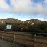
Directions To The Preserve: East – Farmer Staging: Take Highway 78/79 into Julian, to Main Street. Going north, Main Street turns into Farmer Road. Take Farmer Road to Wynola Road and turn right, then a quick left back on to Farmer Road. Pass the Volcan Mountain Wilderness Preserve sign on your right. Santa Ysabel Preserve will be on the left side, approximately one mile from the Volcan sign. Parking is available in the staging area. West: Take Highway 78 to Santa Ysabel. Staging Area is one mile west of Santa Ysabel on Highway 78 at call box #495 or across the street from 29313 Hwy 78.
The Coast to Crest Trail and the trail we took this day, the Kanaka Loop Trail, which is the East approach off of Farmers Rd. One of the benefits of hiking Santa Ysabel Preserve is just getting out there, driving the one lane country roads through Ramona past the hill, into Julian you definitely get the feel of being in the back country surrounded by vast open beauty, pine and oak trees and of course a mountainous terrain.
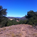
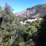
The Santa Ysabel Preserve really reflects the area, both in vastness and vegetation as well as offering views at many spots along the trail of other hikes in the county, including, Mt. Woodson and Iron Mountain, Mt. Gower, and far off in the distance Palomar Mountain.
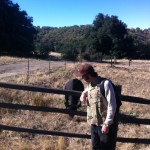
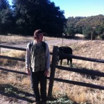
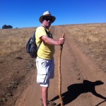
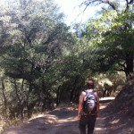
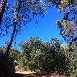
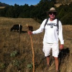
The first thing that strikes you about the Kanaka Loop trail-head start, is that you are greeted by the local 4-legged creatures. In fact as you walk through the gate that starts you onto the trail, you will more than likely be greeted by a bovine friend chopping away at the grasses and vegetation along the trail. The start of this trail is pretty flat and open but soon you are heading uphill through a covered forested area with a creek on your left.
Palomar Mountain and observatory in distance
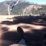
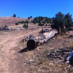
The trail continues to climb to a point where looking to the north far off in the distance is Palomar Mountain and if clear the white dome of the observatory. As you continue to the left a wide-open expanse of a meadow/field is upon you, at this point the trail makes a huge loop and is marked guiding you to veer off to the right beginning the loop section of the hike.
From here you can take a small detour up an easily climbable grade to get good views of Mt. Woodson and Mt Gower off in the distance.
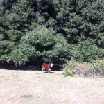
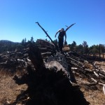
As you wind back down you come upon a small herd of resting cows that gather at a watering hole. Continuing on you will come across good-sized downed burnt charred trees, which are left over remnants of the Cedar Creek fire of 2005. From here you will climb a steep grade through pines and other vegetation, the trail will wind down and then will lead you to an open area that provides amazing views of the surrounding hills and mountains.
Charred trees from 2005 Cedar Fire
and done
You can see Volcan Mountain, which trail-head start is just down farmers road from Santa Ysabel Reserve. Ascending from this point you will so join up with the start point of the loop and the ascent down and back to where you started.
On this day that we hiked the sky was blue, no clouds and the temp was high 60’s when we started and near 80 when we ended in early afternoon. Bring at least 2 quarts of water, snacks a lunch and as always good hiking shoes/boots. …..A gorgeous day for hiking and a gorgeous hike to do. Have fun…..Next… the hike up the road from Santa Ysabel…Volcan Mountain.. See you on the summit…..Hike on!
Here’s a secret tip for the best pie shop in Julian
Mt. Gower located 6 miles southeast of Ramona is a must hike if you consider yourself an avid hiker in San Diego County. Even if you are not an avid hiker this hike is a great way to spend an afternoon out in nature. Located in the 1574-acre Mt Gower Open Space Preserve, Mt Gower rises in the north high above the San Diego Country Estates. Mt Gower is the highest point in the preserve, climbing to 3,103 feet above sea level. With numerous routes and a variety of climbs to the summit, Mt Gower has outstanding views of nearly all of San Diego County’s high-points and beyond.
This is the second attempt at Mt. Gower as the first time was in September and way to hot, 100 degrees at 11am, to consider such a hike. This time around the temperature was perfect as at hike’s start it was 60 degrees and even at hike end the temperature only climbed to 70 degrees. The lower temp absolutely makes for a much more comfortable hike, although lots of water is highly recommended and I would highly suggest doling this hike in late fall to early spring.
As you begin the hike you get a great view of the summit of Mt. Gower and even much of the trail as it winds, dips and climbs all within site.
Heading into Scwartz Canyon
It then crosses the creek and winds up to the water tower and heads east along the ridge. The ridge has a couple of undulations of about 100 to 400 feet in elevation. After this, the trail crosses the brush area and up another rise to a meadow. To this point you will have hiked through various terrain changes consisting of low lying chaparral, numerous tree types, rocky vastness as well as narrow dense brush lined paths. This time of year (November) the colors of the trees are fall in fall bloom with orange and red hues abounding!
Then hikers cross the meadow and climb up another rise to the mantle below the peak. The mantle is a solid rock outcrop. From here you are on your own as you look up to the peak of Mt. Gower. On this day as we looked up at the peak we noticed two hikers descending. We kept a keen eye so that we could retrace their route and as they came upon us we asked about the climb. They were quick to say that although you pretty much are in a “mountain climbing mode”, the scramble up the rocky slope is an easy one so long as you watch out for the outcroppings of rock and or dirt to guide your steps and way.
Scramble to the Summit of Mt. Gower
Although not long in distance, it does offer a quite riggourous challenge to your ascent to the summit and completion of part I to this hike, part 2 being the trip back. The scramble up is well worth the climb as once you get to the summit you are rewarded with amazing views at every degree you look. 360 Video of the Summit! Although this day was cloudy you could still see the faint outlines of downtown San Diego as well as all the prominent peaks in the county. I’ve talked to other’s who have made this trek to the top and they have said that many days you can see Mt Baldy in the distant northeast as well as far as the eye can see due east and out to the dessert floor. Regarding distance of this hike, to the summit, the GPS reading on my iPhone pedometer app said 3.98 miles.
Stonehenge Look Alike!
After spending enough time for lunch and taking in the views we launched our descent back. I always feel that the descent offers as many challenges if not more than the ascent on most hikes and this was surely evident here as scaling the rocky slope down to the solid rock mantle outcrop must be done slowly as footing, which I found out the hard way can be precarious in spots. Once down to the solid rock shelf, take in again the unusual rock formations and views of distant mountains and vistas. This area is quite unique and one can see imitations of stonehenge as well as with the keen eye openings to old mines and caves.
By tracing your steps back you will soon find the trail that took you to this point. Again, once you are on the trail it is easy to follow, well carved and provides reassurance of the way back. At this point your legs will remind you that you have put in a solid days work and accomplished a long difficult hike!
The Mt. Gower hike ranks right up there with Mt. Woodson, The Big Laguna Trail and the North and South Fortuna’s in Mission Trails Regional Park as one of the most physically challenging hikes in the county while providing amazing scenery, diverse geography, varied vegetation and a huge sense of accomplishment at hike’s end!
More Photos on Trail Shots!
Distance: 8 miles
Date and Time: Saturday December 1, 2012 8:40AM to 1:40PM
Hikeability: Strenuous to Difficult (in spots)
Water & Food: 3/4 gallon water, 1/2 bottle gatorade, lunch, oranges and snack bars