Santa Margarita River Trail, Fallbrook, CA Father’s Day Hike 06/18/2017

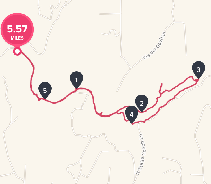
Distance:  6 miles   Elevation Gain: 469′ Date and Time:  Sunday June, 18th  10am to 1pm  Temp:  70’s  Hikeability:  Easy-Moderate  Water & Snack:  1.5 liters, Probar, Orange

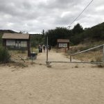
Directions to trailhead :   From the coast, take Highway 76 east and turn left on Mission Road, heading north. Take the first left onto Pico Road, which quickly becomes De Luz Road. Veer right onto Sandia Creek Road, and park on the trailhead just before the bridge.

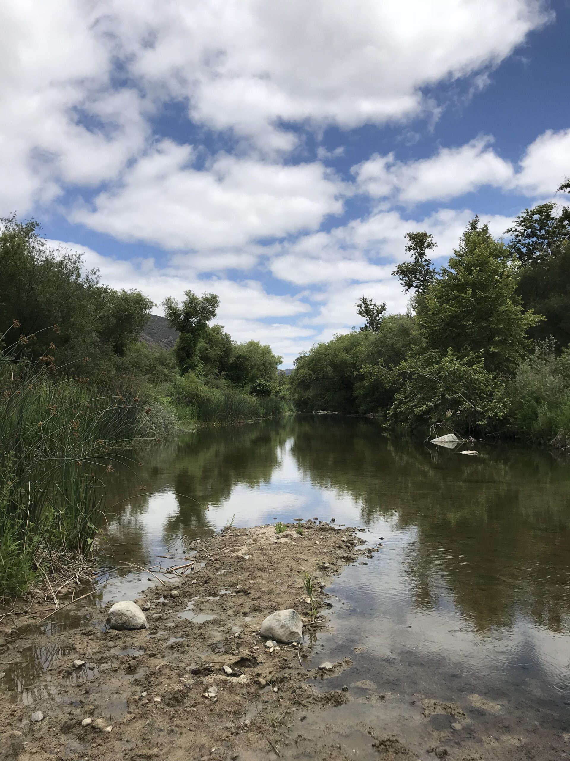
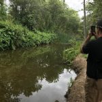
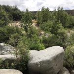
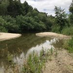
A hike I’ve heard of more about from the local hiking community here in the North County section of San Diego is the Santa Margarita River Trail in Fallbrook, CA. This hidden gem of a trail parallels a clean clear slow moving river out into the back country and hills of Fallbrook.  


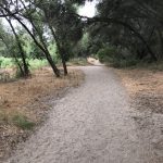
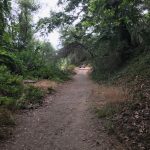
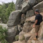
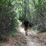
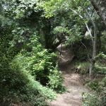
The trail is very well marked, much of the way soft sand with some ares of the trail rock and boulder “hazards” dotted along the way just to add some interest and challenge to this relatively easy trail.  


That said, at trails end, you really do feel like you have hiked a much more aggressive trail than what the Santa Margarita River Trail has to offer.   The fun part of this hike is at certain sections  2 miles out you can find “secret” areas that allow you to cross the river with a few rock climbs and bushwhacking (watch out for the Posion Oak)


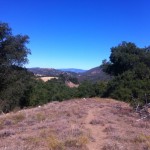
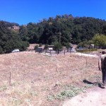
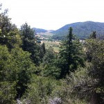
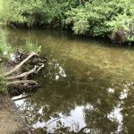
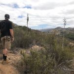
You can  step rock to rock crossing the river leading which will lwad you to the continuation of trail on the other side of the river.  This continuation trail ends further  into the hills and at one point offers you a climb up to a plateau  and sweeping views of the Valley and distant mountains and hills.


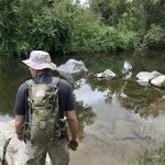
On the way back we had to find a narrow area of the river so the we could cross. We eventually picked a spot that wasn’t too deep, took off our boots, rolled up out pants, and made the adventurous crossing, bare foot and all.  The river is clear, clean nd cooling on the feet.   

Quite refreshing after our previous 3 miles of hiking the trail and up into the hill


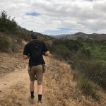
The Santa Margarita River Trail offers two “paths” to hike along, one that gets you closer to the rivers edge and one that is elevated and detours you around thechallenging parts of the river trail.  

Either way, as mentioned earlier, there is plenty of Poison Oak on this trial and from my 6 plus years of hiking San Diego County, the Sant Margarita River Trail has more Poison Oak than on any trail Ive hiked. 

All due respect to the back country of Jullian and Palomar Mountain trails as well 


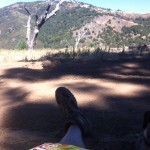
A fun landmark along the way back at about mile 4 on the upper section of the trail was an old rusted out automobile hull, I’m guessing was at least 40 years old due to its all steel chassis (including the steering wheel) conuctrustion, bumper and all.  

The rusted hull of a vehicle makes for great photo opportunities and discovery.


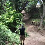
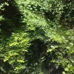
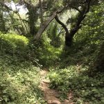
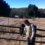
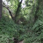
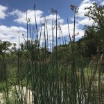
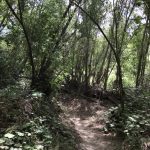
The Santa margarita River Trail also is lined with beautiful green vegetation, oaks and other vine like flour and fauna, making some of this trail feel lie a jungle hike amidst lush tropical dense rai forest like atmosphere. The trail back is quick and before you know it you will be back at the gated trailhead and the parking lot.  

I always like finding new hiking spots and trails in a county we are so fortunate to have lots of diverse and beautiful hiking trails.

As always, don’t hike alone, respect your own limits, respect your partners limits, bring more water than you need and most important….have Fun!…Hike on! 

Santa Ysabel Preserve East, Julian, CA: Back Country Hiking

Distance: 7.4 miles without the loops, 10 miles with the loops ; West Loop is 1.3 Miles, & Kanaka Loop is 2.3 miles Elevation Gain: 1200 feet.  Time to complete: 4 hours  

Directions To The Preserve:   East – Farmer Staging: Take Highway 78/79 into Julian, to Main Street. Going north, Main Street turns into Farmer Road. Take Farmer Road to Wynola Road and turn right, then a quick left back on to Farmer Road. Pass the Volcan Mountain Wilderness Preserve sign on your right. Santa Ysabel Preserve will be on the left side, approximately one mile from the Volcan sign. Parking is available in the staging area.  West: Take Highway 78 to Santa Ysabel. Staging Area is one mile west of Santa Ysabel on Highway 78 at call box #495 or across the street from 29313 Hwy 78.   


The Coast to Crest Trail and the trail we took this day, the Kanaka Loop Trail, which is the East approach off of Farmers Rd.  One of the benefits of hiking Santa Ysabel Preserve is just getting out there, driving the one lane country roads through Ramona past the hill, into Julian you definitely get the feel of being in the back country surrounded by vast open beauty, pine and oak trees and of course a mountainous terrain. 


The Santa Ysabel Preserve really reflects the area, both in vastness and vegetation as well as offering views at many spots along the trail of other hikes in the county, including, Mt. Woodson and Iron Mountain, Mt. Gower, and far off in the distance Palomar Mountain. 


The first thing that strikes you about the Kanaka Loop trail-head start, is that you are greeted by the local 4-legged creatures.       In fact as you walk through the gate that starts you onto the trail, you will more than likely be greeted by a bovine friend chopping away at the grasses and vegetation along the trail.  The start of this trail is pretty flat and open but soon you are heading uphill through a covered forested area with a creek on your left.  


The trail continues to climb to a point where looking to the north far off in the distance is Palomar Mountain and if clear the white dome of the observatory. As you continue to the left a wide-open expanse of a meadow/field is upon you, at this point the trail makes a huge loop and is marked guiding you to veer off to the right beginning the loop section of the hike.  

From here you can take a small detour up an easily climbable grade to get good views of Mt. Woodson and Mt Gower off in the distance. 


As you wind back down you come upon a small herd of resting cows that gather at a watering hole.  Continuing on you will come across good-sized downed burnt charred trees, which are left over remnants of the Cedar Creek fire of 2005. From here you will climb a steep grade through pines and other vegetation, the trail will wind down and then will lead you to an open area that provides amazing views of the surrounding hills and mountains.

You can see Volcan Mountain, which trail-head start is just down farmers road from Santa Ysabel Reserve.  Ascending from this point you will so join up with the start point of the loop and the ascent down and back to where you started.

On this day that we hiked the sky was blue, no clouds and the temp was high 60’s when we started and near 80 when we ended in early afternoon.  Bring at least 2 quarts of water, snacks a lunch and as always good hiking shoes/boots.  …..A gorgeous day for hiking and a gorgeous hike to do.  Have fun…..Next… the hike up the road from Santa Ysabel…Volcan Mountain.. See you on the summit…..Hike on!    

Here’s a secret tip for the best  pie shop in Julian


Palomar Observatory Trail: A Hike to the Stars!

If you are looking for a hike that offer’s you three amazing varied experiences in one, then the Palomar Observatory Trail is the hike for you!

This trifecta trail offers a great aerobic workout, beautiful scenery, and at trails end, one of the truly magnificent scientific wonders in the country, the Palomar Observatory, which houses one of the largest telescopes in the world.

Although “only” 4 miles in length, this out and back trail is a good aerobic jaunt with an elevation gain of 900 feet up Palomar Mountain in the backcountry of San Diego County, east of Interstate 15.  The drive in itself to this hike is an adventure offering landscape that passes through vast open fields bordered by orange groves, hills dotted with avocado orchards and the nearby Palomar Mountain Range which is a high peninsular mountain range in northern San Diego County of Southern California.

There are numerous hikes in the Palomar Mountain area, but the trailhead to the Observatory Trail is in the observatory campground, which is 3 miles from the intersection of S6 & S7.  The entrance to the campground is on the right hand side of the road.  Drive to the back of the campground, where you will see a brown fence and park bulletin board, which marks the trailhead start.  The trail is very straightforward, pardon the pun, and leads you all of the way to the Palomar Observatory gate.

One of the differences about hiking in the backcountry versus the coast or coastal mountains, is there is a good chance that you will see a mountain lion or rattlesnake along the way.  Part of me very much wanted to experience seeing either one, the other part of me was VERY glad I didn’t.   Backcountry hiking also offered me a different experience as far as terrain as well.  Most of my previous hikes have been in a “open” environment on trails that are rocky, cree or gravel covered surrounded by rock, boulders, coastal and dessert type vegetation.

The Palomar Observatory trail is dirt and pine needle covered and moves through a wooded forest like terrain, which at times takes on a feel of “mystery.”  But the smell of pine and the various sounds emanating from the stillness of the forest offers a very tranquil, peaceful hike.  The vegetation along this trail reminded me of what much of my home state of Michigan is like as you go off into the wilderness.  The presence of gnats buzzing about, while at times annoying, does not take away from the pleasurable experience this hike offers.

As you approach the trails end the alabaster white dome of the observatory starts to appear on your right signaling that you are near.  One of the fun things of hiking for me is to see and chart your progress as far as your timing and physical fitness.

Although this hike offers it’s own set of challenges such as the elevation, this is a fairly easy hike.  I covered the 2 miles from trailhead start to the observatory gate in 46 minutes, the quickest I have done 2 miles, fast but not at the expense of enjoying the hike, afterall the peace and mindfulness of the hike are a great part of the journey for me as well.

Focus on the journey, not the destination. Joy is found not in finishing an activity but in doing it. -Greg Anderson


The third reward to this hike is the observatory itself.  From the trail end you can walk over to the pristine white dome and go inside and see what astronomical wonders this building offers.   After that take a lunch break, tour the museum, then head back down the trail and complete your adventure.  A final stop before heading down the mountain on your drive home would be the general store and Mom’s Café which is on the right hand side of S6 at the intersection of S6 &S7

This is a good hike to change it up that not only offers the physical fitness and mental health benefit of a hike but you get the bonus benefit of learning about the Stars!  Have a great time!


Distance:  4 miles

Hike Date and Time:  Thursday June 7, 2012  11:30AM – 2:00PM

Hike-ability:  Easy moderate, the elevation gain and attitude make a difference on your breathing if you are not used to it, even if you are it still does!

Food and Water:  Sandwiches for lunch, an orange and about 50 oz of water.

Tempature:  80’s

Trailhead: From Interstate 15, near Fallbrook, drive twenty-one miles east on Highway 76. Turn north on Road S6 (South Grade Road), continue 6.5 miles to the junction with Road S7, then continue three miles north along Road S6 to the Observatory Campground (located across from the Forest Service Sign on the right side of the road). The parking area for the trailhead and the amphitheatre is located toward the back of the campground “loop” and is signed. A Forest Service Adventure Pass is required to park at the trailhead.