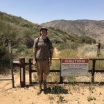
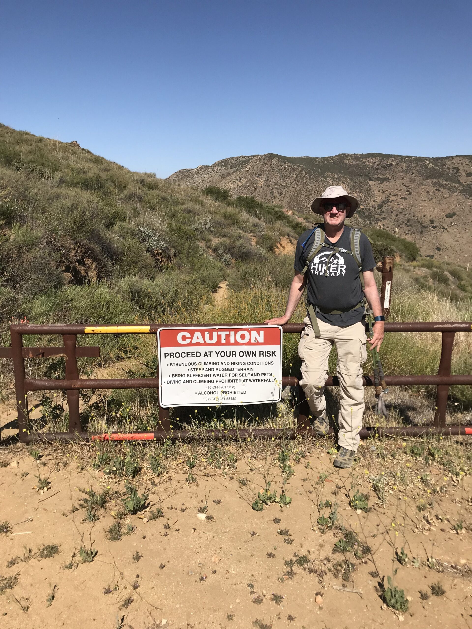
Cedar Creek Falls Hike is located on the Fringes of Julian and Ramona in the Cleveland National Forest back county of San Diego County. This is “The Waterfall Hike” in our county. It is also a hike of some noteriety due its recent years of being closed due to individuals dying on this hike. Both from intoxication and jumping of the rocks at the Waterfall pool. Also, some have died due to heat exhaustion, dehydration and a lack of water. A caution sign at the trailhead speaks to these dangers and absolutely something you need to be aware of this hike.
Direction to Cedar Creek falls; From Santa Ysabel(Dudley’s), take Highway 78 east towards Julian to Pine Hills Road, turn right (from this turn it is 30+ minutes to the trailhead). Turn right onto Eagle Peak Road. The last 8 miles of Eagle Peak Road are dirt but part of the beauty of this hike is getting to the hike. The back country of the Julian Ramona area is gorgeous. This time of year it was green and flowers were out. Eagle Peak Rd will dead end into the cult-de sac trailhead start.
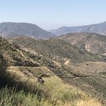
You can park alongside the road edge but be aware that on the weekends the road gets pretty full. After you park walk towards the cul-de-sac with the tree in the middle of the road and veer right to the trailhead start. Interestingly on this weekend day (Saturday), there was not one car along side Eagle Peak Rd. as we arrived. This was both a blessing and a question point for me. Where is everyone, its 9:30am? That said it seems since this hike has opened back up 5 years ago, many use the Thornbush Rd trailhead start in a neighborhood area of Ramona. So, the fact nobody was here was a good thing parking wise, it only added to the ominous feeling of this hike right from the start. So much open vastness, rolling high peaked hills, and lots of it for miles in each direction.
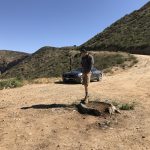
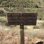
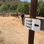
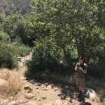
This trail is unique in many ways including the fact that unlike most hikes, the start to this hike immediately begins to descend for the next 2.75 miles it takes to get the waterfall.That’s the good news, but like anything that must go down, you must also go up. Although not a steep ascent it is long and can get very hot. I will take the opportunity to stress the importance of taking a lot of water on this hike; a gallon per person is what I suggest along with snacks and oranges. The caution sign in the phot indicates the dangers of this hike. Cedar creek is very doable, but it can get ruhot, dry and rugged which adds to the difficulty level of this hike by at least 3 points. 0-10 this hike is a 6-7 difficulty wise, add heat its a 8-9.
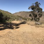
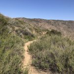
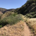
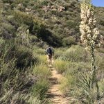
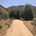
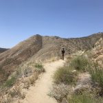
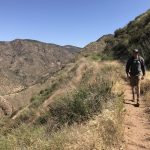
The topography on this hike creates a sense of vastness and an open feel that adds to the majestic views that surround you. You are essentially descending the entire trail to a valley surrounded by the local mountains of the Cleveland National Forest. The trail is very hike-able and although it is strewn with rocks in places the vast majority of the trail is made up of soft earth and sand. On the decent you have the mountainside to the left of the trail and the drop-off to valley floor below on your right.
We all have our own definition of difficult, but whatever the is for you, this hike is very challenging. That said its a beautiful trail, great views and lots of opportunities for great photos, and thats even before you get to the water fall. The trail is very easy to track with posted signs along the way indicating distance traveled and the distance to the waterfall below.
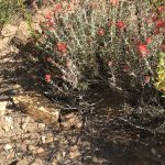
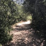
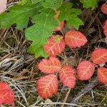
Once you reach the valley floor at about the 2 mile mark or so signs will navigate you left towards the waterfall. The vegetation changes here and becomes denser with California Scub Oak and low-lying brush. Beware of Poison Oak which are those deep red leaves growing from the low lying plant, bush.
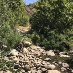
As the trail down in th Valley has flattend out for you, you will approach a canopy of tress and brush to invite you in and on your way towards the falls. You will come across a river bed of rock which help you navigate you across a creek.
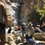
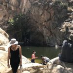
The next “obstacle” on the trail is a few climbs over boulders rocks and up to a spot where you soon see splashing water, the sounds of people jumping and swimming and if there is water running in the falls, the sounds of the falls themselves crashing down to the rocks and “watering hole” area below. On this day there was only a trickle of water running down the falls, but plenty in the pool below.
Once you are done enjoying the falls, replenishing your water and fuel, it will be time to return and the ascent back. Take your time, ascending is a one step at a time process. Keep hydrating, break with snacks along the wy and soon you will have hiked out the 2.75 miles out and back to your car at the trailhead.
As Always hike with a partner, know your limits, know your partners limits, take more than you need water
and know your trail route, use a map and or compasss if you must.
Hike On!
Published by
Mark
My name is Mark Lees and I was born in Detroit, Michigan and moved to San Diego in 1976. I now live in Oceanside, California. I have a son age 26 who is my hiking parter, and thankfully got me started into hiking four years ago. I have a Masters degree in psychology with an emphasis in Marriage and Family Therapy from Chapman University, as well as a certification from the California Association of Addiction and Recovery Resources as an Addiction Recovery Specialist. For fun and self-care I like to Hike, Starbucks to both energize and relax and see as many baseball games as I can each season. The spirit of this website is the same passion that led me to create HikerTherapy.... "Hiking for the Mind, Body and Soul..."
View all posts by Mark
Cedar Creek Falls Hike is located on the Fringes of Julian and Ramona in the Cleveland National Forest back county of San Diego County. This is “The Waterfall Hike” in our county. It is also a hike of some noteriety due its recent years of being closed due to individuals dying on this hike. Both from intoxication and jumping of the rocks at the Waterfall pool. Also, some have died due to heat exhaustion, dehydration and a lack of water. A caution sign at the trailhead speaks to these dangers and absolutely something you need to be aware of this hike.