Water: 1.5 L Snacks: Orange, Pro bar, hard boiled egg
For a hike that covers a lot of diverse trail, assorted vegetation, gorgeous views and beautiful scenery then the Pyles Peak via Cowles Mountain Service Rd, Barker Way Trailhead is the hike for you. Not to mention you bag 2 peaks in one hike. In the Mission Trails Hiking system Pyles and Cowles are 2 of the 5 hikes to bag. The other 3 being both Fortunas, North and South as well as Kwaay Paay.
Barker Way to Cowles Mountain Service Road
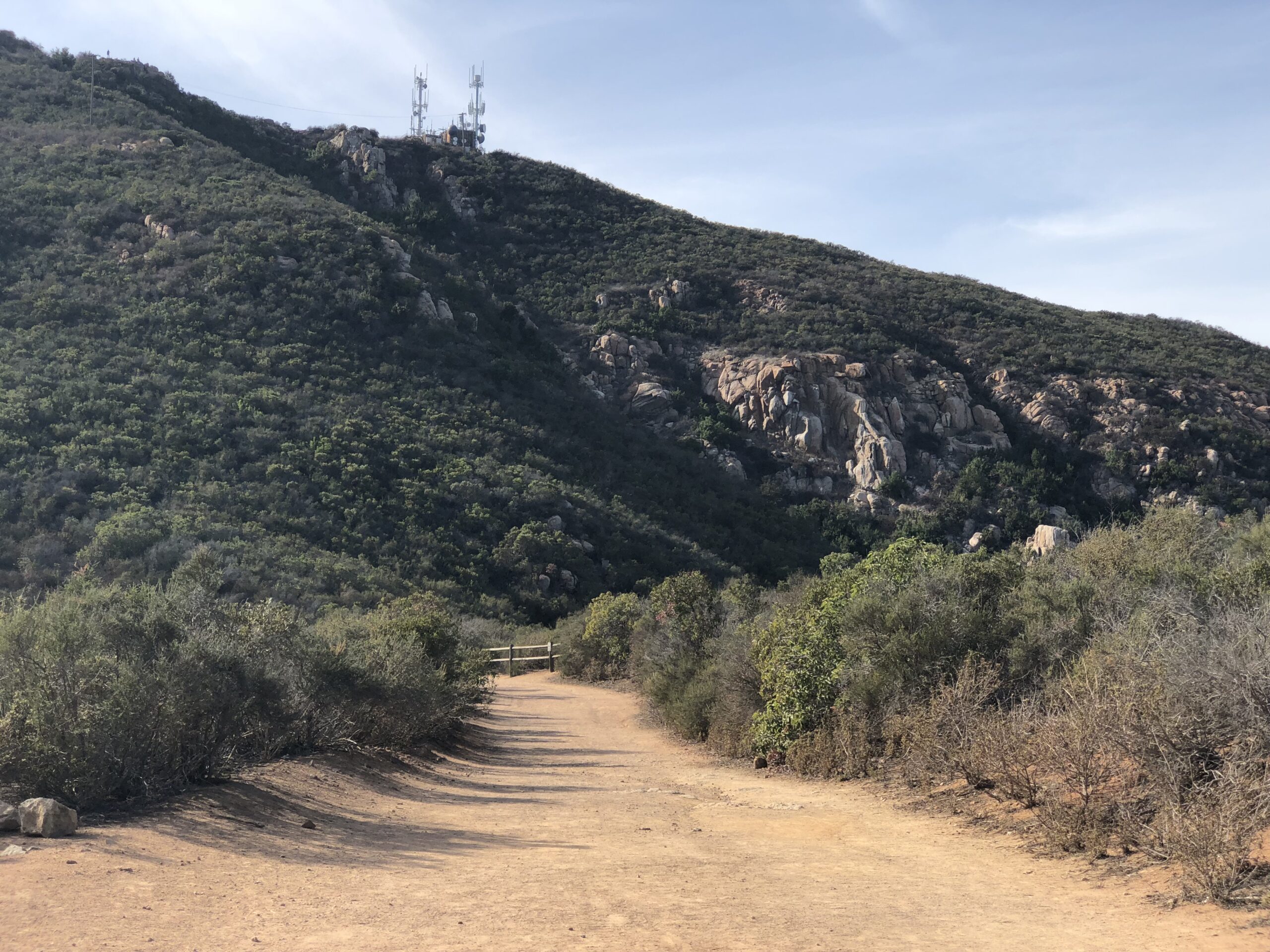
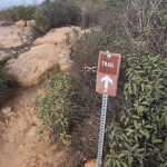
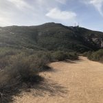
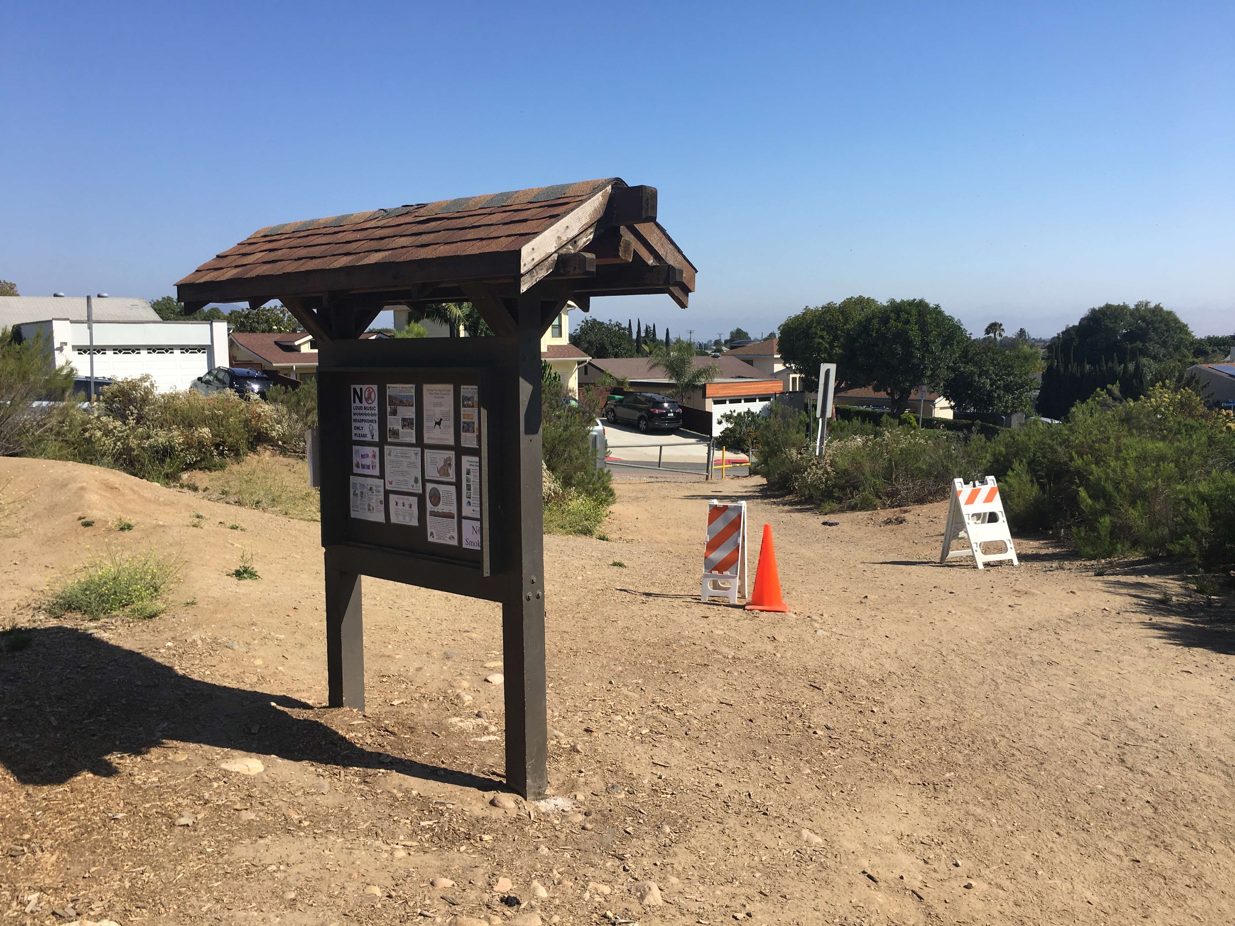
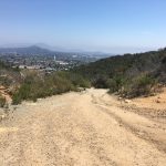
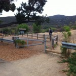
The trailhead for this hike starts at Barker Way In Santee, CA. I like this start due to its less populated trailhead and easier parking. There are also restrooms here for convenience. The trail start is flat, sandy and wide. After 100 yards you will come to a sign that points you left and up towards Cowles, do not go left, continue on the trail as it veers right and up and on your way to the top of Cowles. The trail here starts to climb to the 3/4 mile, then plateaus for awhile then climbs the entire way.
Cowles Mountain Hiker Therapy
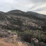
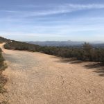
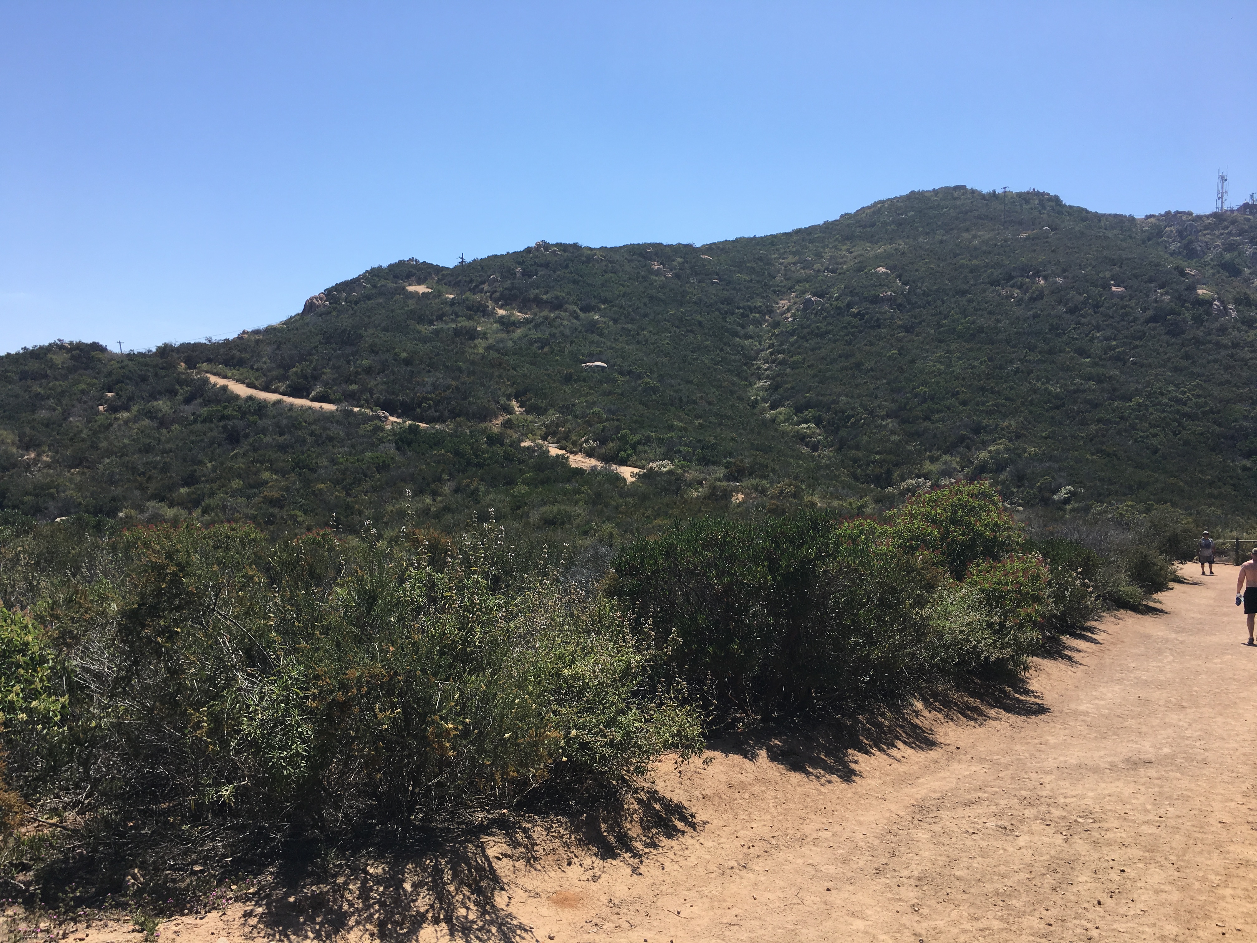
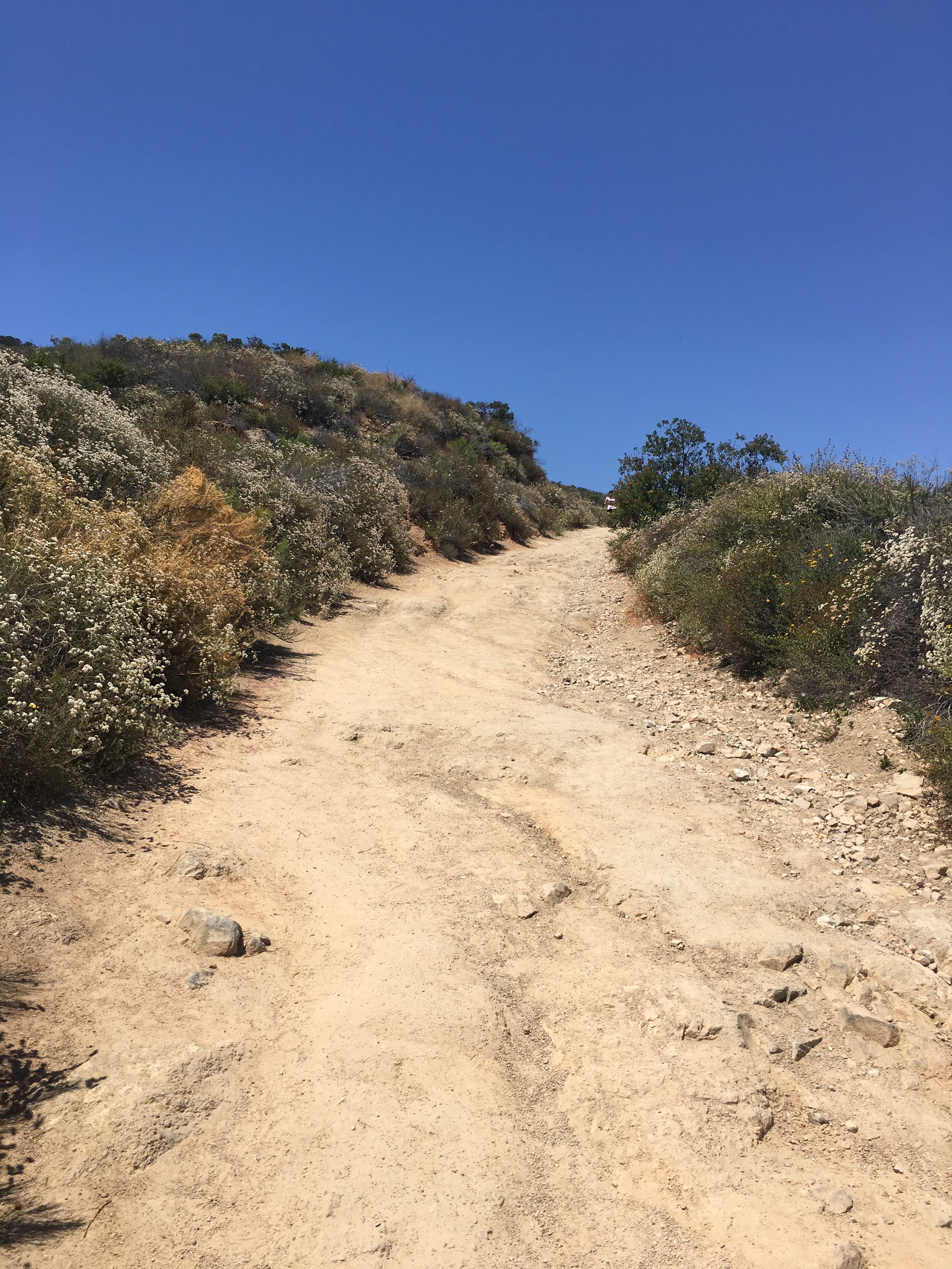
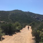
As you plateau at about the .75 mile mark you will look up and catch a glimpse of Cowles, the radio towers, and the trail will “snake” up the mountain to form an “S” pattern. From here to the Peak of Cowles the trail is rocky, and the steep ascent becomes more challenging and strenuous. Although you will see others along the way, compared to the more traditional Golfcrest and Navajo Rd trail, this section of trail in the Colwes system is the less traveled, quite and the most challenging of all the trails up. As you near the Peak of Cowles the trail will steepen dramatically the last 50 yards and then veer left. As you make the gradual left sweep, straight ahead you will see a sign marking the start to the trail over to Pyles.
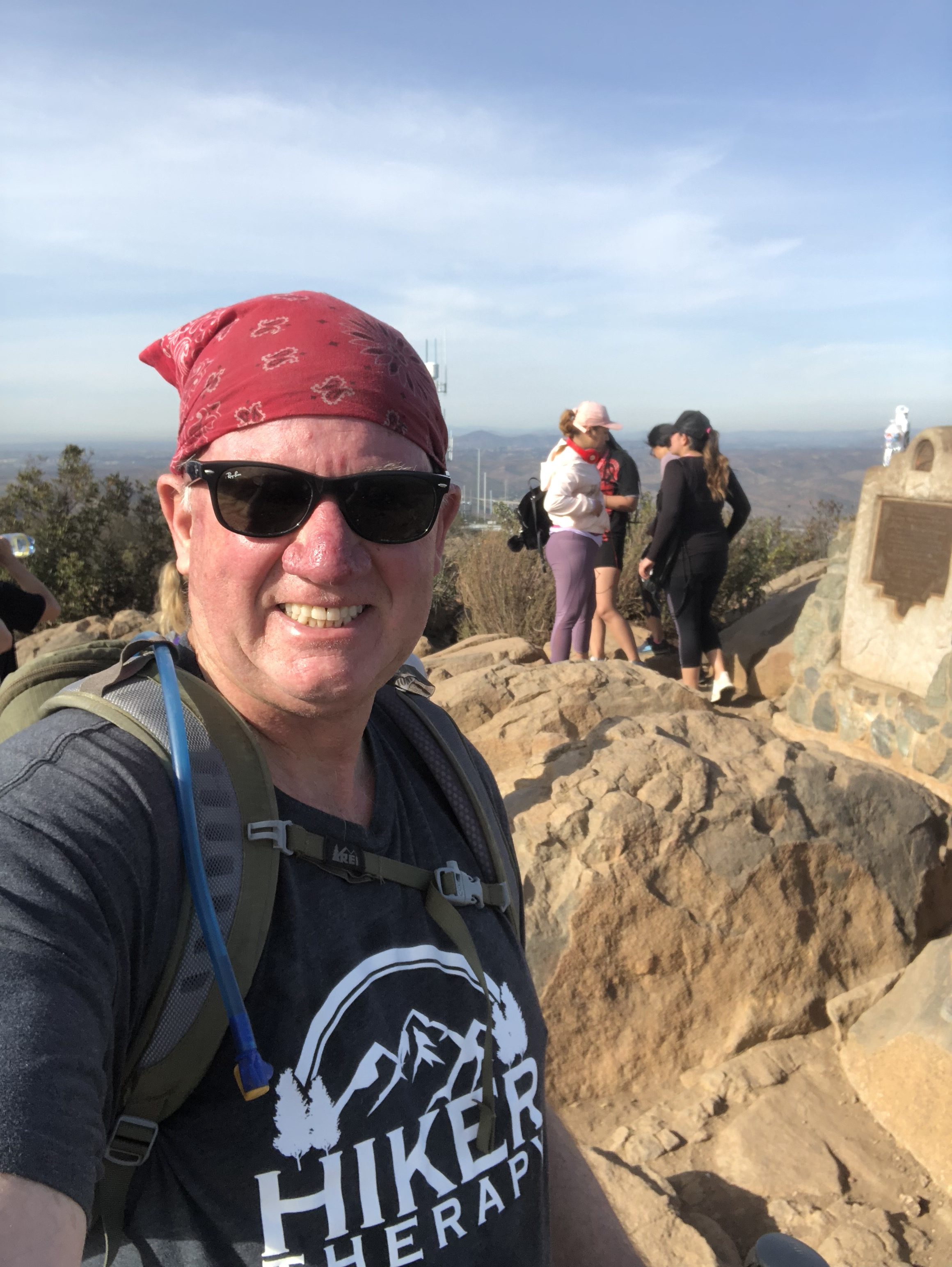
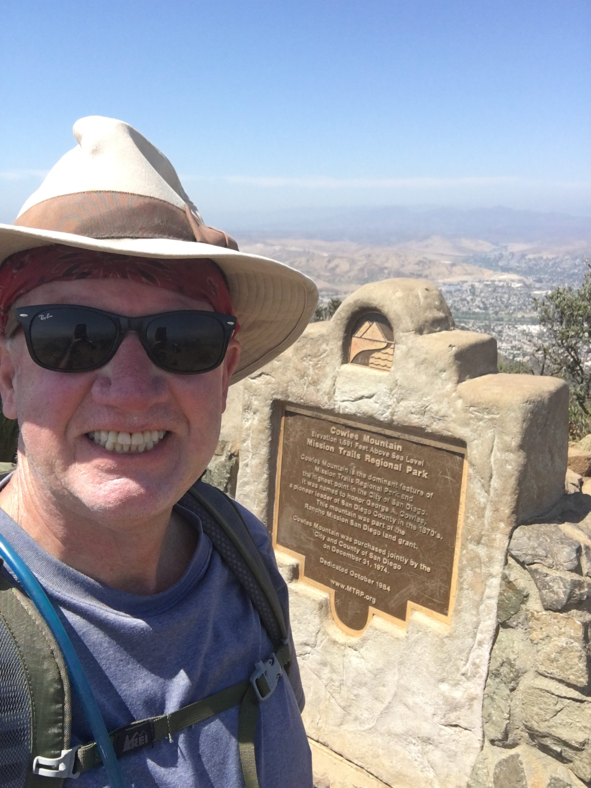
Cowles Mountain Summit Hiker Therapy
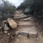
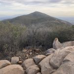
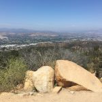
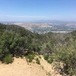
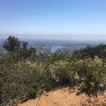
However, as you hike along you will see a set of wooden steps and as you do, make a left to get up to the rocky section of the Peak of Cowles and the path up to the monument. I always love the views from Cowles. Looking North east you see East County and El Cajon Mountain, looking South you can see Mexico, to the Southwest Pt. Loma and looking direct west some of the other peaks in our county including Iron Mountain, Mt Woodson, Black Mountain and on a very clear day the Pacific Ocean. At this point you will have climbed approximately 1.6 miles. I walked around a bit at the peak and added another .4 mile. You can directly see Pyles Peak, looking West from the summit of Cowles.
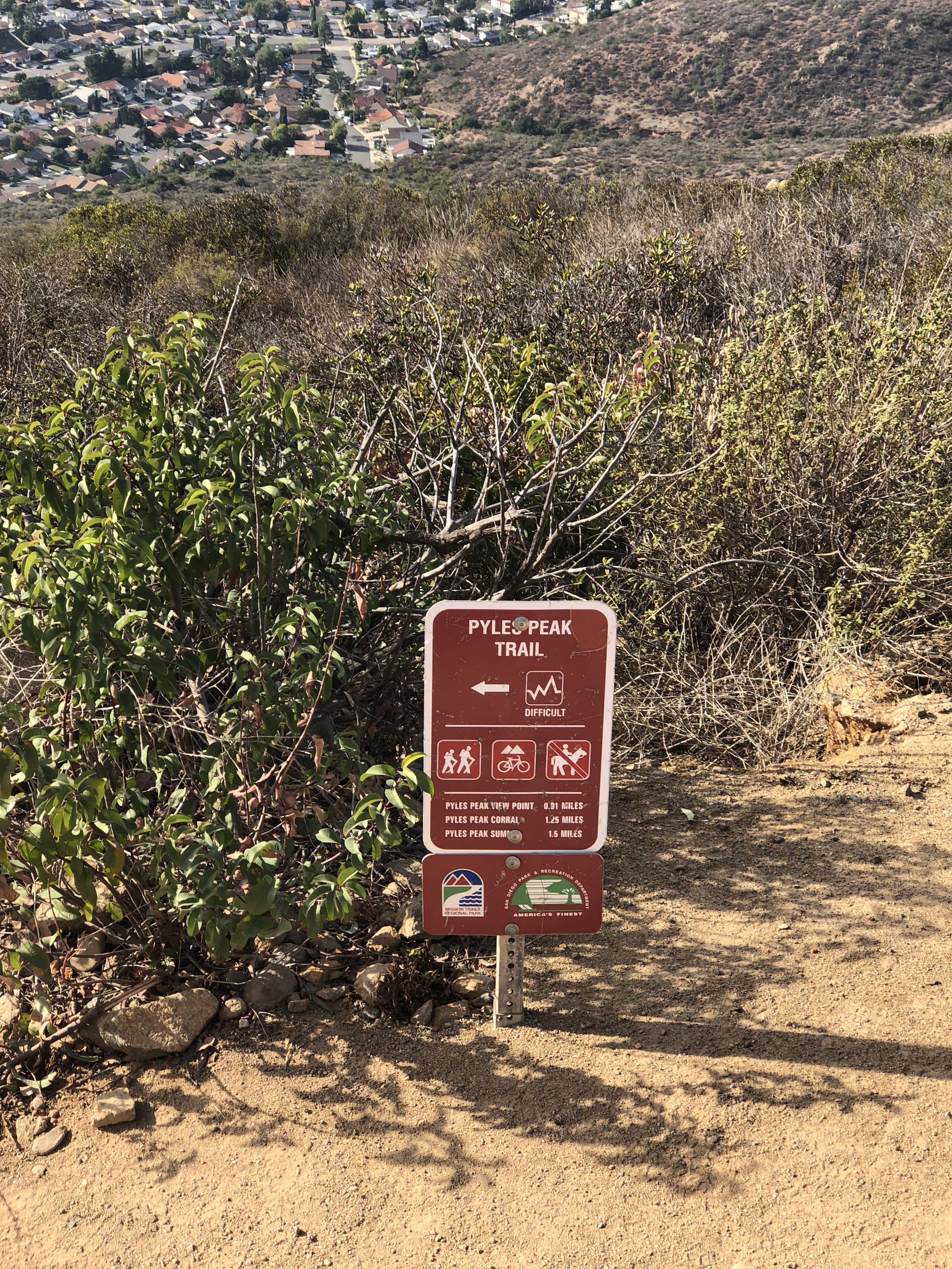
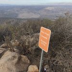
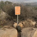
Start of Pyles Peak Trail Hiker TherapySign leading the way to Pyles Peak from Cowles Summit Hiker Therapy
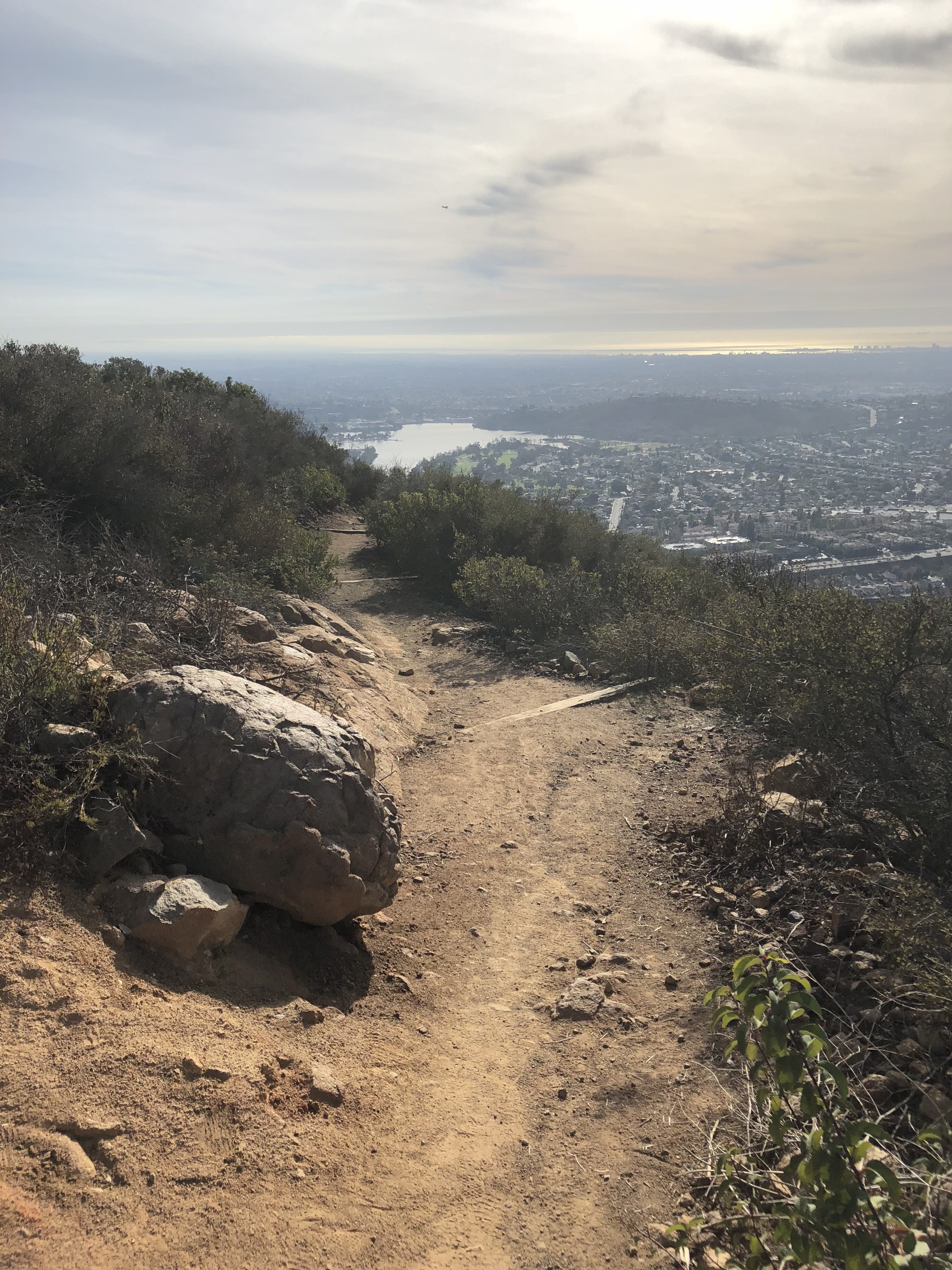
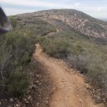
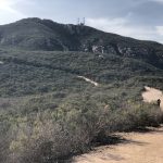
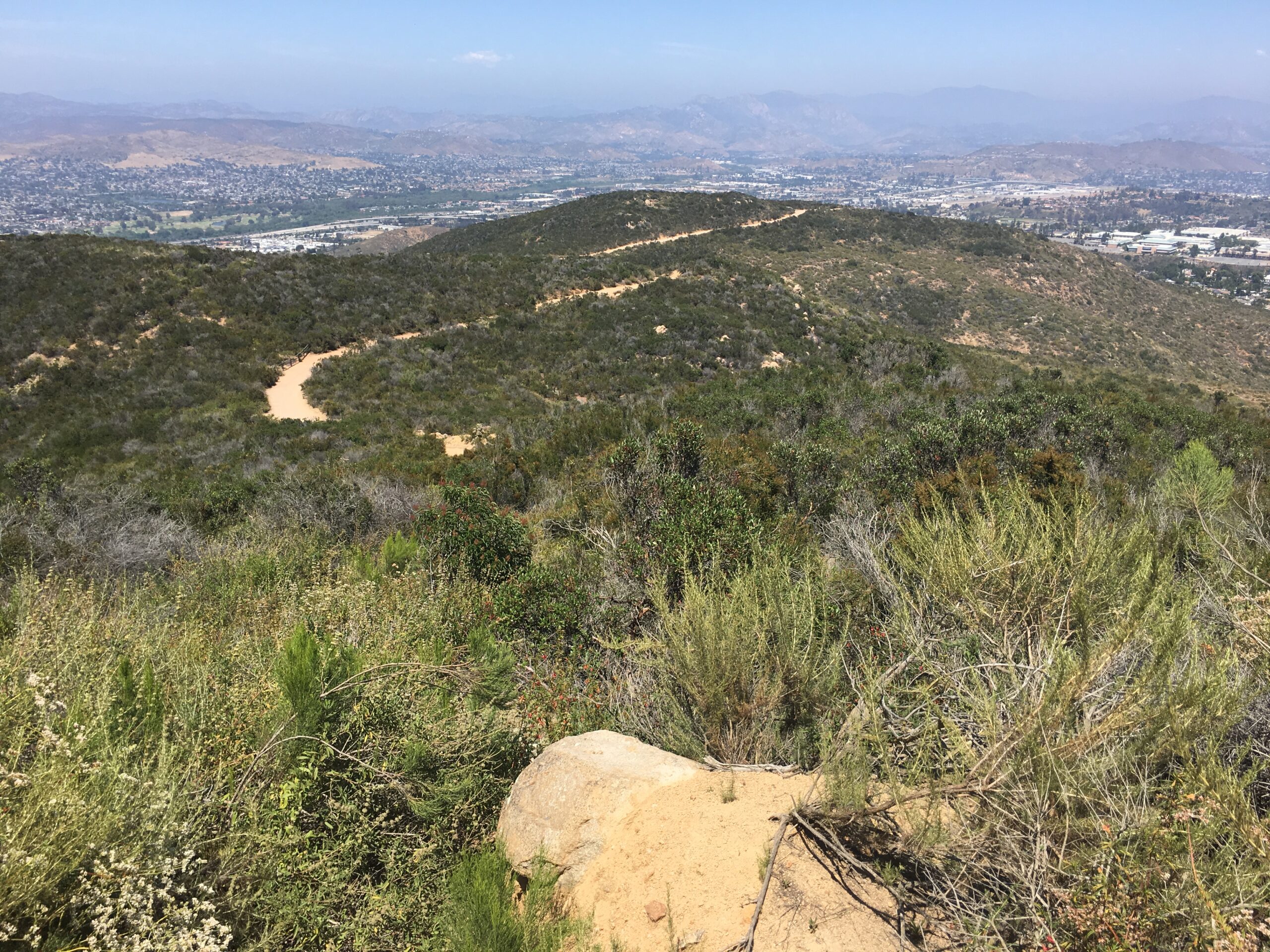
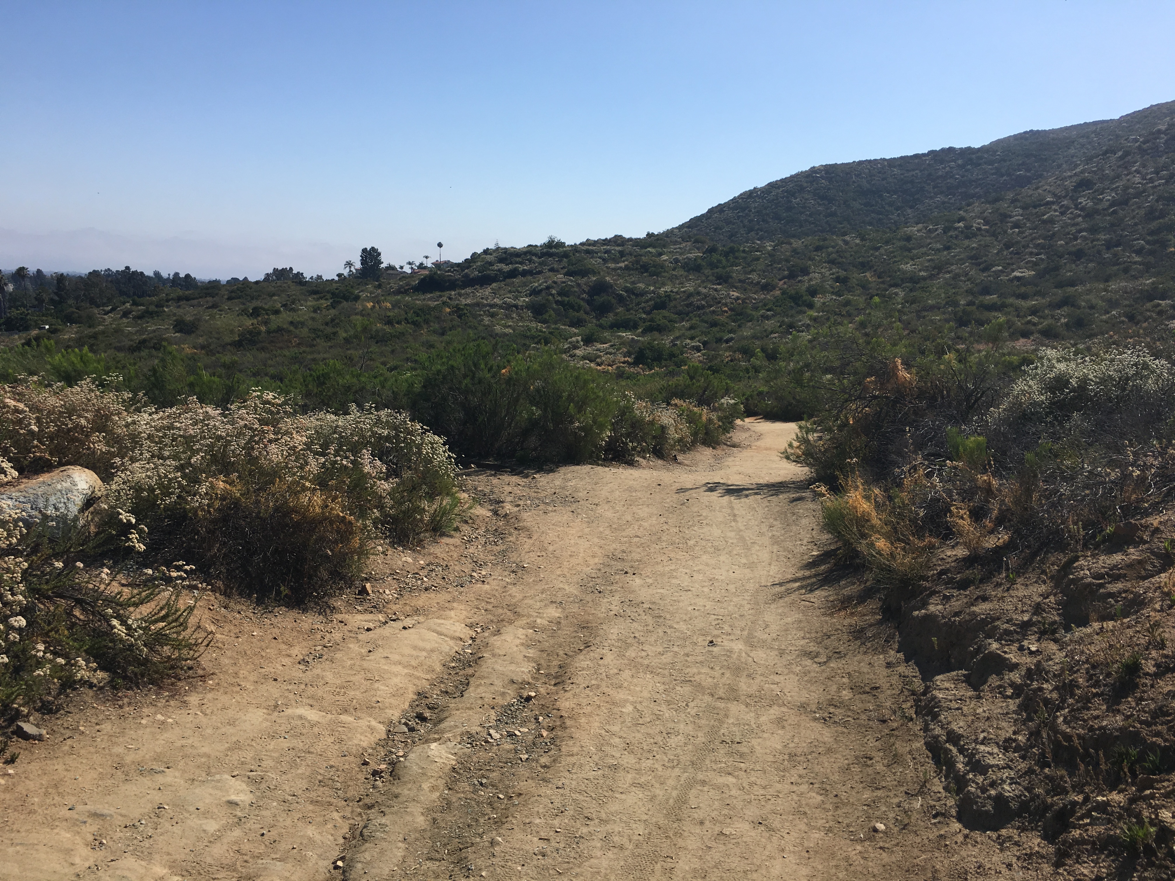
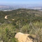
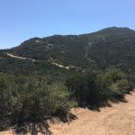
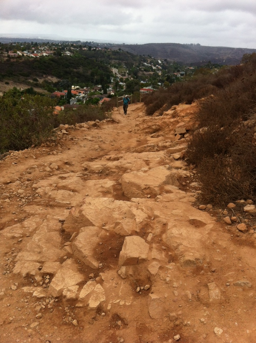
Retracing your steps you will head back down the same stairs you came up on, turn left and head to the marker sign that points you to the trailhead of Pyles Peak. Veering left here you will walk straight into a great view of Santee Lake and a row of greenery. The trail sharp turns right and starts the descent to Pyle peak. The interesting part of this hike is that since Cowles elevation is at 1600” and Pyles is at 1300’, you are spending most of this trail over to Pyles descending and winding in a broad loop to the final ascent back up to Pyles. The ascent to Pyles is the most difficult section of this hike and a very uneven rocky trail. The wide expanses out between Cowles and Pyles are beautiful and quiet. The journey over adds another 1.5 miles to your hike, give or take a few steps.
Trail over to Pyles Peak from Cowles Mountain Summit Hiker Therapy
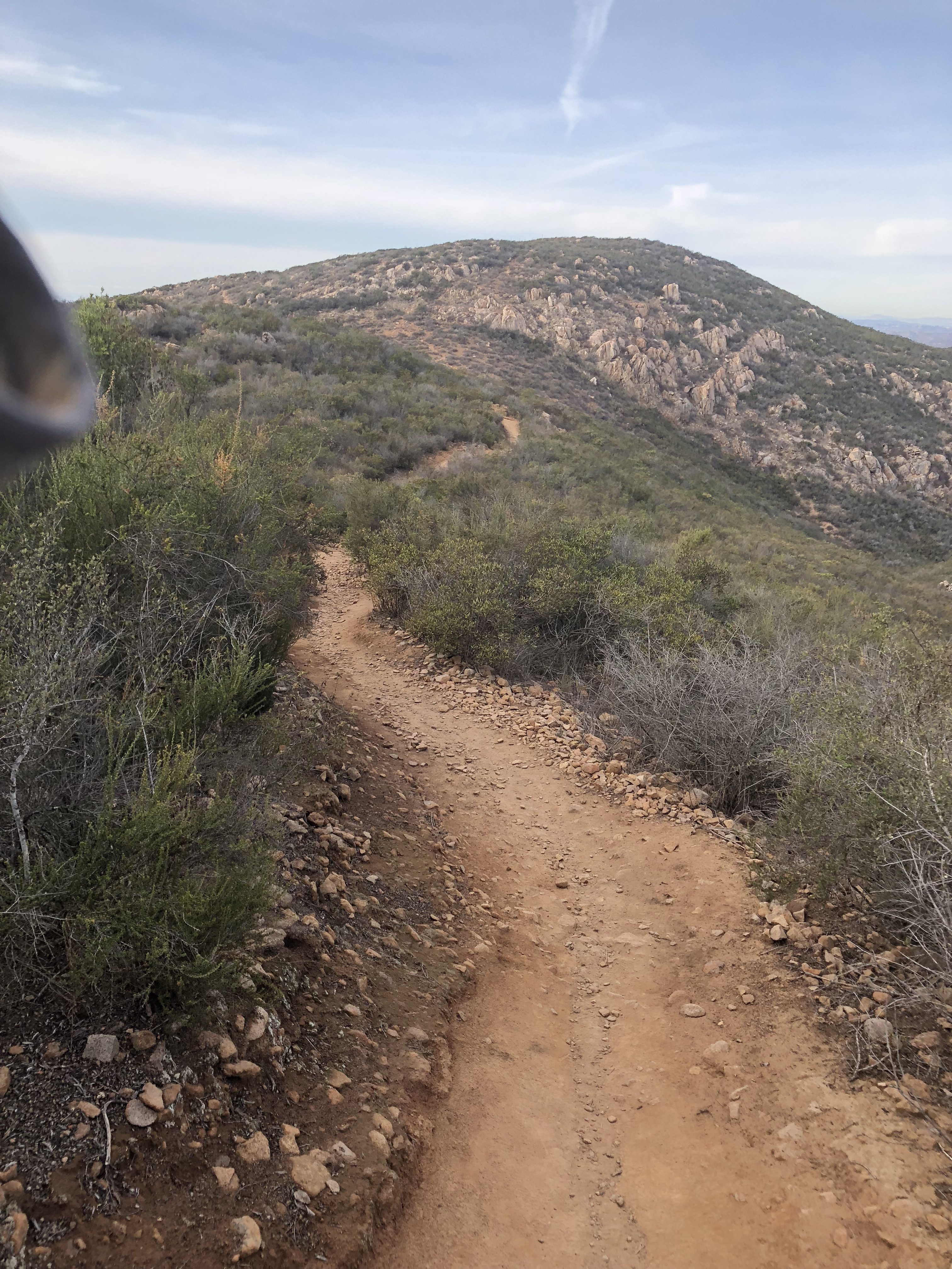
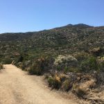
The trail dips and bends on its descent into a flat section that takes you to the junction of the ascent up to Pyles Peak and the Cowles Mt. trail. This time of year the vegetation was somewhat green, not yet flowering. Ive done this hike in March and the flowers on the vegetation are popping then. The vast majority of those who hike Cowles do not continue on to Pyles, which is both a huge plus and a small minus. The minus being there is little contact with others on this trail so its best advised to hike with a partner in case of mishap of injury. Much of the trail is even, sandy, hard packed clay with section of rocky trail, especially on your final ascent up to the Peak of Pyles.
Climb up to Pyles Peak Summit Hiker Therapy
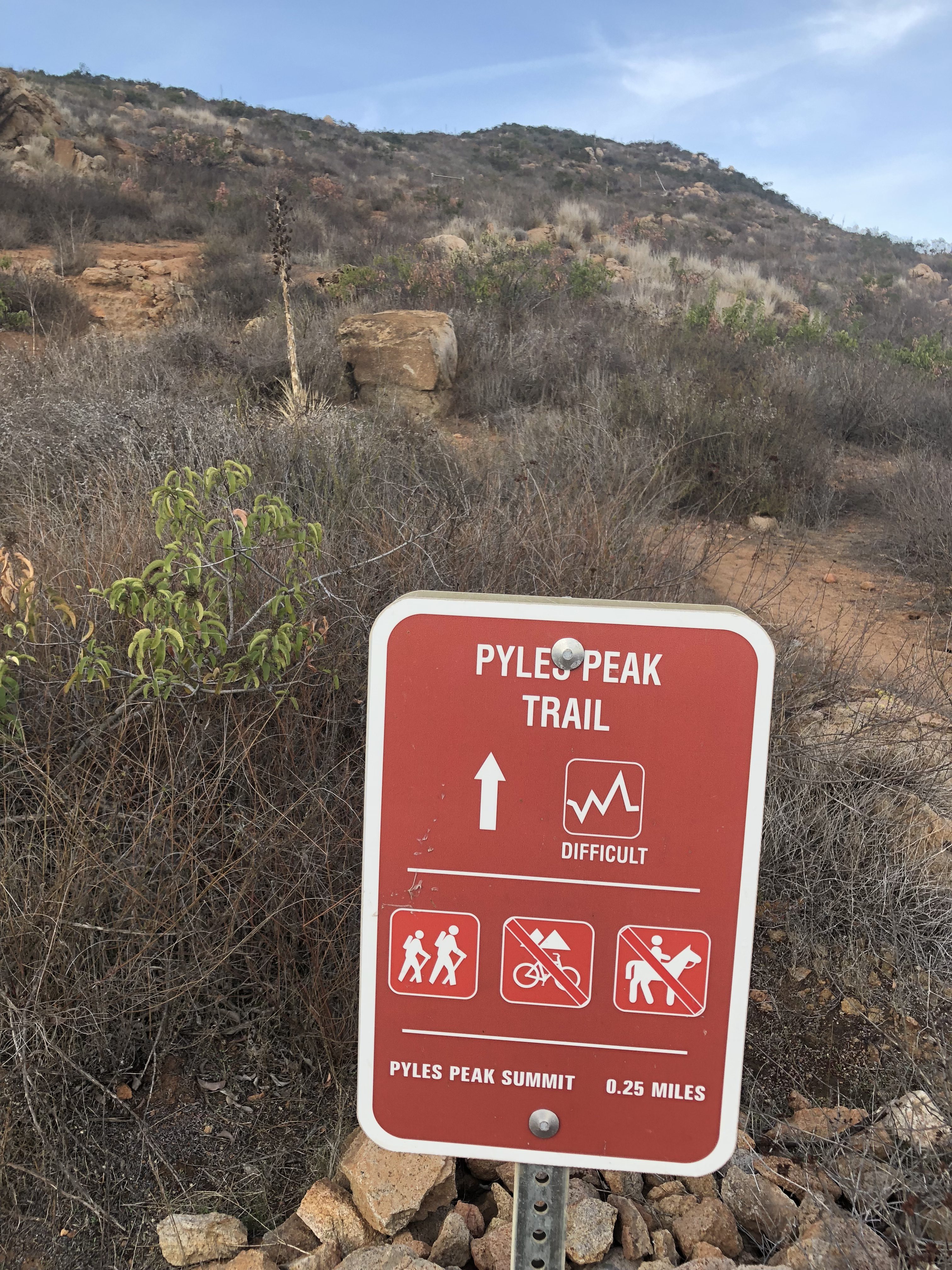
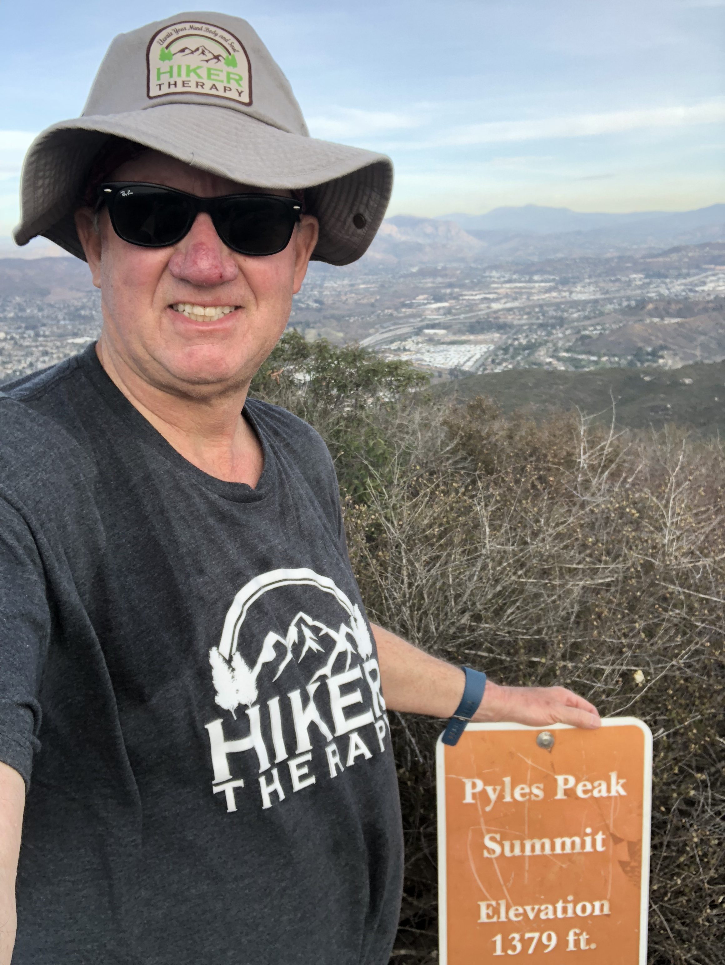
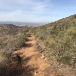
The ascent switchbacks up to the Peak and gets narrow and rocky in spots. Again this is the most diffocult part of the Hike over from Cowles. As you approach the “Pyles Peak Rock” marking your arrival to the summit you will be greeted by the Pyles Peak sign, indicating that you have made it to your second peak of the day. Take in the views, have another snack and scan the surrounding ares between and Cowles and beyond. Looking directly across south you can see the Peak of Cowles Mountain and the radio towers. Although this is a much smaller Peak than Cowles, it is less crowded and in fact for a good amount of my time at the Summit I was the only person there. Another couple came by and we talked. They had been to the other 3 peak in the Mission Trails system this day and just had come over from Cowles, thus making this their 5 of 5 peaks for the day. Nice work indeed! For me the descents challenge me more than the ascents and the descent down the trail from Pyles is challenging indeed. The trail down is about .25 miles and before you know it you will meet up with the main trail junction, go left and follow trail now mostly ascending, back over to Cowles, the radio towers and your journey back.
Summit of Pyles peak Hiker Therapy
Once at the return summit to Cowles you can decide to go back the same way on the service road down to Barker Way or you can descend down Cowles and meet up with the Barker Way trailhead spur about a third of the way down Cowles Mountain trail on your left. I started this hike at 1:15pm, I arrived back at 5pm right about at dusk.My total miles was 7.25 as I hiked around a bit besides the main distance up to Cowles over to Pyles back to Cowles and then down to the Barker Way Trailhead start. The miles achieved on this hike is anywhere between 6-7.5 miles using the Barker Way Trailhead.
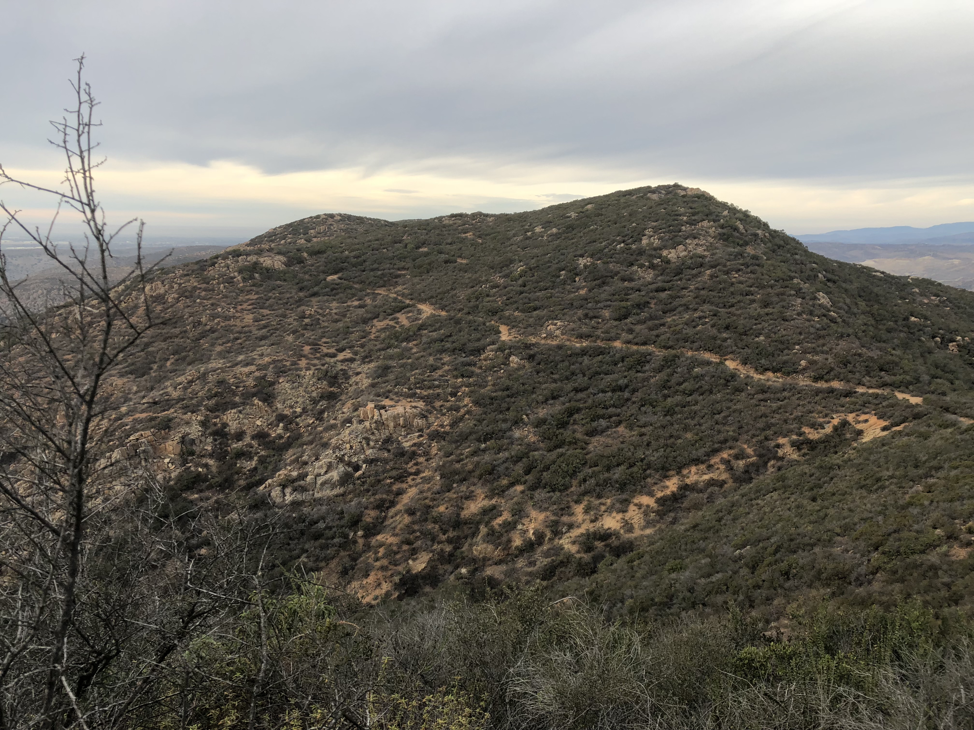
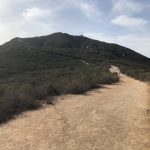
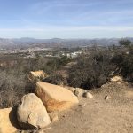
View of Pyles Peak looking over from leaving Cowles Hiker Therapy
So there it is, for a challenging and less trafficked hike up to Cowles Mountain Summit and then over to Pyles Peak I highly suggest the Barker Way Trailhead and the Cowles Mountain Service Rd. trail. Not only do you join a minority of hikers who continue on to Pyles peak after summating Cowles you add 2 hikes in one day to your peak conquests and trail resume.
The mountain is named after George A. Cowles, (Cowles is pronouced like the store Kohl’s). a 1870s-80s rancher and early businessperson in southwestern San Diego County. For many years Cowles Mountain was locally known as “S” Mountain. In 1931, 500 students from San Diego State University (SDSU) painted a 400-foot-tall (120 m) letter “S” on the side of the mountain, after which it took on its popular name. In April 1942, during World War II, the local military ordered the S covered up for the sake of national security. After the war the painting tradition was resurrected. In the 1970s, the annual repainting tradition was ceased for environmental and habitat protection, but suffered a brief resurgence in the late 1980s. The “S” has not been repainted for nearly three decades. In the 1970s, the annual repainting tradition was ceased for environmental and habitat protection, but suffered a brief resurgence in the late 1980s. The “S” has not been repainted for nearly three decades. – wikepedia
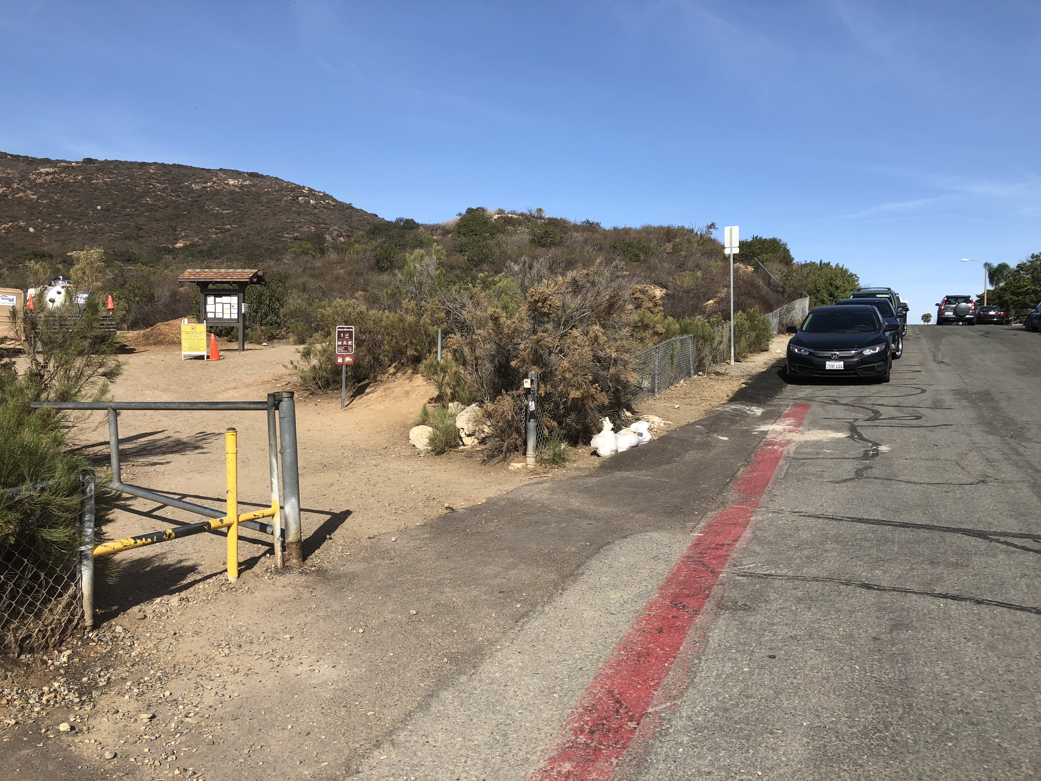
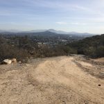
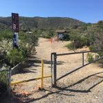
Barker Way Trailhead, Cowles Mountain Service Rd trail stay right
This 3 mile round trip hike offers a more demanding route and although the trail does flatten out in spots, for the most part this trail is the more challenging of the 3 popular routes to the top of Cowles Mountain.The other two being the more traditional climb from Golfcrest and Navajo Rd, and the trailhead starting here, Barker Way.The fire road trailhead start is the same as the Baker Way trail.
“S” Section Hiker Therapy
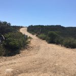
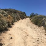
As you start on the trail, go about 100 yards, the Barker Way trail will fork off to the left, the fire road trail will stay right.Continue along this trail/fire road until you reach the peak. The trail at this point changes from hard packed sand to a rockier composition.However, most of the trail up is hard packed sand, intermittent rocker trail. Right from the get go the trail starts to ascend rather steeply, though very doable, you will continue to climb, at the 3/4 mile mark you will plateau.The ascent will again continue to incline climb up to a point where the trail begins to take on an “S” pattern as you wind to the top and the peak.At the most steepest part of the trail near the peak you are going to vier right, this is this last climb to the top and after less than a 1/8 of a mile you will reach the Peak of Cowles Mountain.
“S” section of the trail, or the “Switchbacks” begin here Hiker Therapy
To your right great views facing west, and if you continue past the “steps” on your left you could venture on to the Pyles Peak trail section. Pyles ads another 1.5 miles or 3 round tripto the 3 mile round trip for a total of a 6 mile hike.I highly recommend venturing off to Pyles Peak, if not this day, on another, so you can get yet an added dimension, more miles and diverse scenery.
Near the Peak, last 1/4th mile to go Hiker TherapyThe “Monument” at the Peak of Cowles Mountain- Hiker Therapy
On this day I did take the steps on the left which leads you up to the final approach to the Peak and the famous Cowles Monument.Once Here, after you tap the monument of course,take your time enjoying the panoramic views of San Diego, Pt. Loma, Mexico and scanning east and the ominous Peak of El Cajon Mountain.Cowles is one of my favorite Peaks to be on as the 360 view of our county is more than impressive as well as at 1600’ this being the highest Peak in the City of San Diego. The trek to the top should take you about 45-60 minutes due to the continual ascending steepness of the trail.The descending return route is the same trail, for me the decent many times offers more of a challenge due to the slipperiness of the sand and the rockiness of the trail. Take your time, enjoy the views back and Hike on!
Cowles Mountain Barker Way Gallery
“S” Section
Near the Peak, last 1/8yth mile to go
The “Monument” at the Peak
I prefer the Barker Way start doing either this trail or the Barker Way trail up to the Peak.It is less traveled than the Golfcrest trailhead and in my opinion offers more scenic views, a quieter environment and more of a challenge.As always, bring more than you need water, a snack, know your limits, if hiking with another, which is always my suggestion, respect your partner’s limits as well.
As I was hiking the compacted rock and hard packed sand trail of Cowles Mountainthis past weekend, I felt a sense of being grounded to the earth with each step I took…………..
This grounded feeling triggered a thought of being ground in life. When we are grounded we are in balance with our Mind, Body and Soul
We all have the essentials that have to be done; work, school, family, extracurricular activities and relationships that consumes much of our time. With all these life demands draining us of our peace of mind, how do we achieve this grounded place of mental and physcal heath well being?
I feel an essential step in being grounded starts with self-care.
In the work that I do with HIker Therapy, I make it a point early on when developing a therapeutic relationship with my client/s to ask them, “So, what do you do for you, just you?” I am always amazed when most respond, “Nothing, I don’t do anything just for me.”
In fact when I ask this question to friends, even relatives, most of them cannot come up with something they do just for themselves to get peace or relaxation which are essential elements that self-care provides.
Many say that they do things such as go to a movie, do a family activity or go out to eat but it is in the company of other’s. That is fine, life is meant to be shared, however, many times when we are in the company of other’s our attention is on the group or those we are with, thats an easy ditraction away from self.
The “Monument” Hiker Therapy
By self-care I mean doing something such as; exercise, deep breathing, meditation, journaling, a walk on the beach, playing the guitar, taking a class, anything that gives you time to focus on yourself so that you can relax, gain peace and recharge.
For me, this is one of the great benefits of hiking. Hiking gets you out into nature, provides you with physical exercise, supports your mental well being by reducing anxiety and depressed mood. Hiking also offers a sense of purpose and accomplishment as you hike the trail from beginning to end and back.
Cowles Mountain Trail-head Hiker Therapy
Self-care also provides time to take a look at our “groundedness” or life balance to see if we are too heavily vested in one area of our lives that distracts us from people, relationships, or ourselves.
For example many times people get out of balance by working too long, too hard or too much. Yes, work provides us with purpose and money so that we can enjoy life, survive and take care of that which needs to be taken care of, but often times work can serve as a distraction that keeps us from being grounded in our lives.
In fact, in my experience those who are constantly working; whether that be at a job or volunteering or running from this activity to the next are also the same individuals who answer,” I don’t do anything for me.” These are also the same people who are not grounded and many times not good with themselves, content with life or comfortable in their own skin. They are not balcned in Mind, Bosy and Soul.
Self-care helps alleviate the anxieties that come from our day-to-day activities such as work, taking care of our homes and families as well as other endeavors we consume ourselves with. So often overwhelming anxiety debilitates us and keeps us from being present in what we do and whom we are with. Often time individuals associate doing something for themselves as a selfish act or activity. In fact, many of my clients have voiced this to me that they feel selfish because they do something just for themselves.
I don’t see self-care or doing something for ones self as selfish at all. Self-care in order to become grounded is an act that others will benefit from greatly. After-all the better we are with ourselves the better prepared we are in taking our “groundedness” out into our lives, which can only reflect positively with our families, friends and relationships.
Being less stressed, being good with us, feeling comfortable in our own skin and having a positive sense of well-being is a real benefit of consistent self-care. This consistency is unique to each individual and the activity, however I feel that self-care should be a daily consideration, even if for 15-30 minutes in duration.
I would Challenge those of you that are reading this article to ask yourself
“What do I do that is just for me that offers Peace, Love, and Respect and Self Care for Myself?”
Remember self-care involves only one person, you!
Give yourself a gift and take advantage of this wonderful opportunity to get to know the most important person in your world, you! It will reward you many times over and provide you with the inspiration and motivation to be the best you can be which will lead you to a grounded life.
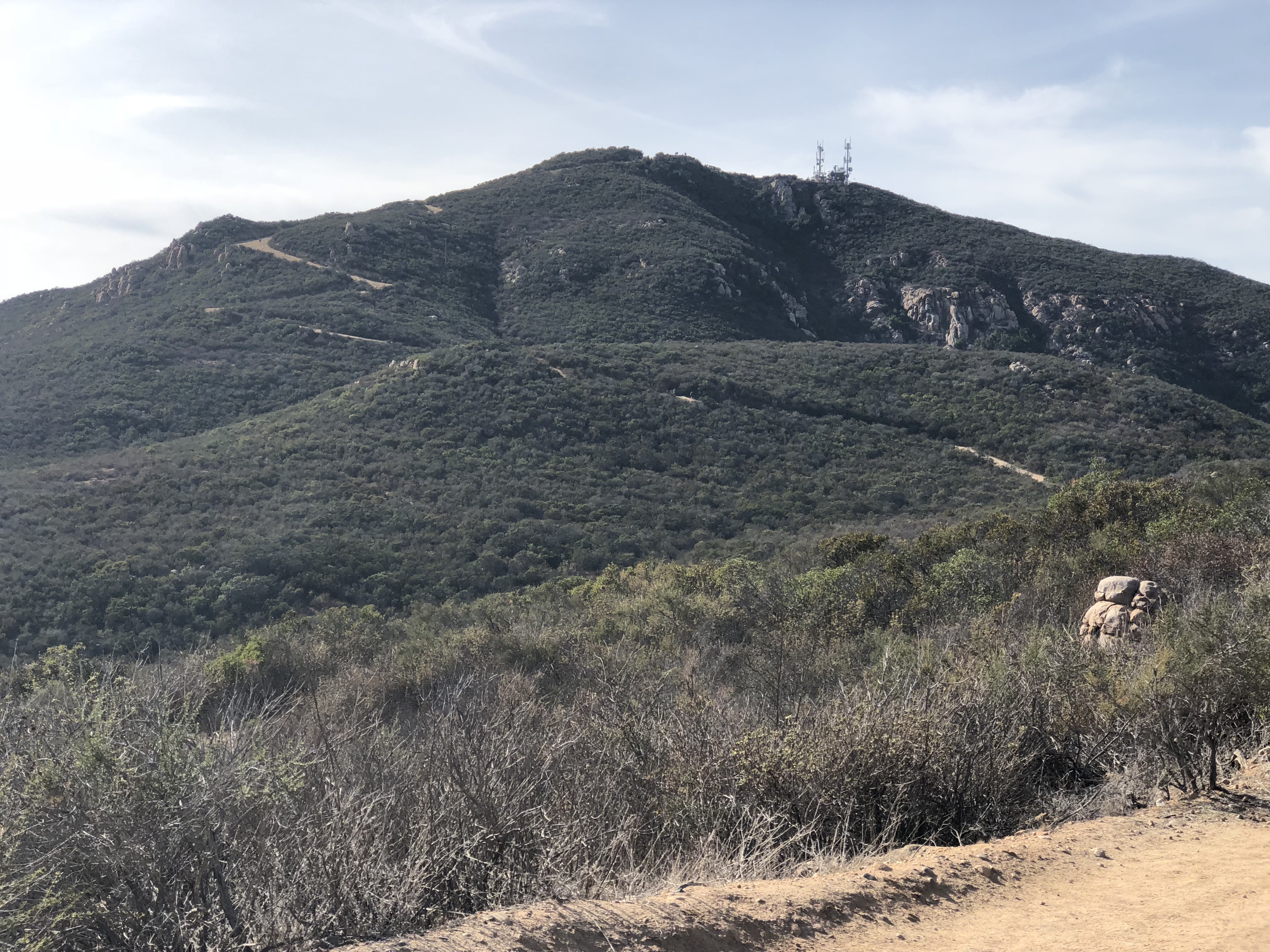
Cowles Summit in distanceBig Rock Rd. trailhead start
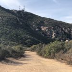
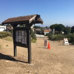
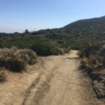
Cowles Mountain, part of the MIssion Trails Regional Park system in San Diego , is by far the most popular hike in the County and a hike I refer to as the Disneyland of hikes due to its heavily traveled trail especially the main trailhead off of Golfcrest Drive which is the preferred starting point of the masses, however there are other trailhead starts including the one I will speak about here. The Big Rock Rd. trailhead beginning offers a rarely used start to hiking Cowles Mountain as well as offering the most scenic and unscathed view of the Cowles Mtn summit. To access the Big Rock Rd. trailhead you can exit from Hwy 52 at either Mast Blvd or Mission Gorge Rd. Big Rock Rd. intersects MIssion Gorge Rd. and is a traffic light landmarking where you need to turn. Take Big Rock Rd to the end where it dead ends at the trailhead beginning. Houses line this neighborhood area and parking is curbside and very much available as opposed to the Golfcrest starting point that again reminds one of the crowds at Disneyland. The Big Rock Rd. trailhead is one of four starting points to trails that lead to the summit of Cowles Mtn. along with Barker Way, Mesa Drive as well as the mentioned Golfcrest Rd. Entrance. The trail starts out near an information board that will list the different trails and their distances to the summit. This particular trail is 2.5 miles from the summit and offers enough challenge in both distance and climb to make the Hikeability of this trail strenuous. One of the strengths of the Cowles Mtn hike as well as others on the Mission Trails regional Park system is the trails are well marked with well placed signs to guide you towards your destination. The Big Rock Rd, trail is no different as signs along the way clearly route the trail and show you where other trails join in and possible alternte trials that may interest you with the same destination at trails end. The start of this hike offers a trail composition of compacted red dirt and sand wandering through low lying brush of various plant life.
Flora and FaunaService road connectionThe Top!
It is here that the trail becomes much more challenging and physically demanding. Keep your eye on the prize and the accomplishment and reward that lay ahead to motivate yourself up this steep ascending Rd. Before you know it you will be at the familiar rock strewn summit of Cowles and a 360 view of the County. On this particular day, although gray skies, we were still able to see Qualcomm Stadium, Mt. Soledad in La Jolla, MIra Mar air-station, Gillespie Field in El Cajon, as well as the various peaks in the distant mountains including Lyons, Miquel, Viejas and the faint outline of San Antonio, San Jacinto and San Gabriel. This vantage point at 1531 feet is the highest Peak in the City of San Diego and offers one of the if not the best view of the area . After taking a twenty minute break for gatorade and a snack bar we head down the more “traditional” descent from the Cowles Mtn summit and the familiar rocky cragged trail. Be careful in this section of the descent as ive heard more than one story about twisted ankles and falls. As you continue the descent you will join up with the Barker Way, Big Rock Rd. sign that alerts you to switch trails and head back towards the original trailhead start. Once you change trails you will come to the same service road taken on the ascent and a much less strenuous travel this time around. Not long after being on the service rd you will meet up with a fence line and the entrance to the Big Rock Rd trail that will lead you back to the trailhead beginning. This route back was a shade less mileage wise than the ascent and totalled about 2.3 miles. Speaking of shade, the day we did this hike gray skies at 10am gave us 75 degrees, at the end of our hike at about 12:45 back at the car it was 95 degrees. However, it did not seem that hot as previous times I’ve hiked Cowles, but as always makle sure you bring plenty of water, at least 75 oz., and a few snacks to keep yourself hydrated and recharged on this somewhat arid hike.
Manzanita Tree
Cowles Mountain always offers a good challenege a scenic route and a summit that provides sweeping views of our county and the city of San Diego. The Big Rock Road trailhead is a preffered start to the Cowles Mountain hike and besides the Barker Way start one I highly suggest. Next I’ll have to do the Mesa Rd trailhead start to comnplete the four routes available. I Always like what MIssion Trails Reginoal Park has to offer, and Cowles does not dissapoint and always lives up to its reputation as a saught out trail among avid hikers in san Diego both young and old.
The beauty of hiking is that it is a sport that requires very little in cost, special equipment or uniform. However, three essential considerations that contribute to your comfort and physical well being when you hike are a must; 1. Quality Hiking Shoes 2. Water 3. Food
FEET!
If there are any pairs of shoes in your closet that require quality and comfort it is your pair of hiking shoes. There is absolutely nothing worse than being 1-2 miles out on your hike and your feet already are screaming! Blisters and crunched toes are not fun.
The two most important things to look for when buying a hiking shoe are size and how it feels when you are hiking down hill. For me, anytime I’m hiking down hill the hike becomes much more physically challenging and this is especially true for the feet! When trying on a hiking shoe make sure you can walk “down hill.” A good outdoor recreational retail store will have a mock “mountain” in their shoe department which will allow you to test how the shoe feels going down hill.
Regarding the size of the shoe, If it feels uncomfortable in the store, it’ll really hurt on the trail, if it feels good in the store you should be good on the hike! When sizing your shoe remember that your feel swell after you have been on the trail awhile. If you are a size 11, chances are you will need at least an 11.5, maybe even a 12 when you try on a shoe at the store. Sock thickness plays into this as well, I prefer a very thin or no sock when I hike, that way when my foot swells a thick sock will not add to what the shoe needs to hold. You can also bring a pair or two of socks with you on the hike and change them as needed.
There are many brands out there, Merrill, Patagonia and Vasque all are quality names, however a shoe that feels good for one may not for another in the same brand. It is imperative that you shop for your hiking shoes in person, not online and not by someone else doing the buying for you. If you are getting hiking shoes as a gift, make sure you are at the store to try them on.
Another suggestion I would offer when buying a hiking shoe is DONT GET CHEAP! Quality absolutely does matter when it comes to hiking shoes and like most things of quality, the better the quality the higher the cost. The good news is a good quality pair of hiking shoes should last you awhile, at least two hiking seasons.
Hiking shoes come in low cut, mid cut and boot style. If you require more ankle support and hike rough trails, I would highly suggest a hiking boot, less rocky more compact trails usually only require a low or midcut shoe. Having said that every trail can offer you a turned ankle, so as always be careful as to where you step.
A good rule of thumb regarding the feet on a hike is to always bring with you over-sized band-aids for blisters, moleskin to cushion the front of the shoe if needed and make sure your toenails are trimmed down short so that your toes are not jammed up against the end of your shoe, especially going downhill.
HEAT!
When recently watching the morning news, a segment came on about hiking safety and tips by the San Diego Sheriff’s Search & Rescue Department on how to be prepared when you hike. First on the list of tips was to respect the heat when you hike and make sure you have enough water and are always hydrated as you hike. In fact, I was surprised to learn that the Sheriff’s Search & Rescue team are called to Cowles Mountain and Torrey Pines hiking trails many times due to emergency issues as related to heat and dehydration. Cowles is always hot when I hike it and a hike where I always consume a lot of water.
Heat plays a tremendous factor when you hike, it not only dictates how much water you should be consuming but the hotter it is the more likely your energy level will be tested. It also requires you take precaution against the sun and be prepared with sunscreen.
As far as how much water to take on a hike, a good rule of thumb is to drink 12-16 oz per hour, more the warmer it gets. On a recent hike to Mt. Woodson, which was roughly 7 miles and took nearly 5 hours on a 75 degree day, I drank nearly 100 oz of water, the Mt. San Antonio hike, which was 11.2 miles took 10 hours and low 80’s required 150 oz of water as well as a bottle of gatorade. Both hikes also required lot’s of sunscreen.
EAT!
Fuel is a must in order to sustain energy on a hike. Fuel equals food! While you are hiking you should try and eat 300-500 calories every hour. Your body has a hard time digesting food while you are hiking, so make sure that you eat and drink small amounts more frequently. Load up on carbohydrates before you hike, potatoes for breakfast do very nicely the day of a hike. I always pack a lunch on any hike over 4 miles. Shorter hikes I take an orange or snack bar. Longer hikes I take all three. I heard someone mention on the Mt. Woodson hike that they expended 2000 calories of energy. I know when my son and I did a recent hike at Mt. Woodson, half of our motivation in getting to the summit lies in the awaiting lunch of tuna fish sandwiches, potato chips and a York Peppermint patty! We also brought along mixed nuts and oranges and as mentioned earlier plenty of water. A quality backpack is always a good idea, especially on long hikes so that you can carry all your essentials. especially food and water.
By paying attention to these three hiking musts, the Heat, your Feet and the need to Eat, you will assure that you maintain optimal phsical condition that will lead to a comfortable hiking experience and a healthy you!