Directions Starting from the Sorrento Valley Trailhead West:
Los Penasquitos Trail Head West 4300 Sorrento Valley Blvd, San Diego, CA 92121
Exit Interstate 805 at Mira Mesa Boulevard/Sorrento Valley Road. Take either I-805 frontage road (Sorrento Valley Road on the west side or Vista Sorrento Parkway on the east side) 1 mile north to Sorrento Valley Boulevard. Turn right on Sorrento Valley Blvd. and continue 1 mile east to the western staging area. Parking lot is on the right off of Sorrento Valley Blvd. for Los Penasquitos Canyon Preserve. Park in the parking lot.
Hike Time and Distance: Across the Preserve and back from trailhead to trail head was about 11 miles. Hike time about 4 hours including break at the Falls.
Water and Food: On this day it was near 90 degrees so lots of water was consumed, about 90oz Beef or Turkey Jerky, Hard boiled eggs, cheese sticks and trail mix are easy to deal with for snacks.
A hidden hike that can be accessed from the West in Sorrento Valley and from the East at Rancho Penasquitos is the Los Penasquitos Canyon Preserve. Each of the mentioned locations offers a trailhead start that leads to a very scenic waterfall, with Rancho Penasquitos being 3.3 miles start to the waterfall and the Sorrento Valley side taking 2.7 from start to waterfall.
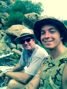
On this day I wanted to include both trails roundtrip. I started this hike from the West approach of the Preserve.
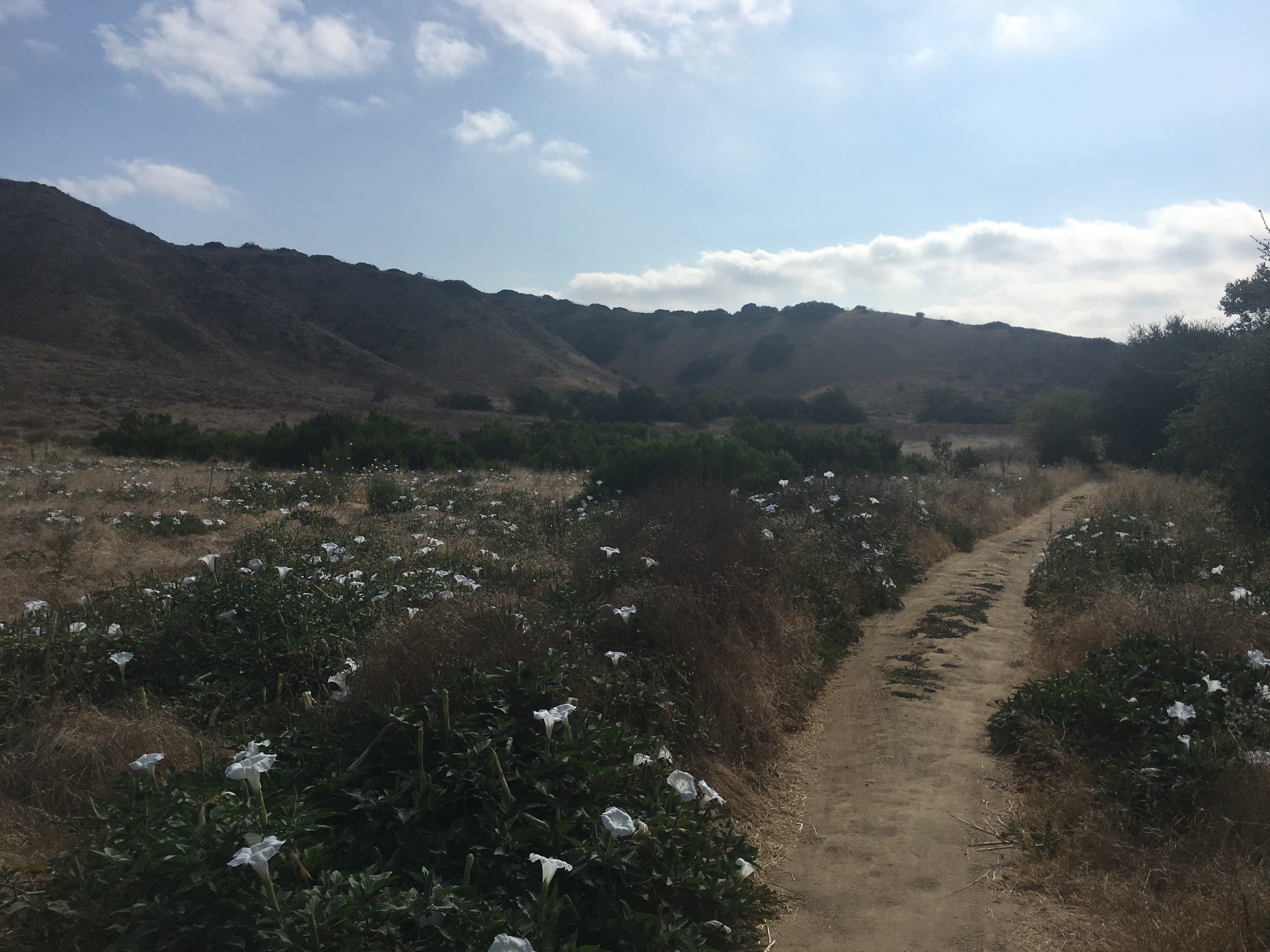
Los Penasquitos (meaning little cliffs) Canyon Preserve lies between Rancho Penasquitos and Sorrento Hills to the north and Mira Mesa to the south. Stretching approximately seven miles from the I-5 and 805 merge to just east of I-15; it encompasses some 4,000 acres of both PeÃasquitos and Lopez Canyons. The Preserve is jointly owned and administered by the City and County of San Diego.
What You Can Expect From This Hike!
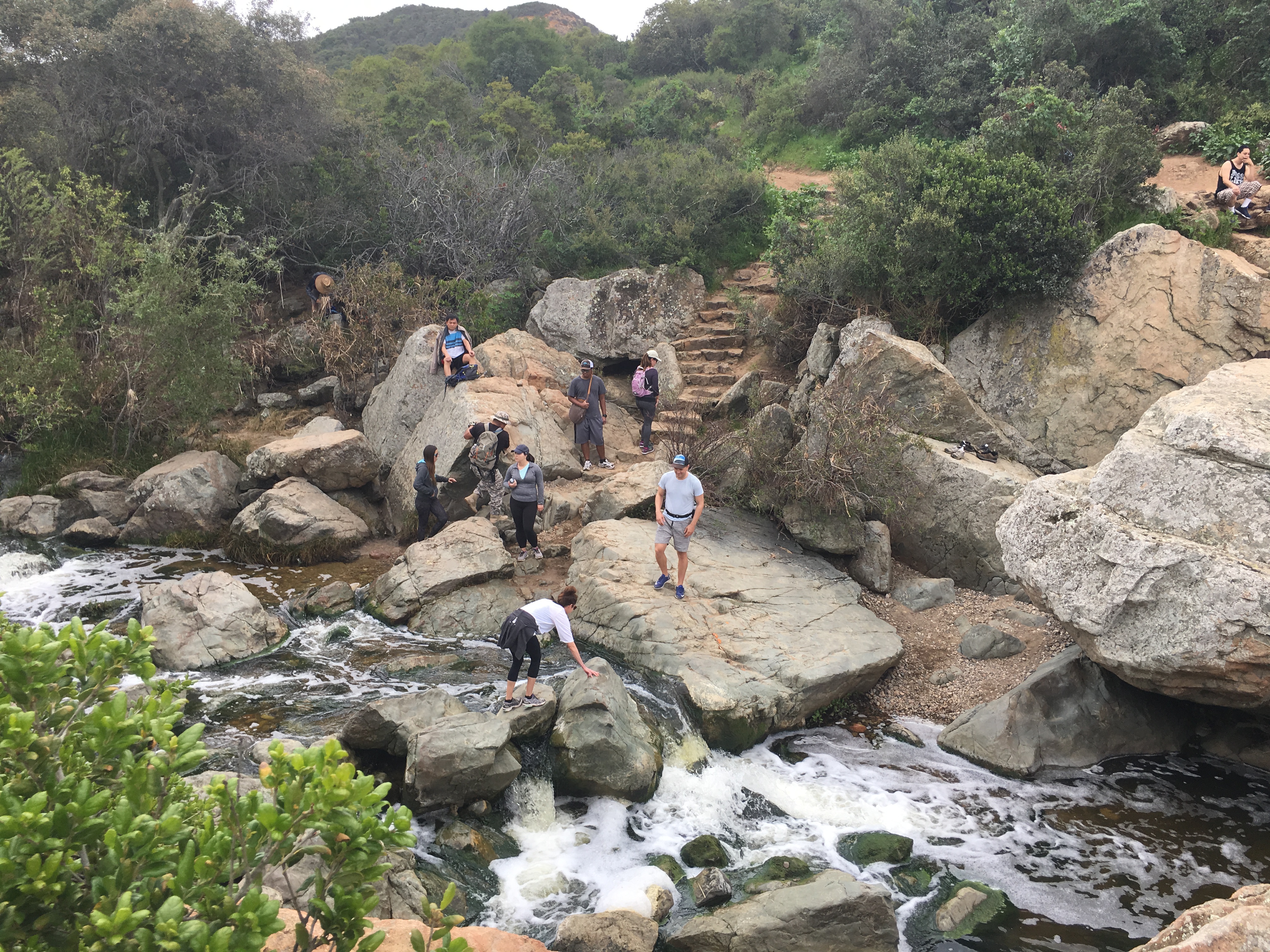
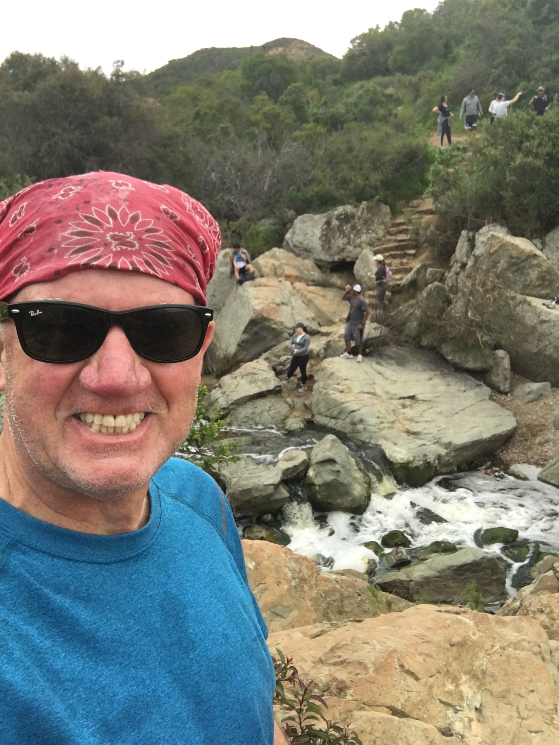
A waterfall cascading through volcanic rock stream side forest of giant California live oaks. Groves of majestic sycamore trees.year-round stream populated by pacific tree frogs, crayfish and largemouth bass.
A freshwater marsh hosting a variety of aquatic birds including great blue herons, egrets, mallard ducks and more. Mule deer, bobcat, red-tail hawks, rattles snakes, coyote, and raccoon are just a few of the mammals that can be observed throughout the Preserve.
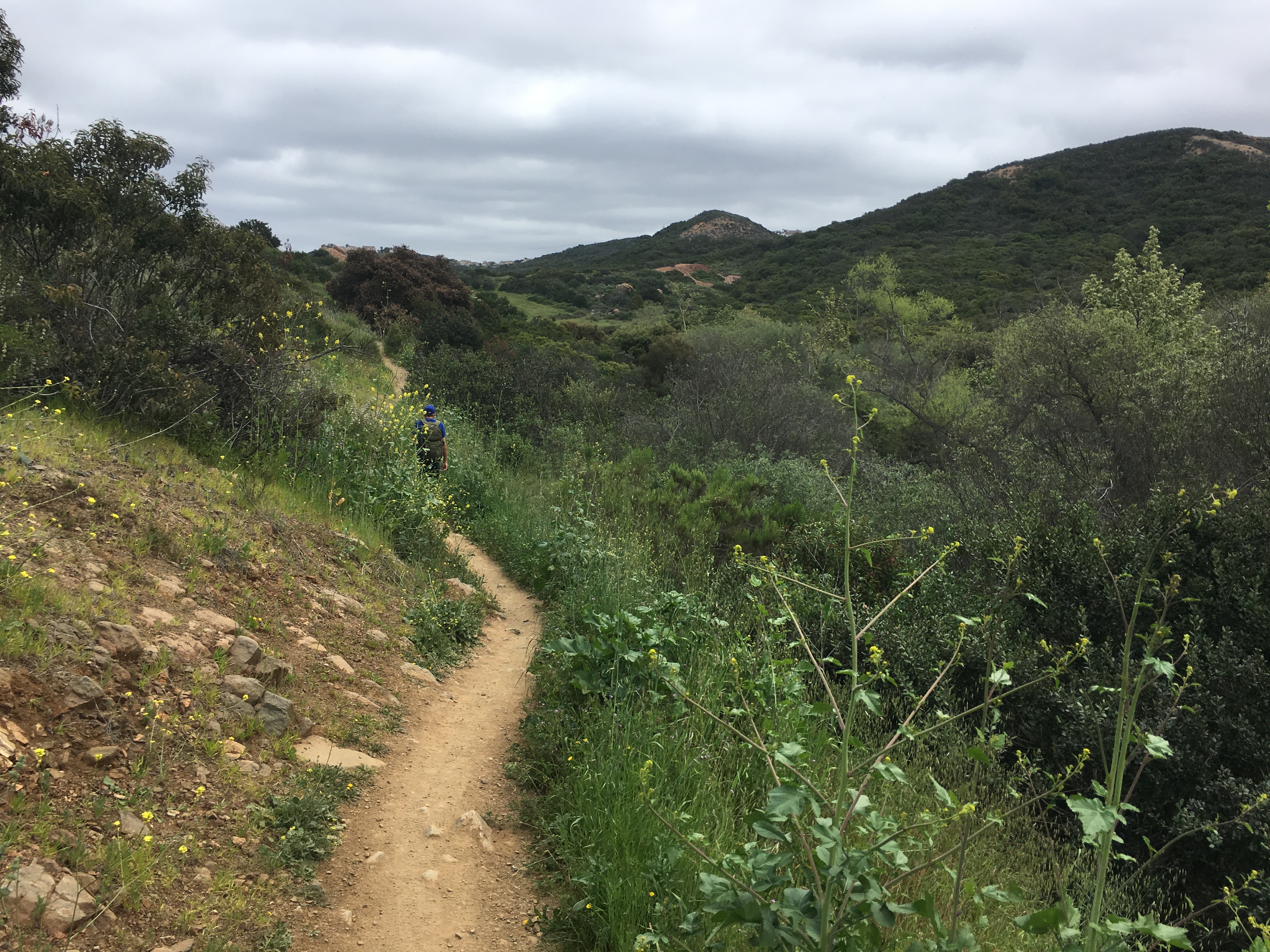
The Sorrento Valley trailhead start offers a good size parking area and a restroom. As you begin you will come to a fork in the trail one leading you to Lopez Canyon the other pointing you towards the waterfall to the left.
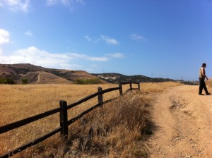
As you veer to the left you will go under the Sorrento Valley Blvd. overpass. The trial from here climbs somewhat and the trail turns from compacted dirt to a rocky path. This portion of the hike is the only real climb as the remainder of the trail is flat. You are now on your way to the waterfall, which is 2.7 miles from where you started.
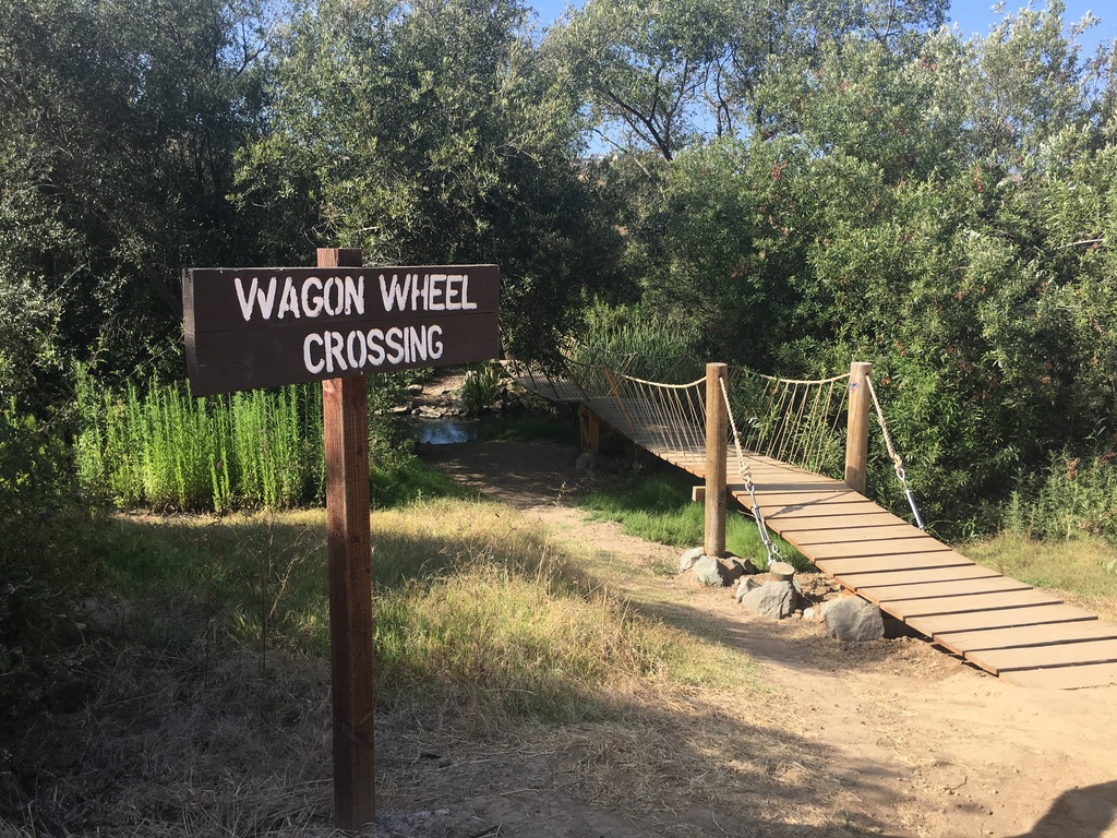
The trail has two different paths you can take. As you come upon the wagon wheel trail section you can veer left
to cross the creek, which leads you to a secondary trail and the waterfall, or you can continue on and be lead to the same waterfall just from a different side, either way you will get to your destination.
We stopped at the waterfall to take a break and since it had rained the day before there was plenty of water running through the rocks and river. After our short break we were ready to continue on to the other side of the trail and the Rancho Penasquitos trailhead start from the East.
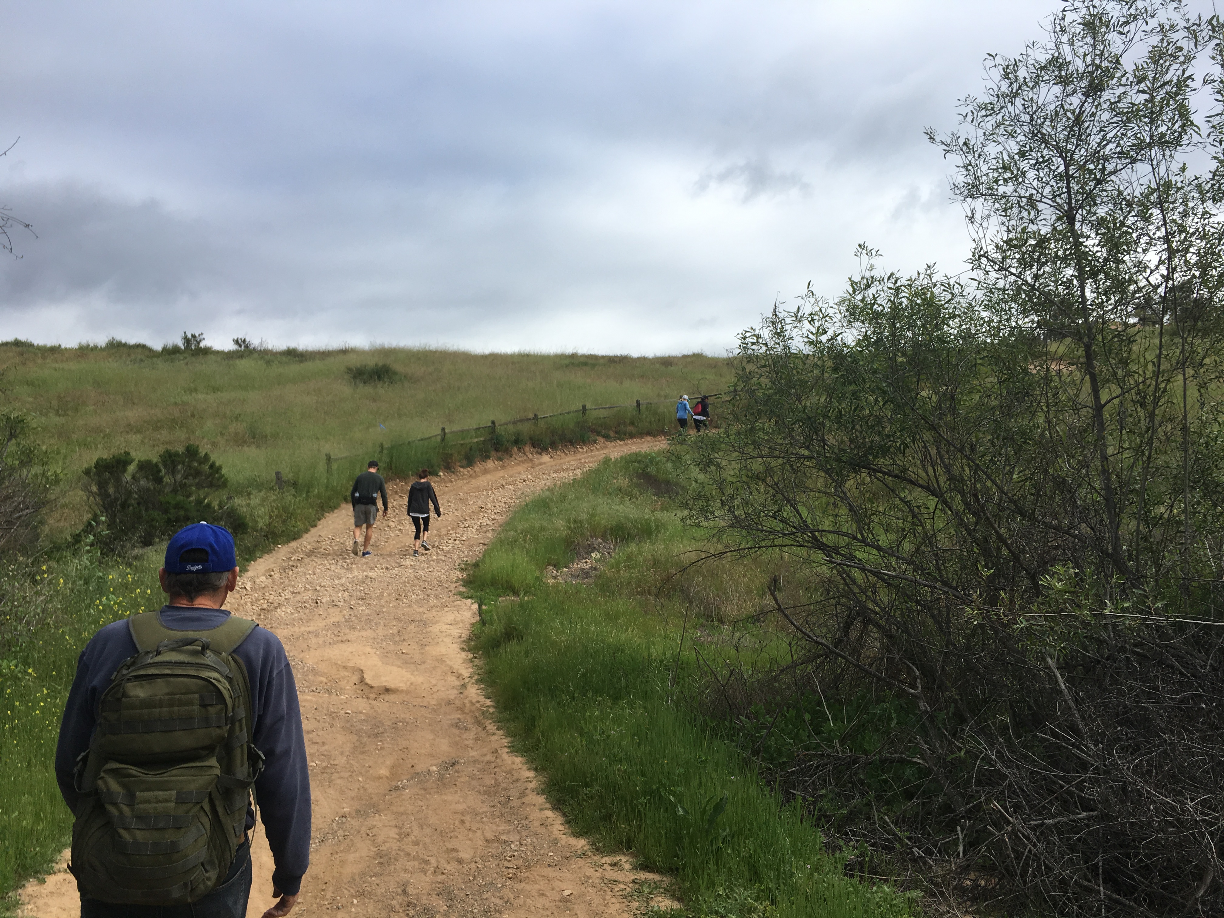
Since this trail is so flat, and more a nature walk then a hike, we covered the next 3.3 miles in less than 90 minutes.


If you want to spin off the trail as you approach the Penasquitos start you can visit the Ranch House, which besides having a historical story is a fun place to walk around.
A trail marker lets you know where to turn. Our destination of the Penasquitos trailhead start was accomplished we stopped turned around and repeated our journey back to the Carmel Valley trailhead.
Starting from Rancho Penasquitos Trailhead: From I-5: Take I-5 to the 56 East, following signs toward the 15. Exit at Black Mountain Road and turn right. At the intersection of Black Mountain Rd. and Mercy Rd., turn right into the Penasquitos Canyon Open Space Preserve Parking lot. From I-15, exit at Mercy Road. Southbound traffic turns right; northbound traffic turns left and crosses the freeway. Mercy Rd. will dead-end at the parking lot for Penasquitos Canyon.
To build up hike endurance, ( this was our last hike befor Mt. Whitney) take in some scenery with a waterfall to boot this hike is very doable and a great family hike to take the dog on as well fun hiking the Los Penasquitos Canyon Preserve!