
Garnet Peak via The Pacific Crest Trail at Penny Pines
Distance/Difficulty: 4.7 mi./easy/moderate Time: 3:11 min including 45 minute break at peak.
Steps: 12,119 Temp: 80 degrees Water: 1.5L consumed, brought 3L Snacks: always bring something for electrolytes; energy bars, fruit, hard-boiled eggs, granola always work.
Elevation: 5900′ Calories Burned: approx. 2000 Restrooms: At Laguna Mtn. Lodge 4 miles south.
Driving Directions: From the I-5, I-15, and state route 67, travel east on I-8 and exit on the Sunrise Highway off-ramp. Turn left, and follow the sunrise highway up through the forest, past the village at Mt. Laguna, and park at the Penny Pines Trailhead. Parking is free.
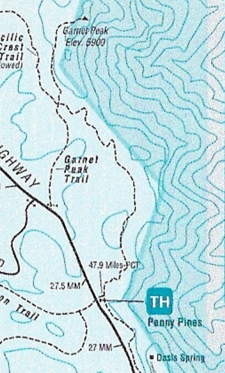
Garnet Peak Map
I love doing first-time hikes and Garnet is one I’ve wanted to do for a while now. Located out in the Beautiful Laguna Mountains Cleveland National Forest area, half the fun of this hike is getting there driving through the Curvy Sunrise Mountainous Hwy., through Pine Valley which is comprised of Jeffrey Pines, gorgeous mountain scenery and at every tune views to die for, literally, so drive safe.
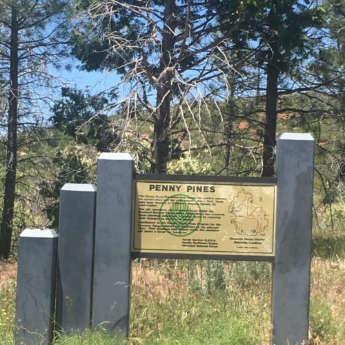
You will pass the Laguna Lodge on the left, stop here to use the restroom and last-minute snacks and or liquids. Continue on about 4 miles and the trailhead starts to Penny Pines is on the right between the 27.0 and 27.5-mile marker. There is plenty of parking which is free with no need for an adventure pass.
The Penny Pines trail is the middle version of hiking Garnet Peak, as there are 10.4 (Pioneer mail) and 2.5-mile (Sunrise Highway 0.1 miles south of Mile Marker 28, near Deer Lake Park Road.), roundtrip trails.
I like this hike because the 4.7 miles offers a challenge, is not overwhelming and gives you enough trail to appreciate everything that the 10.4-mile trail offers and makes the drive out to the Laguna Mountains and Pine Valley worth your time and energy.
Penny Pines trailhead Start
The trailhead is well marked with a large Penny Pines trailhead sign, you will see the Penny Pines Information board and the trailhead start. Pass by the sign onto the trail leading you to Garnet Peak along the Pacific Crest Trail. PCT blue shield markers denote the Pacific Crest Trail. Head northeast on the trail and you are on your way to the beautiful surrounding views of the desert before you and the rocky green landscaped mountain scenery all about you.

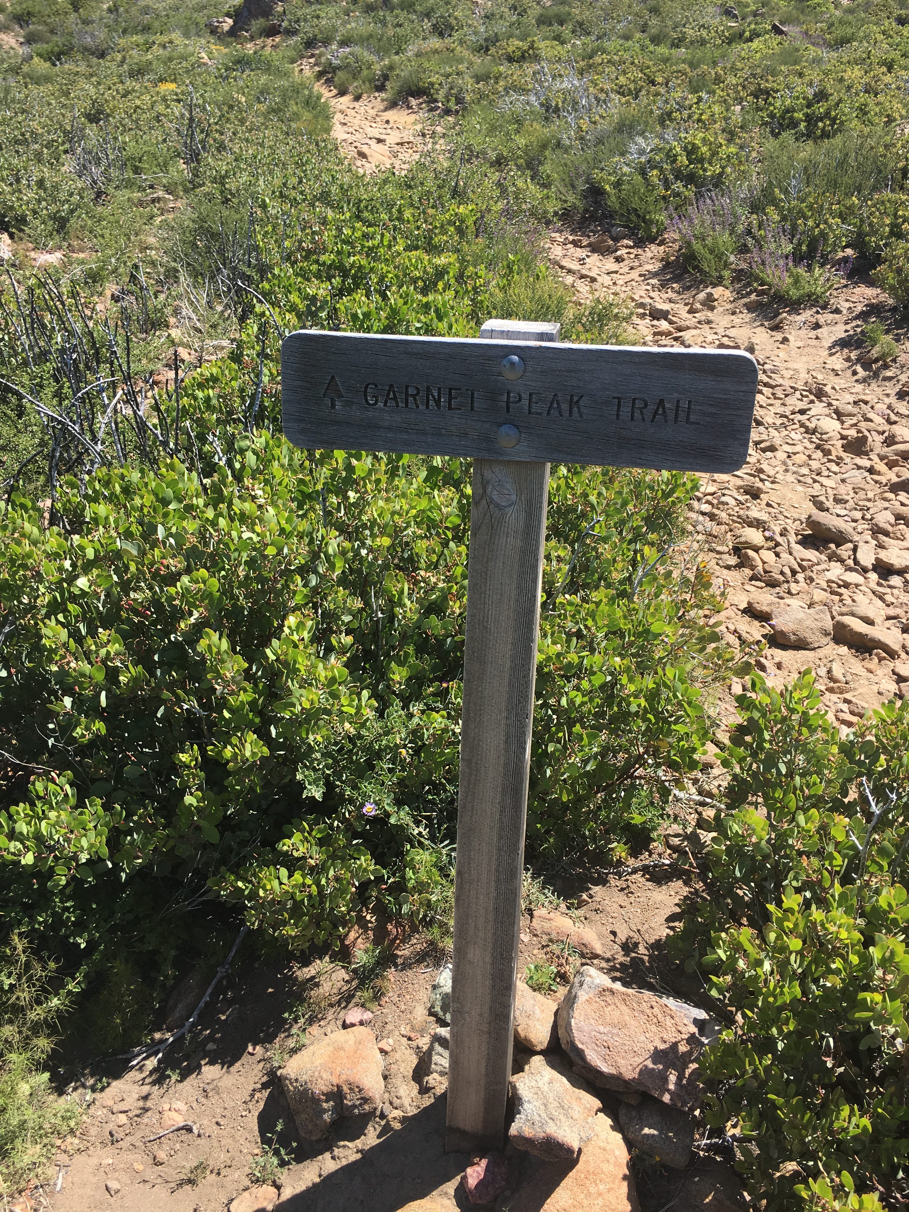
The trail along the PCT will meander north heading for the Garnet Peak junction of the PCT. Once you get to this point you will see a Garnet Peak Trail sign at mile mark approx. 1.85 miles, turn right and head east to Garnet Peak. You will start to see the Peak as you again angle north, don’t be intimidated by the Peak, it’s more intimidating looking than it is. You will come to a Garnet Peak sign, go right and head up the steep rocky trail to the Peak. you are now less than .50 mile from the boulder covered peak.
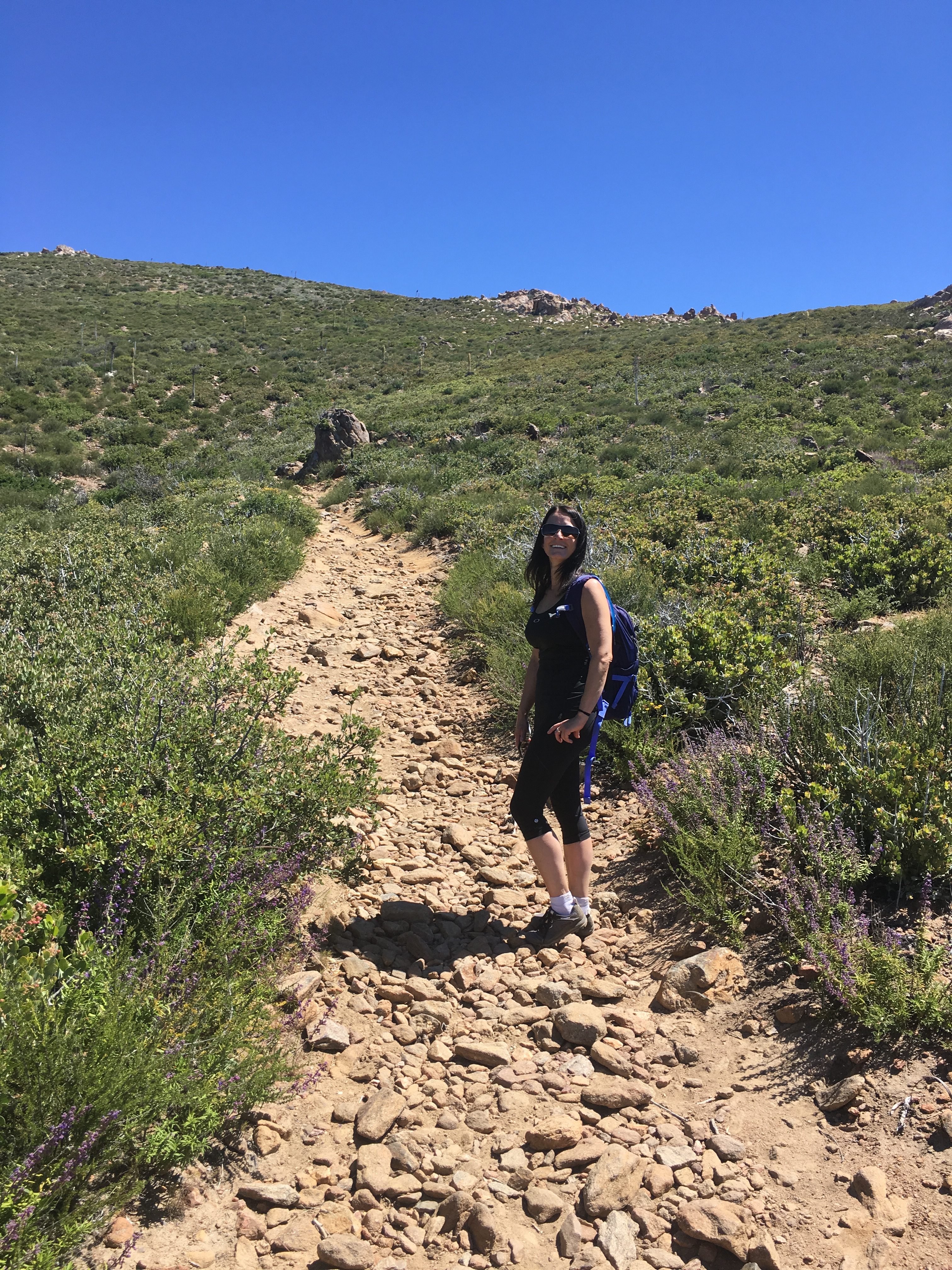
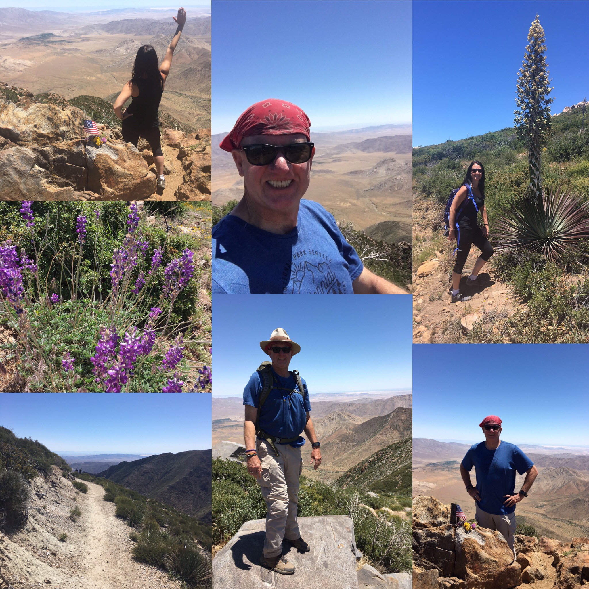
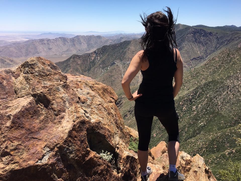
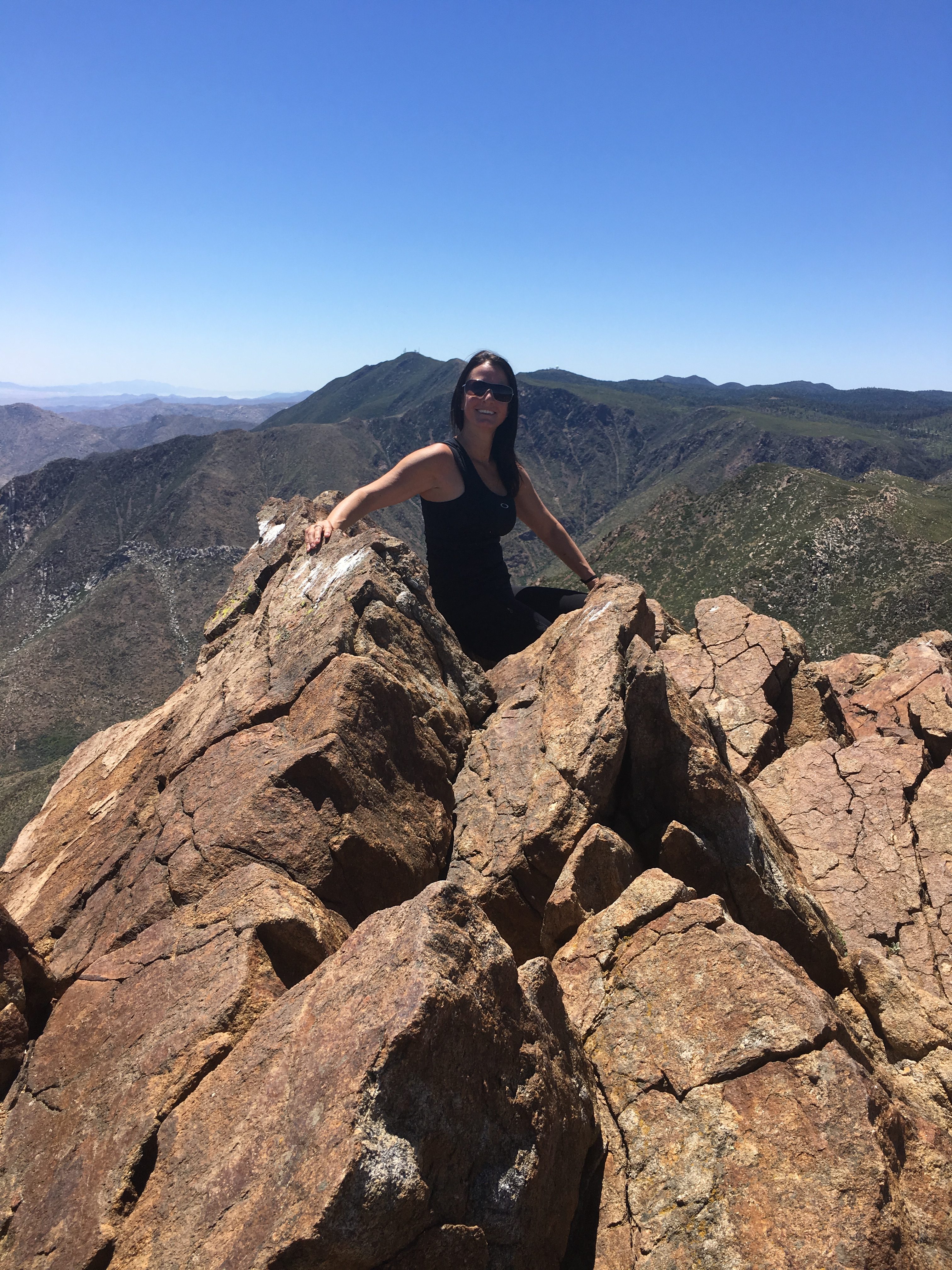
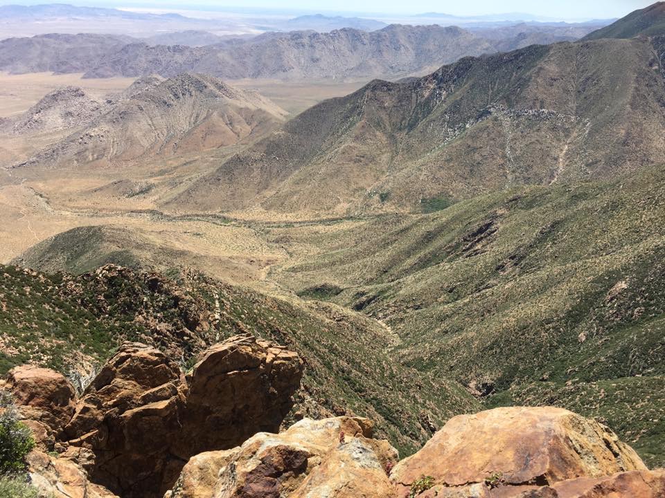
The last trek of this hike, you do some bouldering to the top. Take your time, before you know it you will have summited the beautiful peak of Garnet. Although the Peak is small, there are plenty of places to sit, rehydrate, eat and take in the vast beauty that unfolds before you; the desert floor below, the green covered mountains all around and the trail you left behind all enrich this beautiful visual experience. I love the Peaks!
The journey back is the same route and the 2.35 miles back are easy ones. I feel an added bonus to this hike is that the trail back, although of course the same trail, offers yet another variance to seeing the same you saw on the ascent yet a lot of what you did not see, again making this a totally fulfilling, challenging accomplishment of hiking Garnet Peak.

and the Flag at the Peak!
This is a must-do for any serious or not so serious hiker in San Diego County. You have a choice of 3 routes to get to Garnet Peak, each for every level of hiker. Also, the views at the Peak, as well as along the trail are breathtaking and I’d seriously rank as top5 views of any hike in San Diego County.
Have fun, be safe and as always; Hike with a partner, respect your limits, respect your partners limits, bring more water than you need and be mindful where you step (snakes and rocks are plentiful on this hike) , one step at a time………..
After the Hike go to Alpine Beer Company for a well-deserved meal, drink and or both.