
Distance: 4.5 miles Elevation Gain: 1200 feet. Time to complete: 2 – 3 hours roundtrip Hikeability: Moderate Strenuous
Water: minimum 2 L, more in heat Temp on 01/17/17: 53 degrees Snacks: Pro bar, hard boiled egg, sandwiches
Directions to Eagle Peak Trailhead Directions Quik tip: Once you are on Pine Hills rd. merge onto Eagle peak Rd..be careful to look for Boulder Creek Rd, Eagle Peak rd veers right Boulder Creek Rd to the Left.
San Diego County offers such an array of diverse hikes to satisfy every hiking trail mood, need and challenge. Eagle Peak, just outside of the town of Julian, Ca in San Diego County or as I like to call it one of the Trifecta hikes, does not disappoint if you are looking for a change of pace hike that offers what i consider the best views from any peak in the county and a robust 4.5 mile hike.

Eagle Peak Trail Hike Julian CA
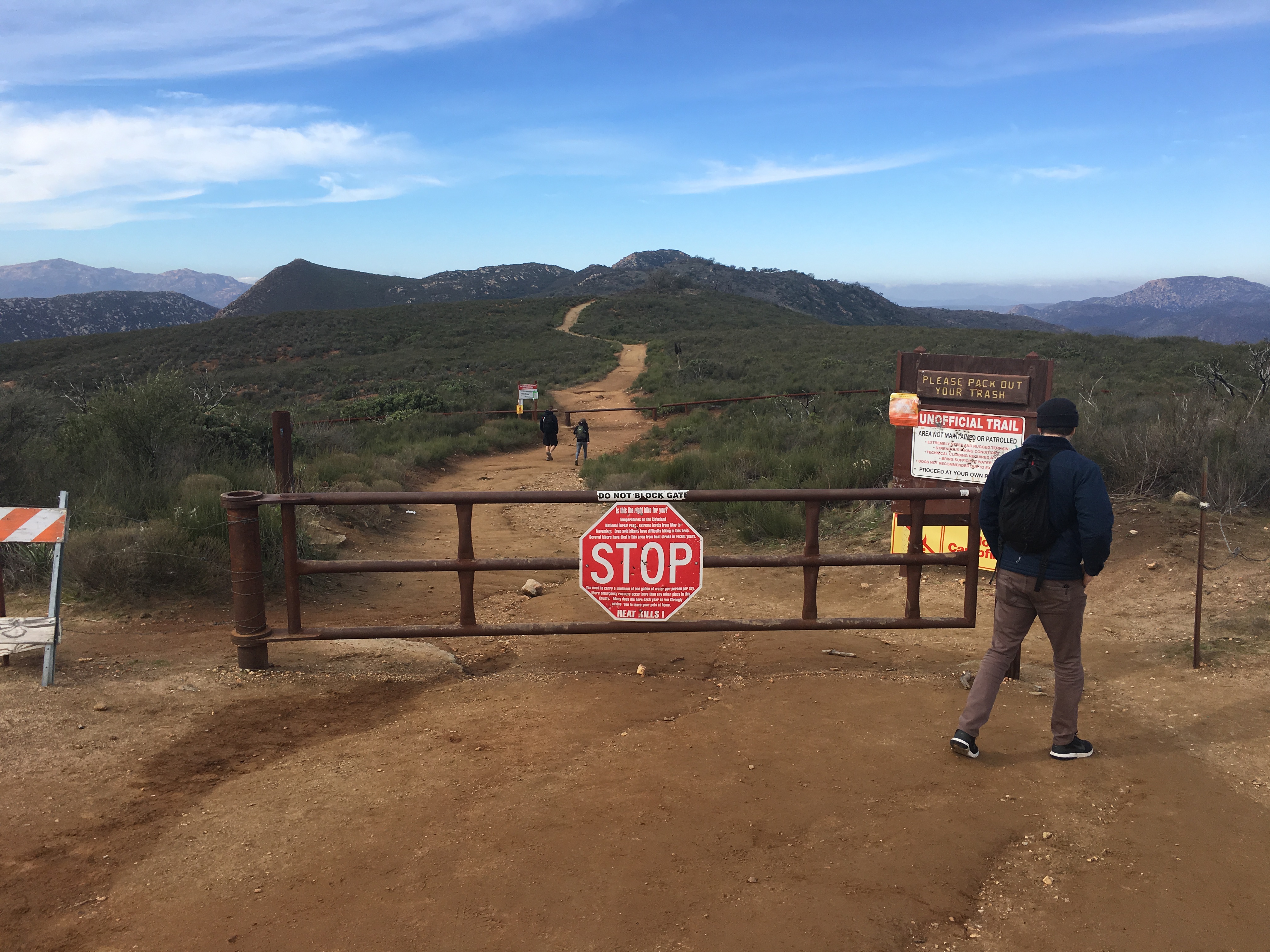
The reason i call Eagle Peak a Trifecta hike is because of its proximity to its neighboring doozy of a hike at Three Sisters waterfalls and the challenging Cedar Creek Falls hike. In fact Eagle Peak has the same trailhead start as Three Sisters along with the ominous greeting of STOP as you start your trek at the warning sign gate.
You know you are the right place when Boulder Creek road suddenly is enveloped in cars parked along side of the road and as stated earlier the STOP sign gate marking the trailhead start. Right from the start the Eagle peak trail leads you to a rich experience of the areas natural beauty with a mix of not so distant mountain peaks, rolling hills, valley’s and surrounding growth of rare Englemann Oaks and various low lying brush and plant life.
Not more than a few hundred yards along, the trail dips down towards the point on the trail where you will start to hear the roar of the waterfalls at Three Sisters, soon the waterfalls will appear on your immediate left where you will come upon a tall wooden marker. 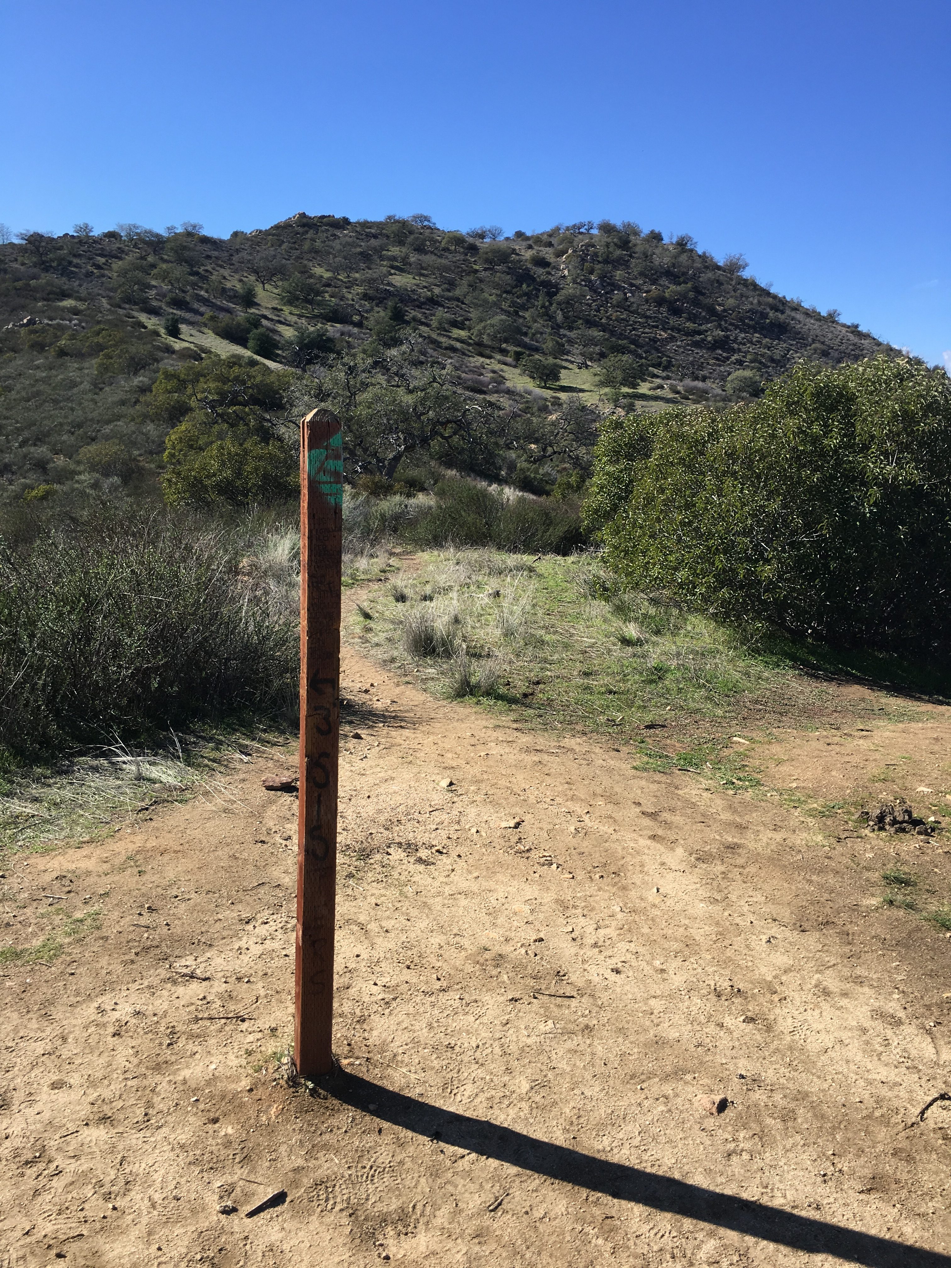 it is here where those who want to travel down into the ravine and on to Three Sisters falls will turn left, or in our case continue straight on past the marker towards eagle peak.
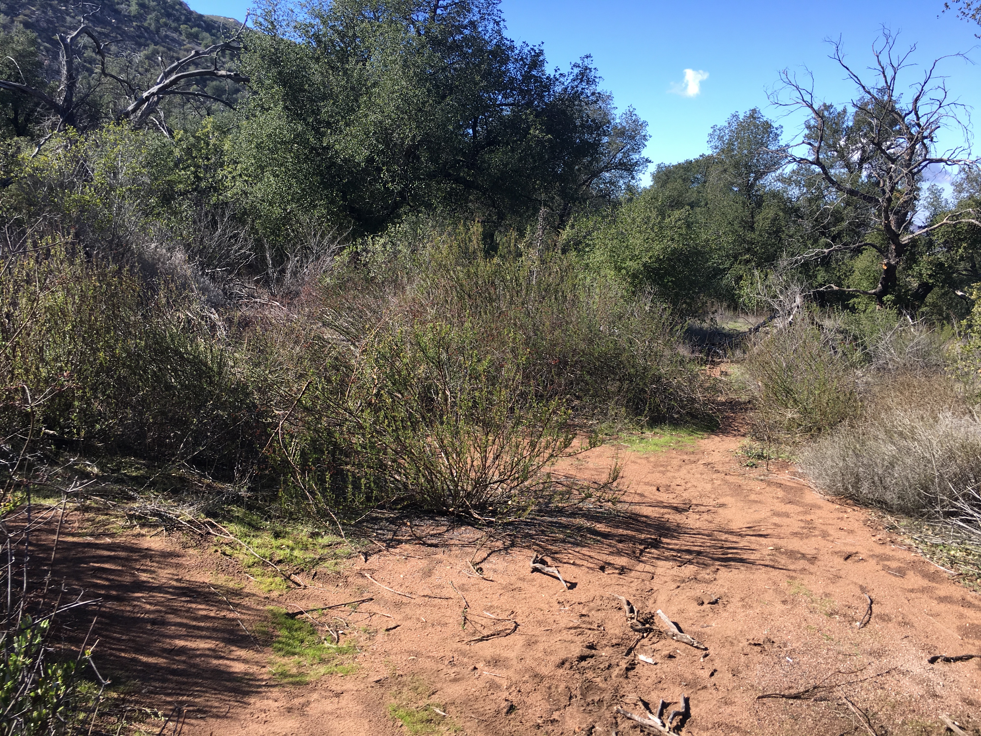
This trail is virtually a straight ahead course with slight climb up the side of the hill. The trail is moderate strenuous with no real “burn”.
Continue until you come to a clearing with a “fork in the trail” veer left here and begin your steep ascent up to Eagle Peak. At this point you are about 1.7 miles into the 2.25 miles climb to the summit.
The trail continues to climb and gets to be difficult strenuous for a short distance. The trail levels off a bit before you yet again climb steeply. Don’t be fooled by the 2 false peaks, you are not there yet. The trail become steeper and turns into stepping up rocks to climb the trail.
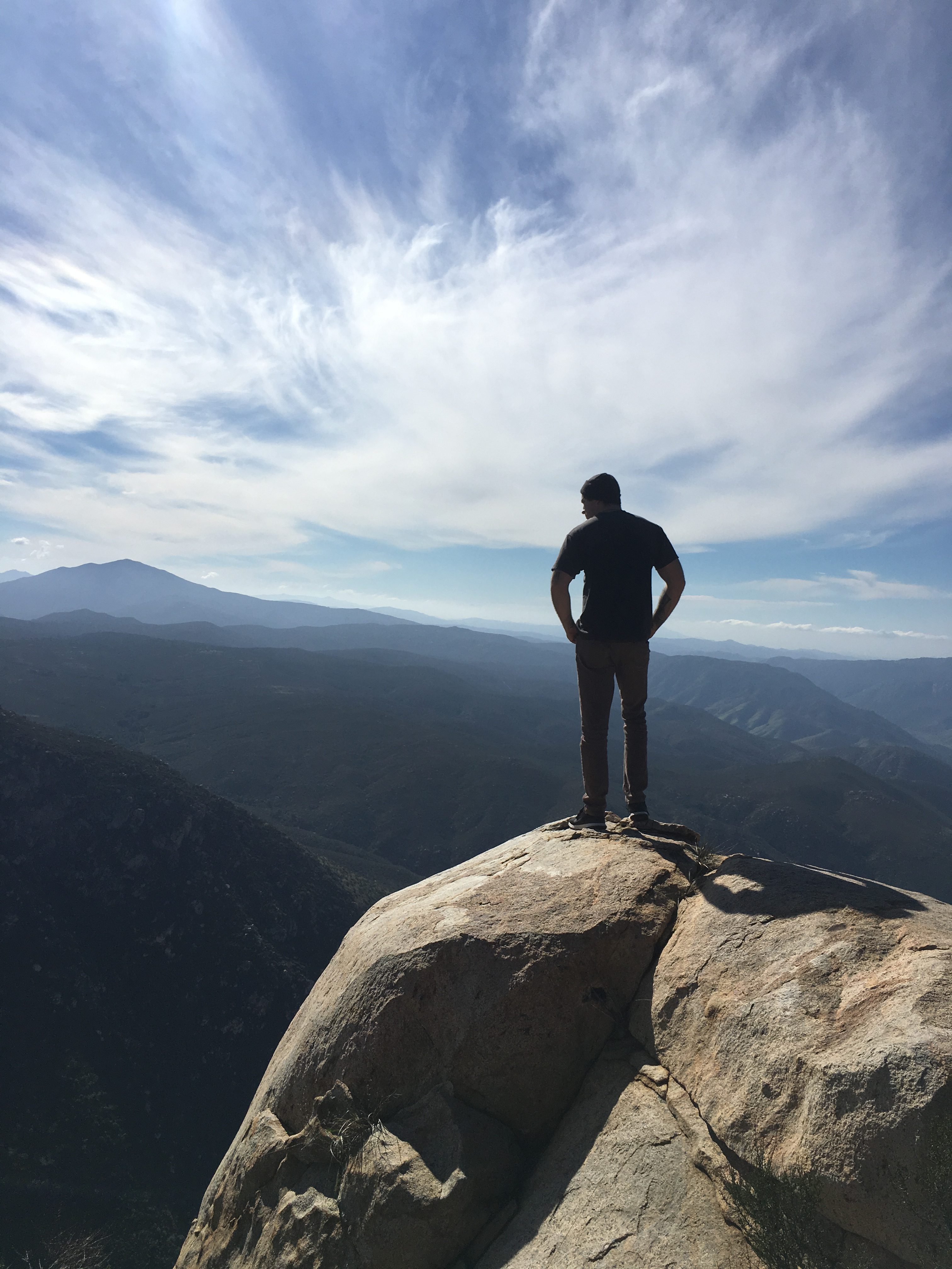
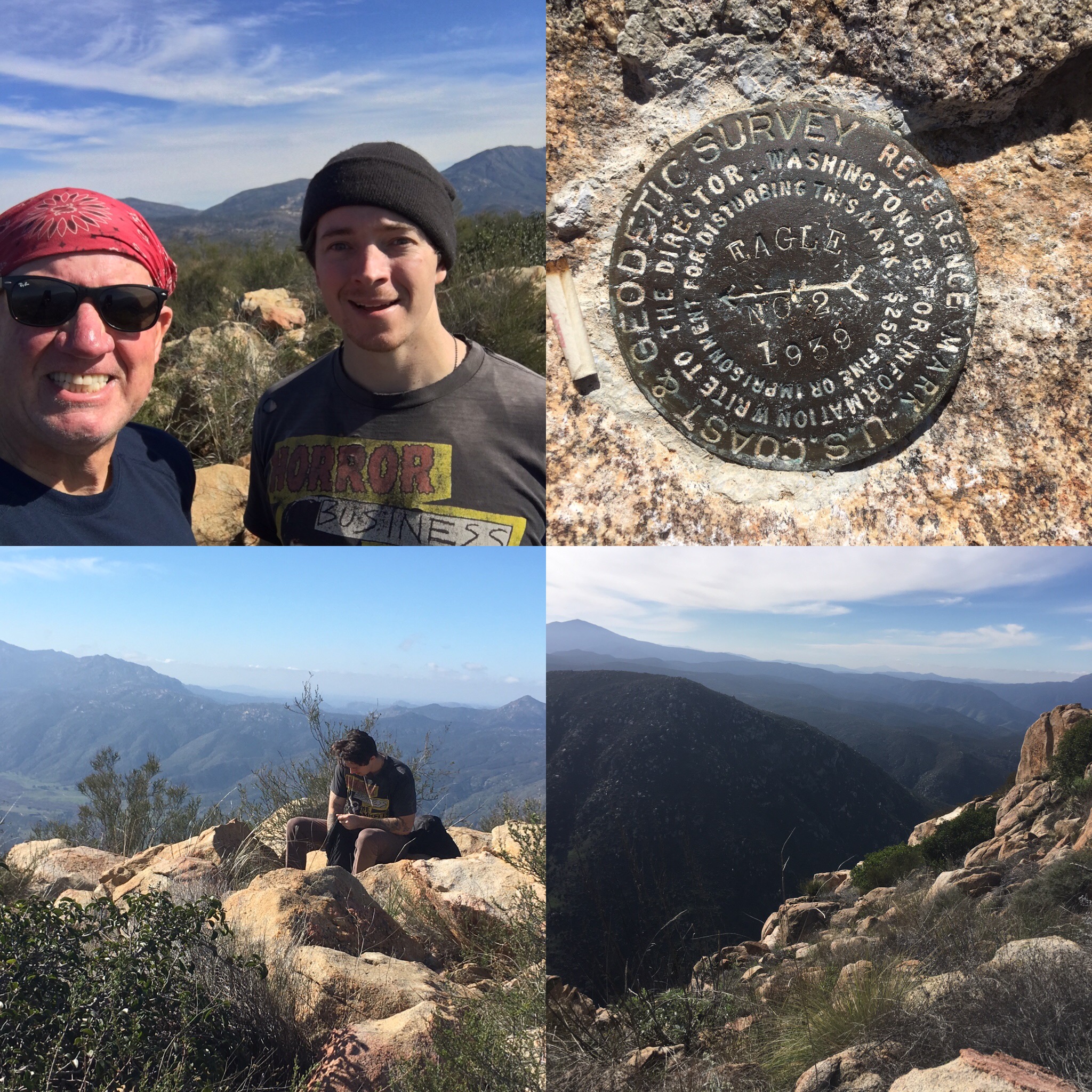 You will soon see the “real” peak and a bowl of rocks to indicate you have made it. 3 geological markers pinpoint the summit, not too mention the breathtaking views of the valley below and the Peaks of Viejas Mountain, El Cajon Mountain and Mt Gower of Ramona in the distance.
And yes there are Eagles at the summit of eagle peak as one flew over head as we staked our accomplishment of making it to the top by high fiving each other I say the view from Eagle Peak rivals none in our county.
My hiking partner, who also is my son Sam, and I kept taking about how the surrounding Julian area offers such a different view. We were fortunate to be hiking on this day what with all the rain we have had in recent weeks, the entire area as far as the eye could see was a sea of green. The total time ascending to the Peak took us 1 hour and 23 minutes. distance to the summit was just over 2.2 miles.
Eagle Peak
As always: hike with a partner, pack water, snacks, first-aid kit and layered clothing.I highly recommend Eagle Peak as a hike that will challenge you but not exhaust you, provide you with a great sense of accomplishment with a reward of one of the best views from any Peak in the County…Have Fun Hike Safe
PS- Hit Dunkin Donuts Ramona on the way back!

Dunkin Donuts Ramona